Area Overview for B16 9GD
Photos of B16 9GD


Area Information
Living in B16 9GD means inhabiting a tightly knit residential cluster within North Edgbaston, a ward in Birmingham’s west. This small area, spanning just 2.7 hectares, is home to 1,908 people, creating a densely populated environment with 69,544 residents per square kilometre. Historically part of Warwickshire, the area was shaped by 19th-century landowners who resisted industrial development, preserving its tree-lined character. Today, it lies south-west of Birmingham’s city centre, blending proximity to urban amenities with a quieter residential feel. The ward’s compact size means residents share a shared identity, with local landmarks like Edgbaston Pool and Deer’s Leap Wood adding green spaces to daily life. While the area is small, it sits near major transport routes and educational institutions, making it a practical choice for families and professionals. Its mix of historic charm and modern infrastructure reflects Birmingham’s evolving urban landscape.
- Area Type
- Postcode
- Area Size
- 2.7 hectares
- Population
- 1908
- Population Density
- 5113 people/km²
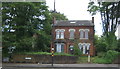
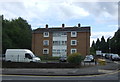
The property market in B16 9GD is characterised by a low home ownership rate—just 30% of residents own their homes—suggesting a strong rental market. The predominant accommodation type is flats, which aligns with the area’s compact size and high density. This housing stock is likely to consist of purpose-built apartments or converted properties, catering to individuals or couples rather than larger families. For buyers, the small area means limited availability of owner-occupied properties, with competition likely focused on a few key developments. The flat-dominated market may appeal to those prioritising convenience over space, but it also means fewer opportunities for long-term equity growth. Nearby, the broader Edgbaston area offers more varied housing, though proximity to Birmingham’s city centre comes with higher demand and potentially elevated prices.
House Prices in B16 9GD
No properties found in this postcode.
Energy Efficiency in B16 9GD
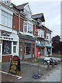
Life in B16 9GD is shaped by its proximity to retail, leisure, and green spaces. Local shops such as Tesco Edgbaston and Aldi Warley provide convenience for daily needs, while nearby metro stations like Edgbaston Village connect residents to Birmingham’s vibrant districts. Rail stations, including Smethwick Rolfe Street, offer swift access to further afield. The area’s natural assets include Edgbaston Pool, a Site of Special Scientific Interest, and Deer’s Leap Wood, a locally protected nature reserve, offering opportunities for walking or relaxation. The compact layout ensures amenities are within practical reach, fostering a self-contained lifestyle. However, the absence of large parks or cultural venues means residents may need to venture slightly further for broader leisure options. The blend of urban convenience and greenery reflects a balance between practicality and quality of life.
Amenities
Schools
Residents of B16 9GD have access to a range of primary and secondary educational institutions. George Dixon Primary School and Cardinal Newman Catholic School cater to younger children, while George Dixon International School and Sixth Form Centre provide a broader curriculum. The George Dixon Academy, rated ‘good’ by Ofsted, offers further education and sixth-form provision. This mix of school types ensures families can choose between state, faith-based, and specialist institutions. The concentration of George Dixon-related schools suggests a strong local educational network, potentially benefiting from shared resources and community ties. However, the absence of independent or grammar schools may limit options for those seeking alternative pathways. For parents, the proximity of multiple schools within walking distance is a practical advantage, though the quality and capacity of each institution should be assessed individually.
| Rank | School | Type | Entry gender | Ages |
|---|
Explore more schools in this area
Go to Schools tabDemographics
The population of B16 9GD is predominantly adults aged 30–64, with a median age of 47. This suggests a mature, established community with fewer young families. Home ownership here is low, at just 30%, indicating that most residents rent their homes. The accommodation type is largely flats, reflecting a housing stock suited to smaller households or couples. The predominant ethnic group is White, though specific diversity statistics are not provided. The high population density—69,544 people per square kilometre—means shared spaces and close proximity to neighbours, which can foster a sense of community but may also limit privacy. For those considering relocation, the area’s demographics suggest a stable, middle-aged population with established routines, though the rental market may offer fewer long-term investment opportunities.
Household Size
Accommodation Type
Tenure
Ethnic Group
Religion
Household Composition
Age
Household Deprivation
NS-SEC
Explore more demographic insights in this area
Go to Demographics tabPlanning
Planning Constraints
- Flood RiskPremium
- Ramsar Wetland SitesPremium
- Area of Outstanding Natural BeautyPremium
- Protected Nature ReservePremium
- Protected WoodlandPremium