Area Overview for B16 9BN
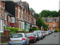
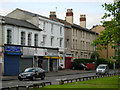
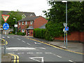
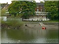
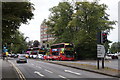
Photos of B16 9BN


Area Information
B16 9BN lies in the heart of North Edgbaston, a historically significant ward in Birmingham’s west. With a population of 2,077, this small postcode area blends 19th-century heritage with modern urban living. Once a refuge for wealthier residents due to its tree-lined streets and refusal of industrial development, it now sits just south-west of Birmingham’s city centre. The area’s proximity to landmarks like Edgbaston Hall and Deer’s Leap Wood offers a mix of natural and cultural appeal. Daily life here is shaped by its compact size and accessibility to Birmingham’s amenities. Residents benefit from proximity to retail hubs, transport links, and educational institutions, while the ward’s low flood risk and moderate crime profile make it a pragmatic choice. Though small, B16 9BN reflects the broader Edgbaston identity—a place where historical legacy meets contemporary convenience, ideal for those seeking a balance between urban connectivity and a touch of tradition.
- Area Type
- Postcode
- Area Size
- Not available
- Population
- 2077
- Population Density
- 5483 people/km²
The property market in B16 9BN is characterised by low home ownership (29%) and a reliance on rental housing. With flats as the predominant accommodation type, the area caters to those seeking compact, urban living rather than larger family homes. This suggests a market skewed towards professionals and couples, rather than growing families. The small size of the postcode area means housing stock is limited, which may drive competition among buyers and renters. For those considering property in B16 9BN, the focus should be on flats within the immediate vicinity, as the area itself offers little in terms of new developments. The rental market’s dominance implies that property values may be more stable than speculative, but buyers should consider the broader Birmingham region for more options. The flat-centric stock also means limited scope for major renovations or extensions, which could influence investment decisions.
House Prices in B16 9BN
No properties found in this postcode.
Energy Efficiency in B16 9BN
Living in B16 9BN offers access to a range of amenities within practical reach. Retail options include Tesco Hagley, Spar Ample, and Morrisons Edgbaston, providing everyday shopping needs. The nearby metro areas of Edgbaston Village, Centenary Square, and Town Hall add to the area’s vibrancy, offering dining, cultural venues, and social spaces. Parks and green spaces, such as Edgbaston Pool (a Site of Special Scientific Interest) and Deer’s Leap Wood, provide opportunities for relaxation and outdoor activities. The area’s historical sites, like Edgbaston Hall, add character, while its proximity to Birmingham’s central hubs ensures easy access to more extensive leisure options. This blend of local convenience, green spaces, and urban connectivity creates a lifestyle that balances practicality with a touch of heritage, appealing to those who value both accessibility and quality of environment.
Amenities
Schools
The nearest school to B16 9BN is St Paul’s School for Girls, a primary school with an outstanding Ofsted rating. This institution provides high-quality education for younger students, though no secondary schools are listed in the data. The presence of a top-rated primary school is a significant advantage for families, ensuring access to a well-regarded early education. However, the absence of secondary schools nearby may require families to consider commuting to other parts of Birmingham for secondary education. The school’s rating reflects a commitment to academic excellence, which is a key factor for parents prioritising educational standards. While the area’s school options are limited to primary-level institutions, the proximity to St Paul’s School for Girls offers a strong foundation for young learners, complementing the area’s broader appeal.
| Rank | School | Type | Entry gender | Ages |
|---|
Explore more schools in this area
Go to Schools tabDemographics
The community in B16 9BN is predominantly composed of adults aged 30–64, with a median age of 47. This suggests a mature, established population, likely including professionals and families. Home ownership rates are low at 29%, indicating that most residents are renters, which is typical of urban areas with limited housing stock. The accommodation type is primarily flats, reflecting the area’s density and historical development patterns. The predominant ethnic group is White, though specific diversity metrics are not provided. The age profile and ownership data suggest a stable, long-term resident base rather than a transient population. For quality of life, the low home ownership rate may impact investment potential, but the area’s amenities and transport links offset this. The demographic profile aligns with a community focused on convenience and proximity to services, rather than large-scale family housing.
Household Size
Accommodation Type
Tenure
Ethnic Group
Religion
Household Composition
Age
Household Deprivation
NS-SEC
Explore more demographic insights in this area
Go to Demographics tabPlanning
Planning Constraints
- Flood RiskPremium
- Ramsar Wetland SitesPremium
- Area of Outstanding Natural BeautyPremium
- Protected Nature ReservePremium
- Protected WoodlandPremium