Area Overview for B16 9AN
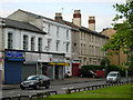
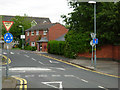
Photos of B16 9AN


Area Information
B16 9AN is a small residential postcode nestled in Birmingham’s West Midlands, forming part of the North Edgbaston ward. With a population of 1,595, it is a compact area characterised by a mix of historic and modern housing. The ward lies immediately south-west of Birmingham city centre, historically shaped by the 19th-century influence of wealthy families who resisted industrialisation, preserving its tree-lined, residential charm. Today, it is a microcosm of urban living, blending proximity to Birmingham’s cultural and commercial hubs with a quieter, more residential atmosphere. The area’s appeal lies in its accessibility to the city’s metro, rail networks, and retail spaces, while retaining a distinct identity. Young adults dominate the population, with a median age of 22, reflecting a dynamic community. For those seeking a balance between city life and residential tranquillity, B16 9AN offers a compact, well-connected environment. Its proximity to landmarks like Edgbaston Hall and the university gardens adds a layer of historical and cultural richness, making it a compelling choice for those prioritising convenience and character.
- Area Type
- Postcode
- Area Size
- Not available
- Population
- 1595
- Population Density
- 9858 people/km²
The property market in B16 9AN is defined by a low home ownership rate of 21%, suggesting that the majority of properties are rented rather than owner-occupied. This contrasts with the accommodation type, which is predominantly houses, indicating a mix of larger, perhaps older homes. The small size of the postcode area means the housing stock is limited, and buyers may need to consider nearby neighbourhoods for more options. The low home ownership rate could reflect the area’s appeal to renters, possibly due to its proximity to Birmingham’s employment and educational hubs. For buyers, this suggests a potentially competitive market for available properties, with a focus on houses rather than flats or apartments. The limited scale of the area also means that property values and availability may be influenced by broader Birmingham trends, such as demand for city-centre housing.
House Prices in B16 9AN
No properties found in this postcode.
Energy Efficiency in B16 9AN
Living in B16 9AN offers access to a range of amenities within walking or short transport distance. Retail options include major stores like Tesco Hagley, Morrisons Edgbaston, and Spar Ample, providing everyday convenience. The area’s proximity to Birmingham’s metro hubs, such as Edgbaston Village and Centenary Square, ensures easy access to dining, entertainment, and cultural attractions. Rail stations like Five Ways and Birmingham Snow Hill connect residents to broader networks, facilitating travel to work or leisure. The nearby Edgbaston Hall and university gardens add a touch of historical and natural interest, while the ward’s links to landmarks like the BBC’s former Pebble Mill Studios highlight its cultural legacy. These amenities combine to create a lifestyle that balances urban accessibility with a sense of local character, ideal for those seeking convenience without sacrificing a distinct community feel.
Amenities
Schools
| Rank | School | Type | Entry gender | Ages |
|---|
Explore more schools in this area
Go to Schools tabDemographics
B16 9AN’s population is overwhelmingly young, with a median age of 22 and the majority of residents falling within the 15–29 age range. This demographic profile suggests a community centred around students, young professionals, and early-career individuals. Home ownership is relatively low, at 21%, indicating that most residents rent their properties. The accommodation type is predominantly houses, which is unusual for a city-centre area, suggesting a mix of older, family-oriented housing stock. The predominant ethnic group is White, though no specific data on diversity or deprivation is provided. The low home ownership rate may reflect the area’s affordability compared to other parts of Birmingham, or the prevalence of rental properties. The young population and rental market dynamics imply a transient community, with residents potentially prioritising proximity to employment, education, or transport over long-term property investment.
Household Size
Accommodation Type
Tenure
Ethnic Group
Religion
Household Composition
Age
Household Deprivation
NS-SEC
Explore more demographic insights in this area
Go to Demographics tabPlanning
Planning Constraints
- Flood RiskPremium
- Ramsar Wetland SitesPremium
- Area of Outstanding Natural BeautyPremium
- Protected Nature ReservePremium
- Protected WoodlandPremium