Area Overview for B16 8NJ
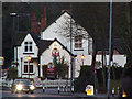
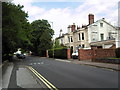
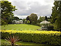
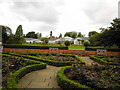
Photos of B16 8NJ


Area Information
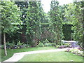
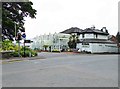
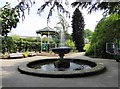
B16 8NJ is a small residential postcode nestled in the Edgbaston area of Birmingham, a historically affluent suburb known for its green spaces and tree-lined streets. With a population of 2077, it reflects the character of a tightly knit community within a larger urban context. The area’s roots trace back to the 19th century, when wealthy families sought to escape industrial Birmingham, shaping a legacy of private homes and historic architecture. Today, it retains an affluent residential feel, with a focus on quiet living and proximity to Birmingham’s cultural and commercial hubs. Residents benefit from being near Edgbaston’s landmarks, such as the Grade I-listed 21 Yateley Road and the Birmingham Oratory church. The postcode’s compact size means it is ideally suited for those prioritising convenience, with nearby amenities and transport links that connect to the city’s broader network. Living here offers a balance of suburban tranquillity and urban accessibility, making it appealing to professionals and families seeking stability in a well-established neighbourhood.
- Area Type
- Postcode
- Area Size
- Not available
- Population
- 2077
- Population Density
- 5483 people/km²
The property market in B16 8NJ is characterised by a low home ownership rate of 29%, suggesting that the area is more rental-focused than owner-occupied. The predominant accommodation type is flats, which aligns with the compact nature of the postcode and its suitability for smaller households. This housing stock may appeal to professionals or families seeking convenience over spacious living, though the limited number of properties means the market is not expansive. Buyers should consider that the area’s small size and focus on flats may restrict options for those seeking larger homes or land. For those prioritising rental flexibility, the availability of flats could be an advantage, but the low home ownership rate also implies competition among buyers. The area’s proximity to Birmingham’s amenities may offset its limited housing stock, making it attractive for those valuing location over property size.
House Prices in B16 8NJ
No properties found in this postcode.
Energy Efficiency in B16 8NJ
Residents of B16 8NJ have access to a range of amenities within walking or short transit distance. The area includes five metro stops, such as Edgbaston Village and Centenary Square, offering easy access to Birmingham’s cultural and commercial centres. Retail options are diverse, with stores like Morrisons Edgbaston, Spar Ample, and Tesco Hagley providing everyday shopping needs. The five railway stations, including Five Ways and University, connect residents to wider transport networks. The presence of these amenities fosters a convenient lifestyle, with opportunities for dining, leisure, and socialising. The area’s proximity to green spaces and historic sites, combined with its accessibility, supports a balanced approach to urban living, blending suburban comfort with city vibrancy.
Amenities
Schools
The nearest school to B16 8NJ is St Paul’s School for Girls, a primary school with an Ofsted rating of outstanding. This indicates a high standard of education, which is a key consideration for families prioritising academic excellence. The presence of a top-rated primary school suggests that the area is well-served for early education, though no secondary schools are listed in the data. The single school’s prominence may mean that families rely on nearby institutions for broader educational needs, potentially requiring travel to other parts of Birmingham. For parents, the outstanding rating at St Paul’s School for Girls is a strong positive, though the absence of additional schools means careful planning is needed for long-term educational requirements.
| Rank | School | Type | Entry gender | Ages |
|---|
Explore more schools in this area
Go to Schools tabDemographics
The population of B16 8NJ has a median age of 47, with the majority of residents falling within the 30-64 age range. This suggests a community skewed towards adults, likely including professionals and families. Home ownership in the area is relatively low at 29%, indicating that a significant proportion of residents rent their homes. The predominant accommodation type is flats, reflecting a housing stock that caters to smaller households or those seeking urban living. The predominant ethnic group is White, though no specific data on diversity or deprivation is provided. The age profile and home ownership figures suggest a stable, mature community with a focus on rental affordability. The absence of data on deprivation means it is unclear whether this influences local services or quality of life, but the demographic makeup aligns with a suburban area where established residents outnumber younger or transient populations.
Household Size
Accommodation Type
Tenure
Ethnic Group
Religion
Household Composition
Age
Household Deprivation
NS-SEC
Explore more demographic insights in this area
Go to Demographics tabPlanning
Planning Constraints
- Flood RiskPremium
- Ramsar Wetland SitesPremium
- Area of Outstanding Natural BeautyPremium
- Protected Nature ReservePremium
- Protected WoodlandPremium