Area Overview for B16 8LY
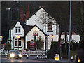
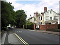
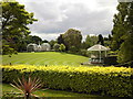
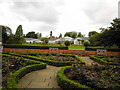
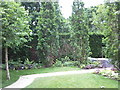
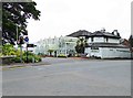
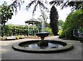
Photos of B16 8LY


Area Information
Living in B16 8LY means inhabiting a small, tightly knit residential cluster within Birmingham’s Edgbaston Ward. With a population of just 2,077, the area retains a quiet, suburban character despite its proximity to the city’s bustling core. Historically part of Warwickshire, it lies southwest of Birmingham’s centre, blending green spaces with historic private houses. The area’s appeal lies in its balance of residential tranquillity and access to urban amenities. Residents benefit from nearby metro hubs like Edgbaston Village and Centenary Square, as well as rail links to Five Ways and University stations. The presence of Grade I-listed homes and tree-lined streets reflects its long-standing appeal to affluent professionals and families. While the population is modest, the area’s small size ensures a tight-knit community feel, with local amenities and schools within easy reach. For those seeking a blend of suburban comfort and city connectivity, B16 8LY offers a distinctive niche in Birmingham’s housing landscape.
- Area Type
- Postcode
- Area Size
- Not available
- Population
- 2077
- Population Density
- 5483 people/km²
The property market in B16 8LY is characterised by a low home ownership rate (29%) and a dominance of flats as the primary accommodation type. This suggests the area functions more as a rental market than an owner-occupied one, with limited availability of freehold properties. The prevalence of flats may reflect a mix of purpose-built housing and conversions, typical of suburban areas near urban centres. For buyers, this dynamic implies that opportunities for purchase are constrained, with potential focus on flats rather than detached homes. The small size of the postcode area also means that property options are limited, requiring buyers to consider nearby suburbs or extensions of the Edgbaston Ward. However, the proximity to Birmingham’s amenities, including transport links and schools, may offset the scarcity of housing stock for those prioritising location over property type.
House Prices in B16 8LY
No properties found in this postcode.
Energy Efficiency in B16 8LY
Life in B16 8LY is enriched by a range of nearby amenities, from retail outlets to public spaces. Within practical reach are five retail venues, including Morrisons Edgbaston and Spar Ample, ensuring daily shopping needs are met. The metro network, with stops at Edgbaston Village, Centenary Square, and Town Hall, provides access to cultural and administrative hubs. Rail stations like Five Ways and University connect residents to broader Birmingham, facilitating commuting or leisure travel. The area’s suburban character is complemented by its proximity to urban conveniences, creating a lifestyle that balances local convenience with city-wide opportunities. Whether for dining, shopping, or leisure, the amenities in B16 8LY support a dynamic yet manageable daily routine, ideal for those seeking both community and connectivity.
Amenities
Schools
The nearest school to B16 8LY is St Paul’s School for Girls, a primary school with an Ofsted rating of outstanding. This indicates high educational standards and effective teaching, which is a significant draw for families seeking quality schooling for their children. The presence of a single primary school suggests that secondary education options may lie further afield, requiring families to consider commuting or additional school choices beyond the immediate area. However, the outstanding rating at St Paul’s School for Girls alone provides a strong foundation for early education, potentially reducing the need for private schooling or long-distance commutes. The school’s status also aligns with the area’s reputation for attracting families, reinforcing B16 8LY’s appeal to households prioritising education.
| Rank | School | Type | Entry gender | Ages |
|---|
Explore more schools in this area
Go to Schools tabDemographics
The population of B16 8LY is predominantly adults aged 30–64, with a median age of 47. This suggests a mature, established community, likely comprising professionals and families. Home ownership here is relatively low, with only 29% of residents owning their homes. The accommodation type is predominantly flats, indicating a rental-heavy market. The predominant ethnic group is White, reflecting the area’s historical ties to affluent, long-standing communities. The demographic profile implies a stable, low-turnover environment, where residents may be more likely to have built careers and long-term ties to the area. The absence of specific data on deprivation levels means the quality of life remains unquantified, but the mix of age groups and property types suggests a balanced, if not particularly diverse, social fabric.
Household Size
Accommodation Type
Tenure
Ethnic Group
Religion
Household Composition
Age
Household Deprivation
NS-SEC
Explore more demographic insights in this area
Go to Demographics tabPlanning
Planning Constraints
- Flood RiskPremium
- Ramsar Wetland SitesPremium
- Area of Outstanding Natural BeautyPremium
- Protected Nature ReservePremium
- Protected WoodlandPremium