Area Overview for B16 8LH
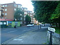
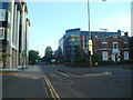
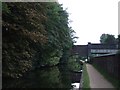
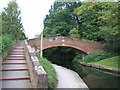
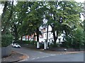
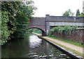
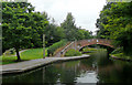
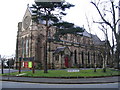
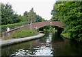
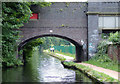
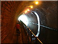
Photos of B16 8LH

Area Information
B16 8LH lies within the Ladywood Ward of west Birmingham, a historically dense inner-city area with a complex past. The postcode covers a small residential cluster near Birmingham’s core, encompassing landmarks like the Council House and Town Hall. With a population of 2077, it is a compact community where urban living meets proximity to city amenities. The area’s character is shaped by its history as a medieval woodland, later redeveloped in the 20th century with housing projects that remain today. Residents benefit from being close to Birmingham’s cultural and administrative heart, with access to nearby retail, transport hubs, and green spaces. While the area has faced challenges historically, its current infrastructure and connectivity offer a practical base for those prioritising convenience over sprawling landscapes. Living here means navigating a mix of urban vibrancy and the realities of inner-city life, with a community skewed toward working-age adults and a rental-dominated housing market.
- Area Type
- Postcode
- Area Size
- Not available
- Population
- 2077
- Population Density
- 5483 people/km²
The property market in B16 8LH is predominantly rental-focused, with only 29% of homes owned by residents. The accommodation type is almost exclusively flats, a legacy of post-1960s housing developments designed to replace slums. This means the area lacks detached or semi-detached properties, limiting options for buyers seeking owner-occupied homes. The small postcode area and surrounding neighbourhoods likely share similar housing stock, with limited scope for property diversification. For buyers, this suggests a niche market where availability is constrained by the existing stock. However, the prevalence of flats may appeal to those prioritising proximity to city amenities over private outdoor space. The rental market here is likely competitive, with demand driven by commuters and professionals seeking affordable urban living.
House Prices in B16 8LH
No properties found in this postcode.
Energy Efficiency in B16 8LH
B16 8LH offers a compact but functional lifestyle, with amenities clustered around Birmingham’s city centre. Residents can access five metro stops, including Edgbaston Village and Centenary Square, which connect to retail, dining, and leisure spots. Retail options include Morrisons Edgbaston and Spar stores, providing everyday shopping needs. The rail network, with stations like Five Ways and Birmingham Snow Hill, facilitates travel to other parts of the city. While the area lacks detailed information on parks or leisure facilities, its proximity to landmarks like the Town Hall and historical sites suggests a blend of urban convenience and cultural accessibility. The density of amenities supports a lifestyle focused on efficiency, with minimal need for long commutes.
Amenities
Schools
The nearest school to B16 8LH is St Paul’s School for Girls, a primary school with an outstanding Ofsted rating. This indicates a high standard of education for younger students, though the absence of secondary schools in the immediate area means families may need to consider commuting for older children. The presence of a top-rated primary school is a significant draw for families, offering a reliable foundation for early education. However, the lack of data on other schools nearby suggests that parents should investigate further for secondary options. The school’s rating reflects the area’s investment in education, aligning with Ladywood’s role as a central district with historical ties to public services.
| Rank | School | Type | Entry gender | Ages |
|---|---|---|---|---|
| 1 | St Paul's School for Girls | primary | N/A | N/A |
Explore more schools in this area
Go to Schools tabDemographics
The population of B16 8LH has a median age of 47, with the majority of residents aged 30–64. This suggests a community of working professionals and families, though the 29% home ownership rate indicates that most households are renters. The predominant accommodation type is flats, reflecting the area’s post-war housing stock. The White ethnic group makes up the largest share of the population, though specific data on other groups is not provided. The age profile and ownership figures suggest a transient population, with limited intergenerational living. The absence of detailed deprivation metrics means it is unclear how economic pressures might affect quality of life, but the moderate age range implies a workforce-oriented demographic. This profile aligns with Ladywood’s history as a redevelopment zone, where housing projects cater to a mix of local and transient residents.
Household Size
Accommodation Type
Tenure
Ethnic Group
Religion
Household Composition
Age
Household Deprivation
NS-SEC
Explore more demographic insights in this area
Go to Demographics tabPlanning
Planning Constraints
- Flood RiskPremium
- Ramsar Wetland SitesPremium
- Area of Outstanding Natural BeautyPremium
- Protected Nature ReservePremium
- Protected WoodlandPremium