Area Overview for B16 6PA
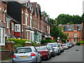
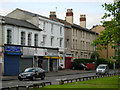
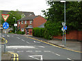
Photos of B16 6PA


Area Information
B16 6PA lies in the heart of Birmingham’s Ladywood Ward, a historically significant inner-city district known for its central location and urban character. With a population of 1,884, this small postcode area is a compact residential cluster situated near key city landmarks such as the Council House, Town Hall, and Birmingham Children’s Hospital. Its proximity to Birmingham City Centre, including Edgbaston Village and Centenary Square, offers easy access to cultural and civic hubs. The area’s history is rooted in medieval woodland, later transformed by 20th-century regeneration efforts that replaced slums with housing stock. Today, it reflects a mix of older infrastructure and modern urban living. Residents benefit from nearby rail links, retail outlets, and educational institutions, though the area’s dense urban fabric and historical challenges—such as past social issues—shape its current dynamics. For buyers, B16 6PA presents a blend of convenience and affordability, though its small size means proximity to amenities is both a strength and a limitation.
- Area Type
- Postcode
- Area Size
- Not available
- Population
- 1884
- Population Density
- 6485 people/km²
B16 6PA’s property market is characterised by a low home ownership rate—just 14% of properties are owner-occupied—suggesting that the area is primarily a rental market. The accommodation type is predominantly flats, a legacy of post-1960s housing projects that replaced earlier slum areas. These flats, many of which were demolished by 2000, may include both older and newer stock, though the exact condition of properties is not specified. For buyers, this means limited opportunities for owner-occupation within the postcode itself, with potential interest in nearby areas where housing stock might be more varied. The small size of B16 6PA also means that the immediate surroundings, such as adjacent wards or nearby Birmingham districts, are likely to hold more significant property diversity. Investors or first-time buyers should consider the area’s rental potential and the need for property renovation in some cases.
House Prices in B16 6PA
No properties found in this postcode.
Energy Efficiency in B16 6PA
Living in B16 6PA grants access to a range of amenities within walking or short transit distance. Retail options include supermarkets like Morrisons Edgbaston and Spar Ample, while the area’s proximity to Birmingham City Centre ensures access to dining, cultural venues, and leisure activities. The metro system connects to key locations such as Edgbaston Village and Centenary Square, offering both commercial and recreational opportunities. Rail links to Five Ways and Birmingham Snow Hill stations provide easy access to surrounding areas. Though the area lacks large parks, its central location means nearby green spaces and public amenities are within reach. The mix of retail, transport, and urban connectivity creates a convenient lifestyle, though the small postcode size means that residents may need to venture slightly further for specialist services or larger leisure facilities.
Amenities
Schools
The schools near B16 6PA include St George’s Church of England Primary School, which has an Ofsted rating of ‘good’, and St Philip’s RC Sixth Form College. The presence of a primary school with a strong rating is a benefit for families, though the absence of secondary schools within the postcode means students may need to travel to nearby areas for comprehensive education. The sixth-form college caters to older students, offering pathways to higher education or vocational training. This mix of primary and post-16 education suggests that the area supports early schooling but relies on external institutions for secondary education. Parents should consider the distance to secondary schools and the availability of transport options, given the area’s urban layout. The ‘good’ rating at St George’s indicates a reliable foundation for primary education, but further research into local secondary institutions is advisable for families prioritising a full range of schooling.
| Rank | School | Type | Entry gender | Ages |
|---|
Explore more schools in this area
Go to Schools tabDemographics
The population of B16 6PA has a median age of 22, but the most common age range is 30–64 years, indicating a mix of younger and middle-aged residents. Only 14% of homes are owner-occupied, with flats comprising the predominant accommodation type. This suggests a rental-dominated market, likely influenced by the area’s history of post-1960s housing developments. The Black community forms the largest ethnic group, reflecting broader demographic trends in central Birmingham. While specific deprivation data is not provided, the low home ownership rate may correlate with economic pressures, though this area’s proximity to employment hubs and transport links could mitigate some challenges. The age profile hints at a community with a balance of young professionals and families, though the absence of detailed household composition data leaves some aspects of daily life unexplored.
Household Size
Accommodation Type
Tenure
Ethnic Group
Religion
Household Composition
Age
Household Deprivation
NS-SEC
Explore more demographic insights in this area
Go to Demographics tabPlanning
Planning Constraints
- Flood RiskPremium
- Ramsar Wetland SitesPremium
- Area of Outstanding Natural BeautyPremium
- Protected Nature ReservePremium
- Protected WoodlandPremium