Area Overview for B16 6DN
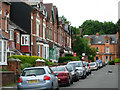
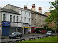
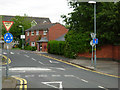
Photos of B16 6DN


Area Information
B16 6DN is a small residential postcode in west Birmingham, part of the Ladywood Ward, an inner-city district with a compact population of 1884. This area sits near Birmingham’s core, adjacent to landmarks like the Council House and Town Hall, and is historically linked to Warwickshire. Its urban density reflects a legacy of 20th-century housing projects, with many properties now converted or repurposed. The community is young, with a median age of 22, though the most common age group is adults aged 30–64. This suggests a mix of long-term residents and younger professionals, shaped by the area’s proximity to city amenities. Daily life here is defined by proximity to central Birmingham’s cultural and commercial hubs, including retail, transport, and historic sites. While the area has faced challenges historically, its location offers convenience for those seeking city living with access to key services. The blend of modern infrastructure and historical context makes B16 6DN a distinctive, if compact, slice of Birmingham’s urban fabric.
- Area Type
- Postcode
- Area Size
- Not available
- Population
- 1884
- Population Density
- 6485 people/km²
The property market in B16 6DN is dominated by rental flats, with only 14% of homes owned by residents. This low home ownership rate suggests the area is primarily a rental market, likely catering to younger professionals and families seeking affordability in Birmingham’s city centre. The prevalence of flats, rather than detached or semi-detached homes, reflects the area’s compact, urban layout. For buyers, this means limited opportunities for owner-occupied properties, with most available housing being leasehold. The small postcode area and its proximity to central Birmingham may make it appealing for those prioritising location over property type, though the limited housing stock could restrict choice. Investors or first-time buyers should consider the rental market’s dynamics and the potential for long-term value in a historically evolving district.
House Prices in B16 6DN
No properties found in this postcode.
Energy Efficiency in B16 6DN
Living in B16 6DN offers access to a range of urban amenities within practical reach. The area’s proximity to Edgbaston Village, Centenary Square, and the Town Hall provides cultural and social hubs, while retail options like Morrisons Edgbaston, Tesco Hagley, and Spar Ample cater to everyday needs. The nearby rail network, with stations such as Five Ways and Birmingham Snow Hill, ensures easy travel to other parts of Birmingham. Though the area lacks green spaces, its compact layout encourages walking and cycling. The mix of historic landmarks and modern infrastructure creates a dynamic lifestyle, blending city life with the convenience of nearby services. Residents can enjoy the vibrancy of Birmingham’s core while benefiting from the area’s accessibility and urban amenities.
Amenities
Schools
B16 6DN is served by St George’s Church of England Primary School, a primary school with an Ofsted rating of ‘good’, and St Philip’s RC Sixth Form College, a sixth-form institution. These schools provide education from early years through to post-16 studies, offering families a range of options. The presence of both a primary school and a sixth-form college suggests a structured educational pathway, though the absence of secondary schools may require commuting for students beyond primary age. St George’s primary school’s ‘good’ rating indicates a satisfactory standard of education, which is a positive for families prioritising local schooling. However, the lack of a comprehensive secondary school within the area could be a consideration for those needing a full range of educational facilities.
| Rank | School | Type | Entry gender | Ages |
|---|---|---|---|---|
| 1 | St George's Church of England Primary School | primary | N/A | N/A |
| 2 | St Philip's RC Sixth Form College | sixth-form | N/A | N/A |
| 3 | St George's Church of England Primary School | primary | N/A | N/A |
Explore more schools in this area
Go to Schools tabDemographics
The population of B16 6DN is predominantly adults aged 30–64, with a median age of 22, indicating a mix of younger residents and working-age adults. Home ownership is low at 14%, suggesting a rental-dominated market, with flats being the primary accommodation type. The predominant ethnic group is Black, reflecting the area’s demographic profile. This data aligns with Ladywood’s history as a district with social challenges, though recent regeneration efforts have shifted its character. The 14% home ownership rate means most residents are renters, which can affect long-term stability for buyers. The age distribution implies a community focused on employment and family life, though the lack of high home ownership may indicate economic pressures or a transient population. The area’s diversity is notable, with no specific deprivation data provided, but its social dynamics are shaped by its inner-city location and historical context.
Household Size
Accommodation Type
Tenure
Ethnic Group
Religion
Household Composition
Age
Household Deprivation
NS-SEC
Explore more demographic insights in this area
Go to Demographics tabPlanning
Planning Constraints
- Flood RiskPremium
- Ramsar Wetland SitesPremium
- Area of Outstanding Natural BeautyPremium
- Protected Nature ReservePremium
- Protected WoodlandPremium
- Crime RiskPremium