Area Overview for B16 0WW
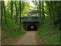
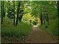
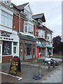
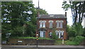
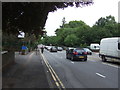
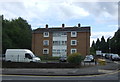
Photos of B16 0WW

Area Information
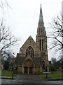
B16 0WW lies within the North Edgbaston ward of Birmingham, a historically tree-lined suburb in the city’s west. With a population of 1,968, it is a small, tightly knit residential cluster known for its 19th-century heritage. The area was once a refuge for wealthier residents, resisting industrial expansion to preserve its green spaces. Today, it retains a quiet charm, with landmarks like Edgbaston Hall—a Grade II listed country house—and Edgbaston Pool, a Site of Special Scientific Interest. The ward is part of Birmingham’s metropolitan district, situated just south-west of the city centre. Living here offers a blend of historical character and modern convenience, with proximity to Birmingham’s cultural and economic hubs. The area’s compact size means amenities are within easy reach, while its low flood risk and accessible transport options make it appealing for families and professionals. However, its small footprint means buyers should consider nearby areas for broader options.
- Area Type
- Postcode
- Area Size
- Not available
- Population
- 1968
- Population Density
- 5595 people/km²
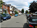
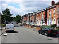
B16 0WW is characterised by a housing stock dominated by houses, with 48% of properties owner-occupied. This suggests a balance between private homeownership and rental properties, though the exact proportion of rentals is not specified. Given the area’s small size and the prevalence of houses, the property market is likely limited in scale, with buyers needing to consider nearby areas for more options. The 48% home ownership rate indicates that a significant portion of the housing stock is available for purchase, potentially offering opportunities for investors or first-time buyers. However, the compact nature of the postcode means competition for properties could be fierce, especially given the area’s historical appeal and proximity to Birmingham’s amenities. Prospective buyers should also consider the limited scope for expansion within the immediate area, as the ward is already densely developed.
House Prices in B16 0WW
No properties found in this postcode.
Energy Efficiency in B16 0WW
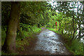
Residents of B16 0WW have access to a range of amenities within walking or short driving distance. Retail options include Tesco Edgbaston, Farmfoods Smethwick, and Tesco Hagley, providing everyday shopping convenience. The area’s proximity to metro lines like Edgbaston Village and Soho Benson Road ensures easy access to Birmingham’s cultural and commercial hubs. Rail stations such as Smethwick Rolfe Street and Jewellery Quarter offer direct links to the city centre and beyond. For leisure, the Edgbaston Pool and Deer’s Leap Wood provide green spaces for recreation, while historic sites like Edgbaston Hall add to the area’s character. The presence of these amenities fosters a lifestyle that balances urban accessibility with local tranquillity, making daily life practical and enriched by both modern and historical elements.
Amenities
Schools
| Rank | School | Type | Entry gender | Ages |
|---|
Explore more schools in this area
Go to Schools tabDemographics
The population of B16 0WW is 1,968, with a median age of 47. The majority of residents are adults aged 30–64, reflecting a mature, established community. Home ownership stands at 48%, indicating a mix of owner-occupied properties and rental stock. The predominant accommodation type is houses, suggesting a more traditional, family-oriented housing stock. The area’s predominant ethnic group is Asian, highlighting its cultural diversity. While specific data on deprivation is not provided, the age profile and ownership rates suggest a stable, middle-income demographic. The presence of a significant Asian population may influence local businesses and community services, though this is not explicitly detailed in the data. The area’s older age range and home ownership figures imply a focus on long-term residency rather than transient populations.
Household Size
Accommodation Type
Tenure
Ethnic Group
Religion
Household Composition
Age
Household Deprivation
NS-SEC
Explore more demographic insights in this area
Go to Demographics tabPlanning
Planning Constraints
- Flood RiskPremium
- Ramsar Wetland SitesPremium
- Area of Outstanding Natural BeautyPremium
- Protected Nature ReservePremium
- Protected WoodlandPremium