Area Overview for B16 0RQ
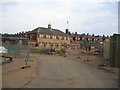
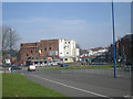
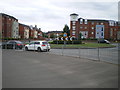
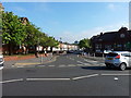
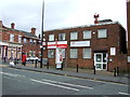
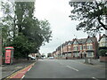
Photos of B16 0RQ


Area Information
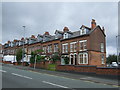
Living in B16 0RQ means being part of a small, tightly knit residential cluster in the west of Birmingham. With a population of just 1,942, this area offers a quiet, community-focused lifestyle close to the city’s core. Historically part of Warwickshire, it lies immediately south-west of Birmingham’s city centre, blending urban proximity with a sense of local identity. The ward’s 19th-century heritage, shaped by families who resisted industrial expansion, has left a legacy of tree-lined streets and leafy suburbs. Daily life here is defined by proximity to amenities, with retail outlets, metro stations, and rail links within practical reach. The area’s modest size means residents often know their neighbours, fostering a close-knit atmosphere. While it lacks the density of central Birmingham, its location provides easy access to the city’s cultural and economic hubs. For those seeking a balance between suburban comfort and urban convenience, B16 0RQ offers a distinct character, rooted in its history and reinforced by its modern infrastructure.
- Area Type
- Postcode
- Area Size
- Not available
- Population
- 1942
- Population Density
- 8925 people/km²
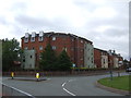
The property market in B16 0RQ is characterised by a 44% home ownership rate, with houses being the predominant accommodation type. This suggests a suburban, low-density housing stock rather than a high-rise or apartment-focused area. The relatively low home ownership rate indicates that a substantial portion of the population may be renting, which could influence the local rental market dynamics. For buyers, this small area offers a limited number of properties, meaning competition may be keen. The presence of houses rather than flats or apartments implies a focus on family-friendly living, with larger homes and private gardens. However, the modest size of the area means that buyers should consider nearby suburbs for more options. The market is likely to appeal to those seeking a quieter, established residential environment with proximity to Birmingham’s amenities, though the limited supply may require flexibility in location or property type.
House Prices in B16 0RQ
No properties found in this postcode.
Energy Efficiency in B16 0RQ
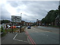
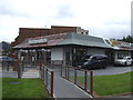
Residents of B16 0RQ have access to a range of amenities within practical reach. The retail sector includes notable venues such as Lidl Winson, Farmfoods Smethwick, and M&S Midland, offering everyday shopping needs. Metro stations like Winson Green Outer Circle and Soho Benson Road provide easy access to local transport, while rail links such as Jewellery Quarter Railway Station and Five Ways Railway Station connect to broader networks. The area’s proximity to Edgbaston Pool, a Site of Special Scientific Interest, and Deer’s Leap Wood, a Site of Local Importance for Nature Conservation, adds green spaces for recreation. The presence of Edgbaston Hall, a Grade II listed building, and historical landmarks like Pebble Mill Studios (now the Birmingham Dental Hospital) reflects the area’s cultural and architectural heritage. These amenities combine to create a lifestyle that balances suburban tranquillity with urban accessibility.
Amenities
Schools
The nearest schools to B16 0RQ are all City Road Primary School, with one of the listed entries holding a ‘good’ Ofsted rating. This suggests that while there is a single primary school in the immediate vicinity, it is the only educational institution explicitly named in the data. The repetition of the same school name may indicate a focus on primary education in the area, though no secondary schools are mentioned. For families, this means a reliance on a single primary school, which could be both a convenience and a limitation depending on the school’s capacity and performance. The ‘good’ Ofsted rating for one instance of the school indicates that at least one version of the institution meets acceptable standards, though the exact location or campus is not specified. Parents should verify which specific branch of City Road Primary School serves their area and consider additional schooling options in nearby wards if needed.
| Rank | School | Type | Entry gender | Ages |
|---|
Explore more schools in this area
Go to Schools tabDemographics
The community in B16 0RQ is predominantly composed of adults aged 30–64, with a median age of 47. This suggests a mature population, likely with established careers and families. Home ownership stands at 44%, indicating a mix of owner-occupied and rental properties. The accommodation type is largely houses, reflecting a suburban layout rather than high-rise or terraced housing. The predominant ethnic group is Asian, which shapes the cultural fabric of the area. While specific deprivation data is not provided, the demographic profile suggests a stable, working-age population. The presence of schools and amenities nearby aligns with the needs of families. However, the 44% home ownership rate implies that a significant portion of residents may be renters, potentially affecting housing stability. The area’s age profile and ethnic diversity contribute to a community with varied experiences and needs, which are reflected in its local services and infrastructure.
Household Size
Accommodation Type
Tenure
Ethnic Group
Religion
Household Composition
Age
Household Deprivation
NS-SEC
Explore more demographic insights in this area
Go to Demographics tabPlanning
Planning Constraints
- Flood RiskPremium
- Ramsar Wetland SitesPremium
- Area of Outstanding Natural BeautyPremium
- Protected Nature ReservePremium
- Protected WoodlandPremium