Area Overview for B16 0RG
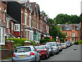
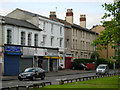
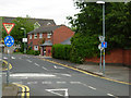
Photos of B16 0RG


Area Information
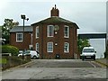
B16 0RG is a small residential postcode area in west Birmingham, part of the historically significant Ladywood Ward. With a population of 2198, it is a compact cluster of homes nestled near the city centre, close to landmarks like Birmingham’s Council House and Town Hall. The area’s character is shaped by its inner-city location, with a mix of older housing stock and post-war developments. While it lacks the sprawling greenery of suburban areas, its proximity to Birmingham’s core offers easy access to cultural, commercial, and administrative hubs. The community here is predominantly middle-aged, with a median age of 47, and a strong presence of Asian residents. Daily life balances urban convenience with the challenges of inner-city living, from bustling retail corridors to the need for vigilance in public spaces. For those seeking a compact, centrally located home with proximity to essential services, B16 0RG offers a distinct blend of practicality and historical context.
- Area Type
- Postcode
- Area Size
- Not available
- Population
- 2198
- Population Density
- 2728 people/km²
B16 0RG is a small postcode area where 56% of homes are owner-occupied, with the remaining 44% likely rented out. The accommodation type is predominantly houses, which is unusual for a densely urban postcode. This suggests a mix of older, possibly characterful properties and post-war housing stock. The limited size of the area means the housing market is constrained, with few new developments. For buyers, this could mean competition for a small number of available properties, but the presence of houses may appeal to those seeking more space than typical inner-city flats. However, the area’s compact nature also means proximity to central Birmingham’s amenities, which could offset the lack of extensive green spaces.
House Prices in B16 0RG
No properties found in this postcode.
Energy Efficiency in B16 0RG
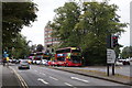
Residents of B16 0RG have access to a range of amenities within walking or short transit distance. Retail options include Lidl Winson, Morrisons Edgbaston, and Tesco Hagley, ensuring everyday shopping needs are met. The metro system, with stops at Edgbaston Village and Centenary Square, connects to Birmingham’s key districts, while rail stations like Five Ways and Birmingham Snow Hill provide regional links. The area’s urban character means parks and green spaces are limited, but its proximity to the city centre offers access to cultural venues, restaurants, and public services. The mix of retail, transport, and urban infrastructure supports a lifestyle focused on convenience, though the lack of extensive recreational spaces may be a drawback for those prioritising outdoor activities.
Amenities
Schools
Residents of B16 0RG have access to three primary schools within practical reach: The Oratory Roman Catholic Primary School and Ladywood School. Both are primary institutions, though the data lists The Oratory Roman Catholic Primary School twice, which may indicate a duplication. The availability of two distinct primary schools offers families options for their children’s early education, though the absence of secondary schools nearby means older students would need to travel further. The concentration of primary schools reflects the area’s role as a residential hub for families with young children, though the lack of secondary education facilities is a potential limitation for those planning long-term in the area.
| Rank | School | Type | Entry gender | Ages |
|---|
Explore more schools in this area
Go to Schools tabDemographics
The population of B16 0RG is 2198, with a median age of 47. The majority of residents fall within the 30-64 age range, indicating a mature, stable community. Home ownership stands at 56%, suggesting a mix of long-term residents and renters. The area is predominantly composed of houses, rather than flats or apartments, which is uncommon for inner-city zones. The predominant ethnic group is Asian, reflecting broader demographic trends in Birmingham. This demographic profile shapes the area’s social fabric, with a focus on family-oriented living and community ties. However, the lack of specific deprivation data means the quality of life cannot be fully assessed, though the presence of essential amenities and services likely supports a moderate standard of living.
Household Size
Accommodation Type
Tenure
Ethnic Group
Religion
Household Composition
Age
Household Deprivation
NS-SEC
Explore more demographic insights in this area
Go to Demographics tabPlanning
Planning Constraints
- Flood RiskPremium
- Ramsar Wetland SitesPremium
- Area of Outstanding Natural BeautyPremium
- Protected Nature ReservePremium
- Protected WoodlandPremium