Area Overview for B16 0HW
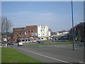
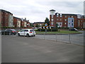
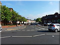
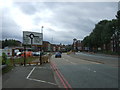
Photos of B16 0HW


Area Information
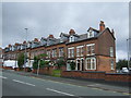
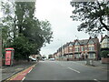
Living in B16 0HW means being part of a small, residential postcode cluster in England with a population of 1,942. This area, though compact, sits within a historically significant part of Birmingham, where the 19th-century legacy of the Edgbaston region still shapes its character. The ward lies south-west of the city centre, a place once protected from industrial development by wealthy families who prioritised green spaces. Today, it balances its heritage with modern amenities. Residents benefit from proximity to both urban infrastructure and pockets of preserved natural areas. The community is defined by its mix of older homes and a focus on local institutions, such as City Road Primary School, which serves the area. While the postcode is small, it connects to broader networks of transport, retail, and cultural sites, offering a blend of convenience and quiet residential appeal.
- Area Type
- Postcode
- Area Size
- Not available
- Population
- 1942
- Population Density
- 8925 people/km²
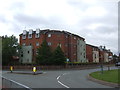
The property market in B16 0HW is characterised by a 44% home ownership rate, indicating that nearly half of residents rent their homes. The area’s accommodation is predominantly houses, reflecting its historical development as a residential zone for families. This contrasts with more densely populated areas where flats or apartments dominate. The relatively low home ownership rate suggests a rental market that may offer flexibility for buyers seeking investment opportunities or first-time buyers looking to enter a competitive market. However, the small size of the postcode means that property availability is limited, and buyers should consider nearby areas for broader options. The focus on houses also implies a preference for family-friendly living, which aligns with the presence of schools and local amenities.
House Prices in B16 0HW
No properties found in this postcode.
Energy Efficiency in B16 0HW
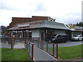
The lifestyle in B16 0HW is shaped by its proximity to a range of amenities within practical reach. Retail options include Lidl Winson, Farmfoods Smethwick, and M&S Midland, offering convenience for daily shopping. Metro services like Winson Green Outer Circle and Edgbaston Village provide access to local hubs, while rail stations such as Five Ways Railway Station connect to broader networks. The area’s historical roots are complemented by modern conveniences, though specific parks or leisure facilities are not detailed in the data. The presence of schools, transport links, and retail venues suggests a functional, community-oriented lifestyle, with opportunities for both routine errands and occasional leisure activities.
Amenities
Schools
The nearest schools to B16 0HW are all City Road Primary School, a primary school with one entry noting an Ofsted rating of ‘good’. While the data lists three identical school names, it is likely that the repetition reflects administrative duplication rather than multiple distinct institutions. For families, this suggests a single primary school serving the area, which may impact choices for secondary education. The ‘good’ Ofsted rating indicates a school meeting standards in teaching and pupil outcomes, though it does not provide information on secondary options. Parents may need to look beyond the immediate postcode for secondary schools, as no data is provided on higher education institutions in the area.
| Rank | School | Type | Entry gender | Ages |
|---|
Explore more schools in this area
Go to Schools tabDemographics
The community in B16 0HW has a median age of 47, with adults aged 30–64 forming the largest demographic group. Home ownership stands at 44%, suggesting a mix of owner-occupied properties and rental homes. The predominant ethnic group is Asian, reflecting broader trends in the West Midlands. The area’s housing stock is largely composed of houses, which aligns with its historical development as a residential zone for wealthier families. This demographic profile indicates a stable, middle-aged population with established roots. However, the 44% home ownership rate also highlights a significant proportion of renters, which may influence local housing dynamics. The absence of specific deprivation data means that quality of life factors like access to services and employment opportunities are not quantified here, but the presence of schools, transport links, and amenities suggests a functional, if modest, community infrastructure.
Household Size
Accommodation Type
Tenure
Ethnic Group
Religion
Household Composition
Age
Household Deprivation
NS-SEC
Explore more demographic insights in this area
Go to Demographics tabPlanning
Planning Constraints
- Flood RiskPremium
- Ramsar Wetland SitesPremium
- Area of Outstanding Natural BeautyPremium
- Protected Nature ReservePremium
- Protected WoodlandPremium