Area Overview for B16 0EA
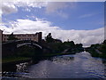
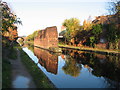
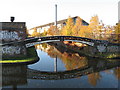
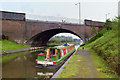
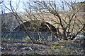
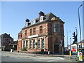
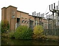
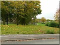
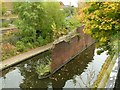
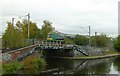
Photos of B16 0EA


Area Information
B16 0EA lies in the heart of North Edgbaston, a historically significant ward in Birmingham’s west. With a population of 2,103, it is a compact residential cluster blending 19th-century heritage with modern living. The area was shaped by families like the Gough-Calthorpe and Gillotts, who preserved its character by resisting industrial development, earning it the nickname “where the trees begin.” Residents benefit from proximity to Birmingham city centre, with landmarks like Edgbaston Hall and Edgbaston Pool nearby. The ward’s mix of tree-lined streets and historic buildings offers a quiet contrast to the city’s hustle. Local amenities, including retail hubs and transport links, ensure convenience without sacrificing the charm of a low-density, house-dominated neighbourhood. For buyers, B16 0EA represents a rare blend of heritage, accessibility, and a community rooted in tradition yet connected to contemporary urban life.
- Area Type
- Postcode
- Area Size
- Not available
- Population
- 2103
- Population Density
- 3499 people/km²
B16 0EA is a house-dominated area with 27% of properties owner-occupied, indicating a rental market that likely outpaces owner-occupation. The low home ownership rate suggests limited availability of long-term buy-to-let properties, with many residents renting from private landlords or housing associations. The prevalence of houses over flats implies a lower density, offering more private outdoor space but potentially fewer communal amenities. Given the area’s small size, buyers may need to look beyond B16 0EA itself, exploring nearby postcode clusters for additional housing options. The market’s character is defined by its historical architecture and limited new-build development, appealing to those seeking traditional properties in a well-established neighbourhood.
House Prices in B16 0EA
No properties found in this postcode.
Energy Efficiency in B16 0EA
The lifestyle in B16 0EA is defined by accessibility to a range of amenities. Within practical reach are five retail outlets, including M&S Midland, and five metro stations like Winson Green Outer Circle, facilitating easy access to shopping and transport. Rail links to Jewellery Quarter and Birmingham Snow Hill stations enhance connectivity for those working or commuting across the city. The area’s proximity to Edgbaston Pool and Deer’s Leap Wood offers green spaces for leisure, while historical sites like Edgbaston Hall add cultural depth. The mix of retail, transport, and natural spaces creates a balanced lifestyle, blending urban convenience with the tranquillity of a historically preserved neighbourhood.
Amenities
Schools
B16 0EA is served by two primary schools with Ofsted ratings of “good.” Barford Primary School and St Patrick and St Edmund’s Catholic Primary School provide quality education for younger children. Both institutions cater to primary-level needs, offering parents a choice between state and faith-based schooling. The presence of two well-rated primary schools within proximity supports families seeking reliable education for their children. While no secondary schools are listed, the area’s connection to Birmingham’s broader network ensures access to further education options. The school mix reflects a focus on early education, aligning with the community’s demographic profile of established adults and families.
| Rank | School | Type | Entry gender | Ages |
|---|
Explore more schools in this area
Go to Schools tabDemographics
The population of B16 0EA is 2,103, with a median age of 47. The most common age group is adults aged 30–64, reflecting a mature, settled community. Home ownership here is low at 27%, suggesting a higher proportion of renters. The area is dominated by houses rather than flats, aligning with its residential character. The predominant ethnic group is White, though specific data on diversity is not provided. The age profile indicates a community likely focused on stability and long-term living, with fewer young families or students. This demographic mix may influence local services and amenities, prioritising convenience for middle-aged residents over facilities tailored to younger demographics.
Household Size
Accommodation Type
Tenure
Ethnic Group
Religion
Household Composition
Age
Household Deprivation
NS-SEC
Explore more demographic insights in this area
Go to Demographics tabPlanning
Planning Constraints
- Flood RiskPremium
- Ramsar Wetland SitesPremium
- Area of Outstanding Natural BeautyPremium
- Protected Nature ReservePremium
- Protected WoodlandPremium