Area Overview for B16 0BZ
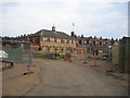
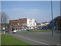
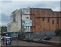
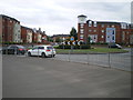
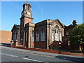
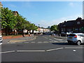
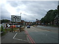
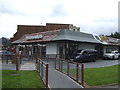
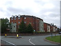
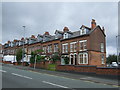
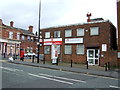
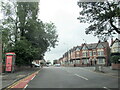
Photos of B16 0BZ
Area Information
B16 0BZ lies within the North Edgbaston ward of Birmingham, a historically significant area that once resisted industrialisation, preserving its tree-lined charm and attracting wealthier residents. With a population of just 1,942, this small postcode area is a tight-knit residential cluster in the city’s western reaches, close to Birmingham’s core. Its 19th-century heritage, shaped by families like the Gough-Calthorpe and Gillotts, created a legacy of green spaces and architectural character. Today, the area blends suburban tranquillity with proximity to Birmingham’s urban vibrancy. Residents benefit from being near cultural landmarks such as Edgbaston Hall and Edgbaston Pool, a Site of Special Scientific Interest. The postcode’s compact size means it is served by multiple transport routes, including rail and metro lines, and it is within reach of Birmingham’s bustling commercial and educational hubs. For those seeking a quieter, yet well-connected slice of the city, B16 0BZ offers a distinct blend of historical preservation and modern convenience.
- Area Type
- Postcode
- Area Size
- Not available
- Population
- 1942
- Population Density
- 8925 people/km²
The property market in B16 0BZ is characterised by a 44% home ownership rate, indicating that nearly half of the area’s properties are owner-occupied, while the remainder are likely rented. The predominant accommodation type is houses, which is typical of suburban areas and suggests a focus on family homes. This mix of ownership and rental properties creates a dynamic market, with potential for both long-term investment and rental opportunities. Given the area’s small size and proximity to Birmingham’s urban core, property values may reflect the appeal of living in a historically preserved neighbourhood with access to amenities. Buyers should consider the limited number of properties available, as the area’s compact nature means competition could be fierce. The presence of houses rather than flats also implies a preference for larger, more private living spaces, which may appeal to families or those seeking a quieter lifestyle.
House Prices in B16 0BZ
No properties found in this postcode.
Energy Efficiency in B16 0BZ
The lifestyle in B16 0BZ is shaped by its proximity to retail, transport, and green spaces. Within walking distance are five retail venues, including Lidl Winson and Farmfoods Smethwick, offering everyday shopping. Metro and rail stations provide easy access to Birmingham’s cultural and commercial districts, while the area’s historical parks and woodlands, such as Edgbaston Pool and Deer’s Leap Wood, offer recreational opportunities. The presence of multiple transport options, combined with local amenities, creates a convenient, balanced lifestyle. Residents can enjoy both suburban tranquillity and urban connectivity, with the area’s tree-lined heritage adding to its appeal. The mix of retail, transport, and green spaces ensures that daily life is both practical and enjoyable, supporting a range of interests and needs.
Amenities
Schools
The nearest school to B16 0BZ is City Road Primary School, which serves the area with primary education. The school has an Ofsted rating of ‘good’, indicating a satisfactory standard of teaching and facilities. While only one primary school is listed, its repeated mention in the data suggests it is the main educational provider for the area. Families in B16 0BZ relying on this school would need to consider secondary education options beyond the immediate postcode, as no secondary schools are mentioned in the data. The presence of a ‘good’-rated primary school is a positive factor for parents seeking quality early education, but the lack of secondary schooling nearby could influence decisions about long-term residency or commuting to other parts of Birmingham.
| Rank | School | Type | Entry gender | Ages |
|---|
Explore more schools in this area
Go to Schools tabDemographics
The population of B16 0BZ is 1,942, with a median age of 47, indicating a mature community. The most common age range is adults aged 30–64, suggesting a stable population with established households. Home ownership stands at 44%, meaning nearly half of properties are owner-occupied, while the rest are likely rented. The predominant accommodation type is houses, which aligns with the area’s suburban character. The largest ethnic group is the Asian_total category, reflecting a diverse demographic. This mix of age groups and backgrounds creates a community with a balance of experience and family-oriented living. The absence of specific deprivation data means the area’s socioeconomic profile is not explicitly detailed, but the high proportion of owner-occupied homes and the presence of established residents suggest a relatively stable, middle-income environment.
Household Size
Accommodation Type
Tenure
Ethnic Group
Religion
Household Composition
Age
Household Deprivation
NS-SEC
Explore more demographic insights in this area
Go to Demographics tabPlanning
Planning Constraints
- Flood RiskPremium
- Ramsar Wetland SitesPremium
- Area of Outstanding Natural BeautyPremium
- Protected Nature ReservePremium
- Protected WoodlandPremium