Area Overview for B16 0BH
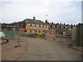
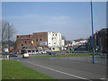
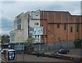
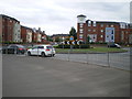
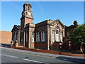
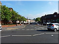
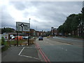
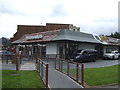
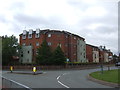
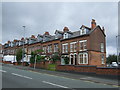
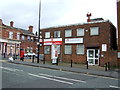
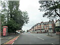
Photos of B16 0BH
Area Information
B16 0BH is a small residential postcode area in the west of Birmingham, part of the North Edgbaston ward. With a population of just 1,942, it reflects the compact, low-density character of the broader Edgbaston area. Historically shaped by 19th-century landowners who resisted industrial development, the area retains a residential charm, earning it the nickname “where the trees begin.” Located immediately south-west of Birmingham city centre, it balances proximity to urban amenities with a quieter, more traditional feel. The ward’s population, while modest, contributes to a tight-knit community, and its proximity to landmarks like Edgbaston Hall and Edgbaston Pool adds local interest. Living here means navigating a mix of historic and modern Birmingham, with easy access to the city’s cultural and economic hubs. The area’s small size means residents are likely to know their neighbours, though the limited population also means fewer large-scale amenities compared to central Birmingham.
- Area Type
- Postcode
- Area Size
- Not available
- Population
- 1942
- Population Density
- 8925 people/km²
B16 0BH is characterised by a housing stock dominated by individual houses, with 44% of properties owner-occupied. This suggests a mix of owner-occupied homes and rental properties, though the precise split is not quantified. The prevalence of houses, as opposed to flats or apartments, aligns with Edgbaston’s historical development as a residential area with low-density housing. For buyers, this means a focus on standalone properties rather than high-rise or shared accommodation. The small size of the postcode area implies limited housing diversity, with potential constraints on availability. Proximity to Birmingham’s city centre may make the area attractive to those seeking a quieter residential environment while retaining access to urban amenities. However, the limited data on property types and prices means buyers should consider the broader Edgbaston area for a more comprehensive market picture.
House Prices in B16 0BH
No properties found in this postcode.
Energy Efficiency in B16 0BH
B16 0BH offers a range of amenities within practical reach, including retail outlets such as Lidl Winson, Farmfoods Smethwick, and M&S Midland. The metro system provides access to stations like Soho Benson Road and Edgbaston Village, while rail stations such as Five Ways and Smethwick Rolfe Street connect to broader networks. These transport options enhance accessibility to Birmingham’s cultural and commercial centres. The area’s proximity to historical sites like Edgbaston Hall and Edgbaston Pool adds local interest, though recreational spaces are not explicitly detailed. The mix of retail, transport, and historic landmarks creates a lifestyle that balances convenience with the area’s traditional character, making it suitable for those seeking a blend of urban and suburban living.
Amenities
Schools
The nearest school to B16 0BH is City Road Primary School, a primary school with an Ofsted rating of “good.” This single listed school indicates a focus on primary education for local families, though no secondary schools are mentioned in the data. The absence of additional schools suggests that families may need to travel beyond the immediate area for secondary education. The “good” Ofsted rating reflects a satisfactory standard of teaching and facilities, though specific details on curriculum or pupil outcomes are not provided. For parents, the availability of a primary school with a positive rating is a key consideration, but the lack of secondary options may necessitate planning for longer commutes or exploring nearby districts.
| Rank | School | Type | Entry gender | Ages |
|---|
Explore more schools in this area
Go to Schools tabDemographics
The population of B16 0BH has a median age of 47, with the majority of residents aged between 30 and 64. This suggests a community skewed towards middle-aged adults, potentially reflecting a mix of long-term residents and families. Home ownership in the area stands at 44%, indicating a significant proportion of renters, though the exact balance between owner-occupied and rental properties is not specified. The predominant accommodation type is houses, which aligns with Edgbaston’s historical character as a residential area. The dominant ethnic group is listed as Asian_total, though specific proportions are not provided. This demographic profile suggests a stable, mature community with established roots. The absence of explicit data on deprivation or socioeconomic status means the area’s quality of life can only be inferred from the available figures, which point to a balanced mix of household types and a focus on residential living.
Household Size
Accommodation Type
Tenure
Ethnic Group
Religion
Household Composition
Age
Household Deprivation
NS-SEC
Explore more demographic insights in this area
Go to Demographics tabPlanning
Planning Constraints
- Flood RiskPremium
- Ramsar Wetland SitesPremium
- Area of Outstanding Natural BeautyPremium
- Protected Nature ReservePremium
- Protected WoodlandPremium