Area Overview for B15 3JL
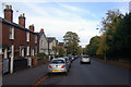
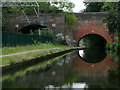
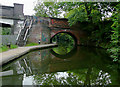
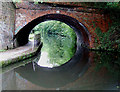
Photos of B15 3JL


Area Information
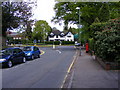
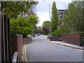
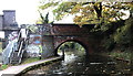
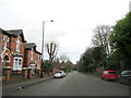
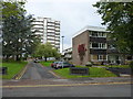
Living in B15 3JL means inhabiting a small, densely populated residential cluster in Birmingham’s southwest. The area covers just 1.1 hectares, yet it holds 1,685 residents, creating a compact, tightly knit community. Situated in the Edgbaston Ward, this postcode lies within a historically affluent suburb known for its green spaces, historic homes, and proximity to the city centre. The area’s character is shaped by its suburban layout, with trees and private residences dominating the landscape. Notable figures like J.R.R. Tolkien and Nick Mason once called this area home, reflecting its long-standing appeal to professionals and families. Modern residents benefit from proximity to Birmingham’s cultural and commercial hubs, while the low crime risk and absence of environmental constraints make it a practical choice for buyers. The blend of historic charm and contemporary amenities, including nearby schools and transport links, ensures B15 3JL remains a desirable spot for those seeking a balance between urban convenience and suburban tranquillity.
- Area Type
- Postcode
- Area Size
- 1.1 hectares
- Population
- 1685
- Population Density
- 2646 people/km²
The property market in B15 3JL is dominated by owner-occupied homes, with 69% of residents in house ownership. This contrasts with areas where rental demand drives the market, suggesting a focus on long-term residency rather than short-term investment. The prevalence of houses over flats indicates a family-friendly environment, though the small area size (1.1 hectares) means housing stock is limited. Buyers should consider competition for properties, as the compact nature of the postcode may restrict availability. The lack of planning constraints—no protected areas or AONB coverage—could ease development pressures, though the high population density suggests land is already maximised. For those seeking a home, B15 3JL offers a mix of historic and modern housing, but buyers must act swiftly given the area’s popularity among young professionals and families.
House Prices in B15 3JL
No properties found in this postcode.
Energy Efficiency in B15 3JL
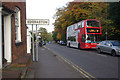
Life in B15 3JL is shaped by its proximity to shops, transport, and green spaces. Retail options include M&S Harborne, Iceland Harborne, and Sainsburys Harborne, offering daily essentials within walking distance. The area’s rail and metro connections—University Station, Five Ways, and Selly Oak—provide swift access to Birmingham’s city centre and beyond. While the data does not detail parks or leisure facilities, the broader Edgbaston area is known for its historic homes and tree-lined streets, suggesting a blend of suburban comfort and urban vibrancy. Residents benefit from a compact, walkable environment where amenities are clustered, reducing the need for long commutes. The mix of retail, transport, and historic character creates a lifestyle that balances convenience with a sense of community.
Amenities
Schools
Residents of B15 3JL have access to a range of educational institutions, including Chad Vale Primary School (Ofsted rating: good) and Harborne Academy (Ofsted rating: good), both offering strong state education. The Blue Coat School Birmingham, an independent institution, provides an alternative for families seeking fee-paying options. Harborne Hill School, a primary school without an Ofsted rating listed, complements the local network. This mix of state and independent schools ensures flexibility for families, whether prioritising affordability or specialised education. The presence of two schools with ‘good’ ratings suggests a commitment to quality education, which is a key factor for parents considering the area. Proximity to these schools, combined with the area’s safety profile, makes B15 3JL appealing for families seeking a balanced educational environment.
| Rank | School | Type | Entry gender | Ages |
|---|
Explore more schools in this area
Go to Schools tabDemographics
B15 3JL’s population of 1,685 is predominantly young adults, with a median age of 22 and 69% of residents owning their homes. This suggests a community skewed toward professionals, students, or young families seeking affordable housing. The area’s high population density—148,110 people per square kilometre—reflects its compact nature, with housing stock focused on family homes rather than flats. The predominant ethnic group is White, and the absence of specific deprivation data implies a relatively stable socioeconomic profile. However, the high proportion of young adults may indicate a transient population, with potential impacts on local services and community cohesion. For buyers, this demographic suggests a dynamic but possibly evolving neighbourhood, where demand for housing could shift with changing trends.
Household Size
Accommodation Type
Tenure
Ethnic Group
Religion
Household Composition
Age
Household Deprivation
NS-SEC
Explore more demographic insights in this area
Go to Demographics tabPlanning
Planning Constraints
- Flood RiskPremium
- Ramsar Wetland SitesPremium
- Area of Outstanding Natural BeautyPremium
- Protected Nature ReservePremium
- Protected WoodlandPremium