Area Overview for B15 3EP
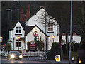
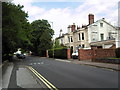
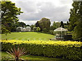
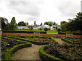
Photos of B15 3EP


Area Information
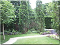
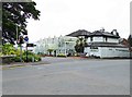
B15 3EP represents a specific postcode area covering a small residential cluster within the broader Edgbaston ward in southwest Birmingham. This location forms part of the larger Edgbaston area, which historically belonged to Warwickshire before becoming a key suburb of the city. The specific cluster houses a population of 1,881 residents, making it a compact community compared to the wider ward which holds over 18,000 people. Data from the area indicates coordinates roughly at 52.470108, -1.91752, pinpointing its precise location just south-west of the city centre. Living in this postcode offers proximity to historic sites and green spaces that define the wider neighbourhood's character. The area retains an affluent residential feel rooted in its history as a place where the Gough-Calthorpe family banned factories to attract wealthy owners in the 19th century. Today, the cluster sits within a ward that includes Bartley Green, Edgbaston, Harborne, North Edgbaston, and Quinton. Whether you are considering a property here or exploring the surrounding neighbourhoods, your starting point is this established residential core.
- Area Type
- Postcode
- Area Size
- Not available
- Population
- Not available
- Population Density
- Not available
The property market in B15 3EP is distinctly characterised by high levels of private residence. With 82% of the household population owning their home, this small cluster operates more as an established owner-occupied market than a landlord-dominated rental hub. The accommodation type data confirms that houses make up the primary stock, meaning few flats or converted apartments exist within this specific postcode boundary. This housing profile aligns with the area's history of attracting wealthy business owners and notable figures during the 19th and 20th centuries. The Grade I listed house at 21 Yateley Road and the historic presence of Edgbaston Hall set the tone for the architectural standards in the wider neighbourhood. If you are looking to buy, the high ownership rate suggests strong local sentiment and likely good maintenance standards across the estate. While specific price trends are not listed, the nature of the stock points towards a market where buyers are purchasing established freehold properties rather than seeking entry-level leaseholds. The concentration of houses also implies larger gardens and more space per household compared to city centre developments.
House Prices in B15 3EP
No properties found in this postcode.
Energy Efficiency in B15 3EP
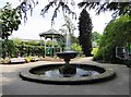
Daily life in B15 3EP is defined by the convenience of nearby amenities and the character of the surrounding streets. You have immediate access to five retail sites including Spar Ample, Tesco Hagley, and Morrisons Edgbaston, ensuring your weekly shopping needs are met without long journeys. The wider neighbourhood offers substantial transport links with five metro stations and five rail stations nearby. Specific venues like Edgbaston Village, Centenary Square, and the Birmingham Town Hall provide cultural and civic engagement options within reach. The area Research highlights the presence of notable features such as the Birmingham Oratory church on Hagley Road and the former BBC Pebble Mill Studios site, now the Birmingham Dental Hospital. While the specific postcode itself is a residential cluster, these nearby landmarks enrich the daily experience for residents. The layout of the area, part of the Edgbaston ward, balances private housing with public infrastructure. You can walk to local shops or catch a train to these vibrant city centres, blending suburban comfort with urban accessibility. This mix allows you to maintain a quiet home life while staying connected to the city's pulse.
Amenities
Schools
| Rank | School | Type | Entry gender | Ages |
|---|
Explore more schools in this area
Go to Schools tabDemographics
The community profile for B15 3EP shows a mature population with a median age of 47 years. Most residents fall into the adult age range between 30 and 64 years old. This demographic structure suggests an area dominated by families in their middle years and older adults rather than a young professional crowd or retirees alone. Home ownership stands at a robust 82% within this specific postcode, indicating that the vast majority of these homes are privately owned rather than rented. Housing stock in the area consists primarily of houses, fitting the historical legacy of large Victorian and Edwardian residences associated with figures like J.R.R. Tolkien and Nick Mason. The predominant ethnic group recorded in the data is Asian. With such a high rate of home ownership and a stable age profile, you are looking at an established community where residents have a long-term stake in their neighbourhood. This stability often translates to lower turnover and more settled local groups.
Household Size
Accommodation Type
Tenure
Ethnic Group
Religion
Household Composition
Age
Household Deprivation
NS-SEC
Explore more demographic insights in this area
Go to Demographics tabPlanning
Planning Constraints
- Flood RiskPremium
- Ramsar Wetland SitesPremium
- Area of Outstanding Natural BeautyPremium
- Protected Nature ReservePremium
- Protected WoodlandPremium