Area Overview for B15 2UA
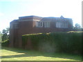
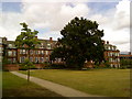
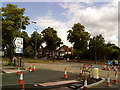
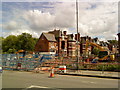
Photos of B15 2UA


Area Information
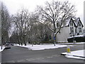
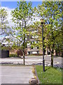
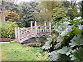
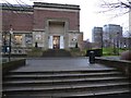
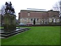
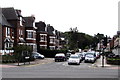
Living in B15 2UA means residing in a compact, residential cluster within Birmingham’s Edgbaston area. The postcode covers 4.4 hectares and is home to 2,444 people, translating to a population density of 1,053 people per square kilometre. This small area sits in the southwest of Birmingham, historically part of Warwickshire, and is known for its suburban character. Edgbaston’s legacy as a wealthy residential district persists, with green spaces, historic homes, and a mix of modern and traditional architecture. The area’s proximity to the city centre, combined with its quiet, tree-lined streets, offers a balance of urban convenience and suburban tranquillity. Residents benefit from nearby educational institutions, including independent schools and the University of Birmingham, as well as transport links via rail and metro systems. The community is young, with a median age of 22, and reflects a mix of home ownership and rental properties. Daily life here is shaped by a blend of local amenities, cultural landmarks, and the area’s historical significance as a former hub for affluent families and notable figures.
- Area Type
- Postcode
- Area Size
- 4.4 hectares
- Population
- 2444
- Population Density
- 1053 people/km²
The property market in B15 2UA is characterised by a 49% home ownership rate, with flats being the dominant accommodation type. This suggests a rental market that caters to students, young professionals, and those seeking affordable housing near Birmingham’s educational and transport hubs. The compact size of the postcode area means property availability is limited, potentially driving competition among buyers. Flats in this area are likely to be part of larger residential developments, reflecting the suburban yet urbanised nature of Edgbaston. For buyers, this small area’s proximity to the University of Birmingham and independent schools may make it attractive to those prioritising convenience over expansive living spaces. However, the predominance of flats could limit options for those seeking larger homes or family-friendly layouts. The market’s dynamics are influenced by the area’s historical appeal to affluent residents, though current affordability may align with younger demographics.
House Prices in B15 2UA
Showing 1 properties
| Address | Type | Beds | Baths | Last Sale Price | Last Sale Date | |
|---|---|---|---|---|---|---|
| King Edwards School, Edgbaston Park Road, Birmingham, B15 2UA | education | - | - | - | - |
Energy Efficiency in B15 2UA
Residents of B15 2UA enjoy a range of amenities within practical reach, enhancing daily life in the area. Retail options include Spar, Tesco Selly Oak Bristol, and Asda Edgbaston, providing essential shopping and convenience services. The proximity to rail stations and metro stops like Edgbaston Village and Centenary Square connects residents to Birmingham’s cultural and commercial hubs. While specific parks or leisure facilities are not listed, the area’s suburban character suggests access to green spaces and historic sites, such as Edgbaston Hall and the Birmingham Oratory. The presence of independent schools and the University of Birmingham adds to the area’s academic and social vibrancy. Overall, the combination of retail, transport, and educational resources creates a convenient, connected lifestyle, though the absence of detailed leisure amenities may require residents to venture slightly further for recreational activities.
Amenities
Schools
Residents of B15 2UA have access to a range of educational institutions, including two independent schools and the University of Birmingham. King Edward’s School and King Edward VI High School for Girls are both independent institutions, likely offering high-quality education with selective admissions. The University of Birmingham, a major research university, provides higher education opportunities and contributes to the area’s academic environment. The presence of independent schools may appeal to families seeking structured, fee-paying education, while the university’s proximity supports students and academic staff. This mix of school types ensures a variety of options for different educational needs, from primary to tertiary levels. However, no Ofsted ratings or specific performance data are provided in the data, so prospective families may need to conduct further research into individual school standards.
| Rank | School | Type | Entry gender | Ages |
|---|
Explore more schools in this area
Go to Schools tabDemographics
The population of B15 2UA is predominantly young adults, with 15–29-year-olds making up the most common age range. The median age of 22 reflects a community skewed towards students and early-career professionals. Home ownership stands at 49%, with flats being the primary accommodation type. This suggests a mix of rental properties and owner-occupied units, likely influenced by the area’s proximity to educational institutions and its appeal to younger residents. The predominant ethnic group is White, though no specific diversity statistics are provided. The population density of 1,053 people per square kilometre indicates a moderately compact living environment. While no deprivation data is explicitly stated, the presence of independent schools and transport links suggests access to resources that support quality of life. The relatively low median age also implies a dynamic, youthful community with potential for social and economic growth.
Household Size
Accommodation Type
Tenure
Ethnic Group
Religion
Household Composition
Age
Household Deprivation
NS-SEC
Explore more demographic insights in this area
Go to Demographics tabPlanning
Planning Constraints
- Flood RiskPremium
- Ramsar Wetland SitesPremium
- Area of Outstanding Natural BeautyPremium
- Protected Nature ReservePremium
- Protected WoodlandPremium