Area Overview for B15 2RY
Photos of B15 2RY

Area Information
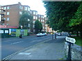
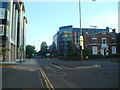
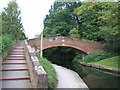
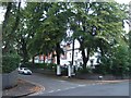
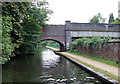
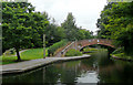
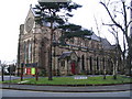
Living in B15 2RY means inhabiting a small, residential cluster in the southwest of Birmingham, where suburban tranquillity meets proximity to the city’s core. The area forms part of the larger Edgbaston district, historically rooted in Warwickshire, and is marked by its green spaces, historic architecture, and affluent residential character. With a population of 1,538, it reflects a compact community defined by low-density housing and a mix of long-standing residents and families. The area’s appeal lies in its balance of suburban comfort and easy access to Birmingham’s amenities, from cultural hubs to transport networks. Daily life here is shaped by the presence of independent schools, well-connected rail links, and a heritage of private homes. The postcode’s boundaries encompass parts of Edgbaston Ward, which has evolved since the 19th century, influenced by figures like J.R.R. Tolkien and Cardinal Newman. While small in scale, B15 2RY offers a distinct identity, blending historical legacy with modern convenience.
- Area Type
- Postcode
- Area Size
- Not available
- Population
- 1538
- Population Density
- 2653 people/km²
The property market in B15 2RY is characterised by a 54% home ownership rate, with houses forming the predominant accommodation type. This suggests a residential area where private, low-density housing dominates, likely catering to families and professionals seeking stability. The relatively high proportion of owner-occupied homes indicates a community with long-term residents, though the exact proportion of rental properties is not specified. Given the area’s small size and suburban nature, property availability may be limited, making it a niche market for buyers prioritising space and historical character. The presence of historic homes, such as Grade I listed properties, adds to the area’s appeal for those seeking unique architectural features. However, the compact postcode means buyers should consider nearby areas for broader options, balancing the charm of B15 2RY with practicality.
House Prices in B15 2RY
No properties found in this postcode.
Energy Efficiency in B15 2RY
Residents of B15 2RY have access to a range of amenities within walking distance, including retail outlets such as Co-op Edgbaston, Spar Edgbaston, and Morrisons Edgbaston. These shops cater to everyday needs, from groceries to household essentials. The area’s transport links connect residents to Birmingham’s cultural and commercial centres, with metro stops at Edgbaston Village and Centenary Square offering proximity to leisure and dining options. While specific parks or recreational spaces are not detailed in the data, the area’s suburban character suggests nearby green spaces, consistent with Edgbaston’s reputation for tree-lined streets and historic homes. The combination of retail, transport, and proximity to Birmingham’s core ensures a lifestyle that balances convenience with suburban tranquillity.
Amenities
Schools
The nearest school to B15 2RY is Priory School, an independent institution. While no Ofsted rating is provided, the presence of an independent school suggests a focus on high-quality education, potentially attracting families prioritising private schooling. The area’s proximity to such a school aligns with Edgbaston’s historical reputation as a desirable residential zone for educated professionals and families. However, the absence of state school data means families relying on public education may need to look further afield. The mix of school types reflects the area’s demographic profile, with independent education serving as a key draw for households seeking tailored academic environments.
| Rank | A + A* % | School | Type | Entry gender | Ages |
|---|---|---|---|---|---|
| 1 | N/A | Priory School | independent | N/A | N/A |
Explore more schools in this area
Go to Schools tabDemographics
The population of B15 2RY is 1,538, with a median age of 47, indicating a community skewed toward adults aged 30–64. Home ownership here stands at 54%, suggesting a mix of owner-occupied properties and rental stock. The predominant accommodation type is houses, reflecting a suburban layout with private residences rather than high-density housing. The area’s demographic profile is largely shaped by the White ethnic group, though specific data on diversity is not provided. The age distribution suggests a stable, middle-aged population, potentially attracting families or professionals seeking a settled environment. With no explicit data on deprivation levels, the area’s quality of life is inferred from its low crime risk and access to amenities. This profile aligns with Edgbaston’s historical role as a residential area for affluent residents, maintaining a sense of continuity in its social fabric.
Household Size
Accommodation Type
Tenure
Ethnic Group
Religion
Household Composition
Age
Household Deprivation
NS-SEC
Explore more demographic insights in this area
Go to Demographics tabPlanning
Planning Constraints
- Flood RiskLocked
- Ramsar Wetland SitesLocked
- Area of Outstanding Natural BeautyLocked
- Protected Nature ReserveLocked
- Protected WoodlandLocked
- Crime RiskLocked