Area Overview for B15 2RW
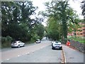
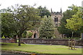
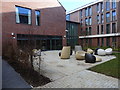
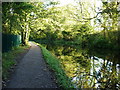
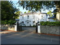
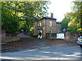
Photos of B15 2RW
Area Information
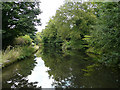
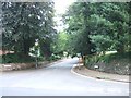
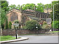
Living in B15 2RW means inhabiting a small residential cluster in southwest Birmingham, where the population of 2,444 residents lives at a density of 1,053 people per square kilometre. This postcode area, part of the broader Edgbaston region, blends suburban tranquillity with proximity to the city’s academic and cultural hubs. Historically shaped by wealthy landowners like the Gough-Calthorpe family, the area retains an affluent residential character, with green spaces and historic private houses defining its landscape. Residents benefit from proximity to the University of Birmingham, which anchors the local economy and offers opportunities for education and employment. The area’s compact size means amenities and services are within practical reach, while its boundaries encompass parts of Edgbaston, Harborne, and Quinton. With a median age of 22, the community is young, reflecting the presence of students and young professionals drawn to the area’s mix of residential comfort and urban connectivity.
- Area Type
- Postcode
- Area Size
- Not available
- Population
- 2444
- Population Density
- 1053 people/km²
The property market in B15 2RW is characterised by a 49% home ownership rate, with flats comprising the majority of accommodation types. This suggests a mix of rental and owner-occupied properties, though the small area’s limited size means the housing stock is unlikely to cater to large families or those seeking larger homes. The prevalence of flats may indicate a focus on affordability and proximity to amenities, particularly for students or young professionals. Buyers considering this area should note its compact nature, which may limit property diversity. The surrounding regions, such as Edgbaston and Harborne, likely offer more varied options, but B15 2RW itself remains a niche postcode with limited scope for expansion.
House Prices in B15 2RW
No properties found in this postcode.
Energy Efficiency in B15 2RW
Residents of B15 2RW enjoy access to a range of amenities within practical reach. Retail options include Spar, Tesco Selly Oak Bristol, and Sainsburys Selly Oak, offering everyday shopping needs. The area’s rail network connects to University, Selly Oak, and Five Ways stations, while metro stops like Edgbaston Village and Centenary Square provide further transport links. These facilities support a convenient lifestyle, with proximity to both local services and broader urban connectivity. The mix of retail, transport, and nearby green spaces contributes to a balanced daily life, though the area’s small size means major leisure or entertainment hubs may require travel beyond the immediate postcode.
Amenities
Schools
Residents of B15 2RW have access to a range of educational institutions, including two independent schools: King Edward’s School and King Edward VI High School for Girls. These institutions cater to private education, offering structured curricula and resources. The University of Birmingham, though not a traditional school, is within proximity, providing higher education opportunities and research facilities. The mix of independent and higher education options suits families seeking structured schooling or those pursuing academic careers. However, the absence of state schools in the data means families relying on public education may need to look beyond the immediate area.
| Rank | School | Type | Entry gender | Ages |
|---|
Explore more schools in this area
Go to Schools tabDemographics
The population of B15 2RW is dominated by young adults, with 15–29-year-olds making up the most common age group. This demographic profile aligns with the area’s proximity to the University of Birmingham, where students and academics may reside. Home ownership rates stand at 49%, indicating a balance between owner-occupied properties and rental housing. The accommodation type is predominantly flats, reflecting the area’s residential density and likely influence of student housing or shared living arrangements. The predominant ethnic group is White, though specific diversity metrics are not quantified in the data. The low median age of 22 suggests a dynamic, transient community, with potential implications for local services and housing demand.
Household Size
Accommodation Type
Tenure
Ethnic Group
Religion
Household Composition
Age
Household Deprivation
NS-SEC
Explore more demographic insights in this area
Go to Demographics tabPlanning
Planning Constraints
- Flood RiskPremium
- Ramsar Wetland SitesPremium
- Area of Outstanding Natural BeautyPremium
- Protected Nature ReservePremium
- Protected WoodlandPremium