Area Overview for B15 2RD
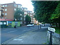
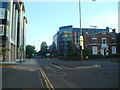
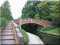
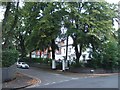
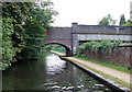
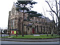
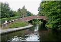
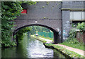
Photos of B15 2RD


Area Information
B15 2RD is a small, residential postcode area within Edgbaston, a suburban district in Birmingham’s southwest. With a population of just 1,179, it reflects the character of a tightly knit community, shaped by historic influences and modern convenience. Edgbaston itself is defined by its tree-lined streets, green spaces, and a mix of private homes and flats, many of which date back to the 19th century. The area’s proximity to Birmingham’s city centre, combined with its suburban tranquillity, makes it appealing to professionals and families seeking a balance between urban accessibility and residential comfort. Notable landmarks include Grade I-listed buildings and the former BBC Pebble Mill Studios, now a dental hospital. The postcode’s small size means it is part of a larger electoral ward, but its distinctiveness lies in its blend of historical legacy and contemporary amenities, from independent schools to nearby rail links. For those considering living here, the area offers a compact, well-served environment with a focus on community and convenience.
- Area Type
- Postcode
- Area Size
- Not available
- Population
- 1179
- Population Density
- 1551 people/km²
B15 2RD’s property market is characterised by a 60% home ownership rate, with flats being the predominant accommodation type. This suggests a mix of owner-occupied properties and rental units, though the exact proportion of the latter is unspecified. The prevalence of flats indicates a housing stock that may include older, purpose-built blocks or converted buildings, typical of suburban areas with limited land for detached homes. Given the postcode’s small size, the available housing stock is likely constrained, meaning buyers may need to consider nearby areas for more options. The 60% ownership rate also implies a degree of stability, with long-term residents potentially outnumbering renters. However, the lack of specific data on property prices or availability means the market’s dynamics remain opaque. For buyers, the focus should be on the area’s proximity to amenities and transport, as well as its historical character, which may appeal to those prioritising location over property type.
House Prices in B15 2RD
No properties found in this postcode.
Energy Efficiency in B15 2RD
The lifestyle in B15 2RD is shaped by its proximity to a variety of amenities. Retail options include Spar Ample, Morrisons Edgbaston, and Co-op Edgbaston, ensuring residents have access to essential shopping. The metro areas of Edgbaston Village, Centenary Square, and Town Hall offer dining, leisure, and cultural opportunities, while nearby rail stations connect to Birmingham’s broader network. The area’s suburban character, with its green spaces and historic architecture, complements its practical amenities. Residents can enjoy a mix of convenience and tranquillity, with easy access to both urban and suburban environments. The presence of independent schools and low flood risk further enhances the appeal of daily life here, though the high crime risk necessitates awareness of personal safety.
Amenities
Schools
Residents of B15 2RD have access to a range of schools, including independent and special education institutions. Edgbaston High School for Girls and Mander Portman Woodward Independent College are both independent schools with an Ofsted rating of outstanding, reflecting high standards in education. Edgbaston High School Prep Department also operates as an independent institution, catering to younger students. Hopwood Hall School, a special school, holds a satisfactory Ofsted rating, providing tailored support for students with specific needs. The mix of school types ensures families can choose between high-performing independent institutions and specialist provision. This diversity is particularly valuable for parents seeking either academic excellence or tailored educational support. The proximity of these schools to the postcode underscores Edgbaston’s reputation as a family-friendly area with strong educational infrastructure.
| Rank | School | Type | Entry gender | Ages |
|---|
Explore more schools in this area
Go to Schools tabDemographics
The population of B15 2RD is 1,179, with a median age of 47, indicating a mature demographic skewed towards adults aged 30–64. Home ownership in the area stands at 60%, suggesting a mix of long-term residents and renters. The predominant accommodation type is flats, reflecting the area’s historical development as a residential cluster. The majority of residents identify as White, though specific diversity metrics are not detailed in the data. The age profile and ownership figures suggest a stable, established community, with fewer young families compared to other parts of Birmingham. This demographic profile aligns with Edgbaston’s reputation as an affluent, low-density suburb. The absence of specific deprivation data means the area’s quality of life is inferred from its amenities, transport links, and safety assessments, which include a high crime risk that may impact daily life.
Household Size
Accommodation Type
Tenure
Ethnic Group
Religion
Household Composition
Age
Household Deprivation
NS-SEC
Explore more demographic insights in this area
Go to Demographics tabPlanning
Planning Constraints
- Flood RiskPremium
- Ramsar Wetland SitesPremium
- Area of Outstanding Natural BeautyPremium
- Protected Nature ReservePremium
- Protected WoodlandPremium