Area Overview for B15 2QR
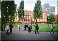
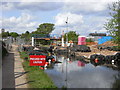
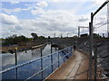
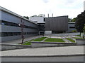
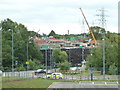
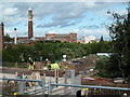
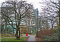
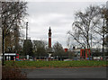
Photos of B15 2QR
Area Information
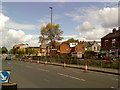
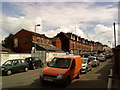
Living in B15 2QR means inhabiting a compact, densely populated residential cluster in the southwest of Birmingham. With 2,550 residents squeezed into a space of 2,388 people per square kilometre, this postcode reflects a suburban yet tightly knit community. Historically part of Warwickshire, the area now sits within Birmingham’s Edgbaston ward, a place shaped by 19th-century affluence and green spaces. Today, it retains a quiet, residential character, with homes predominantly in private ownership. The area’s proximity to the city centre, combined with its low flood risk and limited planning constraints, makes it a practical choice for those seeking a balance between urban access and suburban calm. However, the high crime risk score of 1/100 demands caution. For those who prioritise proximity to transport links and a mix of retail and cultural hubs, B15 2QR offers a compact, if densely lived, slice of Birmingham life.
- Area Type
- Postcode
- Area Size
- Not available
- Population
- 2550
- Population Density
- 2388 people/km²
The property market in B15 2QR is characterised by a 35% home ownership rate, indicating that nearly two-thirds of properties are likely rented. This suggests a rental market that may cater to both short-term tenants and long-term residents seeking stability. The area’s accommodation type is predominantly houses, which, given the small postcode area, implies a limited but possibly high-value housing stock. Buyers should consider that the compact nature of B15 2QR may mean competition for properties, particularly as the area’s proximity to Birmingham’s city centre and transport links could attract interest. However, the low flood risk and lack of planning constraints (such as protected woodlands or AONBs) may make it an attractive option for those prioritising practicality over scenic landscapes. The mix of owner-occupied and rental properties also suggests a dynamic market, though the exact demand drivers remain unclear.
House Prices in B15 2QR
No properties found in this postcode.
Energy Efficiency in B15 2QR
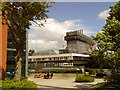
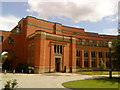
Residents of B15 2QR have access to a range of amenities within walking or short driving distance. Retail options include M&S Birmingham QE Hospital, Spar, and other local shops, providing essentials and everyday convenience. The rail network is particularly well-served, with stations like University, Selly Oak, and Bournville offering links to Birmingham’s broader transport system. Metro stops such as Edgbaston Village and Centenary Square connect to cultural and commercial centres, while Town Hall provides proximity to civic and administrative services. The area’s character is defined by its mix of suburban tranquillity and urban accessibility, with green spaces and historic architecture adding to its appeal. While the density of the area may limit expansive leisure options, the proximity to Birmingham’s city centre ensures a wealth of dining, entertainment, and cultural opportunities just a short journey away.
Amenities
Schools
| Rank | School | Type | Entry gender | Ages |
|---|
Explore more schools in this area
Go to Schools tabDemographics
The population of B15 2QR skews towards adults aged 30–64, with a median age of 47. This suggests a mature, established community, likely with strong family ties and a focus on stability. Home ownership stands at 35%, indicating a mix of owner-occupied properties and rental units, though the exact proportion of renters is not specified. The area is predominantly composed of houses, reflecting a preference for larger, private residences over flats. The dominant ethnic group is White, though no specific breakdown of diversity is provided. The absence of detailed deprivation data means the quality of life implications of this demographic profile remain unquantified. However, the age range and home ownership rate suggest a community with a mix of long-term residents and those seeking a settled environment, possibly including professionals or families.
Household Size
Accommodation Type
Tenure
Ethnic Group
Religion
Household Composition
Age
Household Deprivation
NS-SEC
Explore more demographic insights in this area
Go to Demographics tabPlanning
Planning Constraints
- Flood RiskPremium
- Ramsar Wetland SitesPremium
- Area of Outstanding Natural BeautyPremium
- Protected Nature ReservePremium
- Protected WoodlandPremium