Area Overview for B15 2NJ
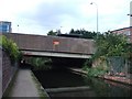
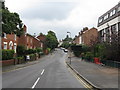
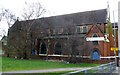
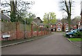
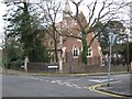
Photos of B15 2NJ
Area Information
B15 2NJ is a specific postcode area covering a small residential cluster within the broader Edgbaston Ward in the southwest of Birmingham. This location serves approximately 2,702 residents and forms part of the historic Edgbaston area that once belonged to Warwickshire before integrating into Birmingham City Council. The address sits just south-west of the city centre, placing it within a zone that historically attracted wealthy business owners and academic figures. Notable historical connections link this postcode to the Gough-Calthorpe family, who banned factories in the region in the 19th century to foster an affluent residential environment. The boundaries of Edgbaston Ward have evolved significantly since 1885, eventually incorporating wards like Harborne and Quinton, though B15 2NJ remains a distinct small cluster within this larger suburban landscape. Living in this postcode means residing in a suburb defined by green spaces and trees, characteristic of its origins as a planned retreat from industrial noise. The area retains an affluent residential feel today, distinct from the commercial hubs nearby while remaining close to key landmarks like Centenary Square and the Birmingham Oratory. Residents benefit from a location that balances suburban tranquillity with proximity to the university district and historical sites such as Edgbaston Hall. The small scale of the population creates a tightly knit local environment where daily life revolves around established residential streets and well-maintained private housing.
- Area Type
- Postcode
- Area Size
- Not available
- Population
- 2702
- Population Density
- 4130 people/km²
Homes in B15 2NJ are dominated by traditional house types rather than apartment blocks. The predominant accommodation type for this postcode is houses, which aligns with the area's historical development as an affluent suburb. Ownership figures show that 72% of residents own their property, signalling that this is fundamentally an owner-occupied market. This high rate of homeownership suggests that buyers are likely to find a market where selling can be relatively straightforward compared to rental-dominated districts. The housing stock reflects the historical land-use decisions of the Gough-Calthorpe family, who protected the area from industrialisation to preserve large estates and private residences. Living in this postcode means accessing established private properties rather than converted flats or high-density living arrangements. The prevalence of houses offers privacy and space, catering to those who prioritise garden access and structural permanence. While specific price indices are not available in the current dataset, the high ownership rate implies competitive equity for long-term residents. The market in this small cluster is likely influenced by the broader demand for housing in the Edgbaston Ward, where demand exceeds supply. Buyers looking at this area can expect a consistent stock of period properties and larger homes suitable for family expansion.
House Prices in B15 2NJ
No properties found in this postcode.
Energy Efficiency in B15 2NJ
Amenities in B15 2NJ fall into three main categories: retail, rail, and metro access, all within practical walking distance of the residential cluster. Five retail outlets serve daily shopping needs, including notable venues such as Co-op Edgbaston, Spar Edgbaston, and Co-op Birmingham. These supermarkets ensure that groceries and essentials are available without requiring long car journeys into the city centre. The rail network offers connections to five stations, with Five Ways Railway Station, Birmingham Moor Street Railway Station, and Birmingham Snow Hill Railway Station providing direct links to Greater Birmingham. Metro services connect residents to Edgbaston Village, Centenary Square, and Birmingham Town Hall, facilitating easy access to the city's cultural and commercial heart. Living in this postcode means having convenient access to food, transport, and social venues without leaving the immediate neighbourhood. The combination of Co-op stores and high-frequency train lines creates a lifestyle where daily errands and commuting blend seamlessly. Residents enjoy the convenience of being close to transport hubs while remaining in a predominantly residential zone. The mix of national chain stores and local infrastructure supports a self-sufficient lifestyle for families and professionals alike.
Amenities
Schools
Residents in B15 2NJ have access to three independent schools within the immediate vicinity. St George's School Edgbaston operates as an independent institution and serves as a key educational option for families in the neighbourhood. Hallfield School also functions as an independent school, offering another choice for private education within reach of the postcode. Accelerated Tutorial School rounds out the trio of independent providers near this residential cluster. No state-maintained schools are explicitly listed for this specific postcode area in the available records, meaning the local educational landscape is shaped by private schooling. Living in B15 2NJ places families within practical distance of these prestigious independent institutions. The mix of school types is exclusively private, catering to households seeking specific educational philosophies or curricula outside the state system. Prospective parents must consider travel times and catchment boundaries when evaluating these options, as distance can impact daily commutes. The presence of these schools reinforces the area's affluent character and suggests a locality where parents invest heavily in elite education for their children.
| Rank | School | Type | Entry gender | Ages |
|---|
Explore more schools in this area
Go to Schools tabDemographics
The community within B15 2NJ is defined by a distinctly young demographic profile. The median age for residents is 22 years, and young adults aged 15 to 29 years form the most common age range. This concentration suggests the area attracts individuals entering the workforce or pursuing further education in the nearby university district. Despite the youthful median age, a significant 72% of households own their home, which is a substantial proportion for such a young population. This high level of ownership contrasts with typical rental-heavy university towns, indicating that many residents have achieved financial stability early in their careers. The predominant ethnic group in B15 2NJ is White, reflecting the area's established historical character. The local housing stock consists primarily of houses rather than flats, offering spacious accommodation suited to families or those seeking separate living grounds. This profile paints a picture of established young professionals who have settled down in the area rather than transient students. Living in B15 2NJ means joining a community where independence and homeownership coexist within a youthful demographic framework. The area maintains a clear residential identity without mixing with commercial or industrial zones, ensuring a stable neighbourhood atmosphere for long-term residents.
Household Size
Accommodation Type
Tenure
Ethnic Group
Religion
Household Composition
Age
Household Deprivation
NS-SEC
Explore more demographic insights in this area
Go to Demographics tabPlanning
Planning Constraints
- Flood RiskPremium
- Ramsar Wetland SitesPremium
- Area of Outstanding Natural BeautyPremium
- Protected Nature ReservePremium
- Protected WoodlandPremium