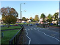
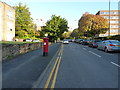
Area Overview for B15 2GW
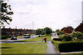
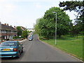
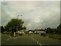
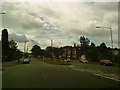
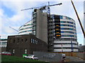
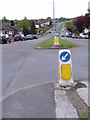
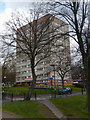
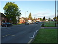
Photos of B15 2GW


Area Information
B15 2GW is a compact residential postcode in Birmingham’s southwest, encompassing 4.7 hectares and home to 2,550 residents. Its population density of 2,388 people per square kilometre reflects a tight-knit, suburban character, typical of areas like Edgbaston, historically shaped by affluent families and green spaces. The area lies just south-west of Birmingham’s city centre, offering proximity to urban amenities while retaining a quieter, residential feel. With a median age of 47 and a majority of residents aged 30–64, B15 2GW is a stable community with a focus on family living. Its history as a former Warwickshire suburb, now part of Birmingham, is marked by tree-lined streets and historic homes. Daily life here balances suburban tranquillity with access to nearby transport hubs, retail, and cultural landmarks. The area’s small size means residents are close to key services, though its limited footprint means community interactions are concentrated within a tight radius. For buyers, this postcode represents a blend of traditional housing stock and modern connectivity, though its small scale means availability is constrained.
- Area Type
- Postcode
- Area Size
- 4.7 hectares
- Population
- 2550
- Population Density
- 2388 people/km²
B15 2GW’s property market is defined by its 35% home ownership rate, with the majority of residents renting. This suggests a rental-dominated market, likely driven by the area’s appeal to professionals and families seeking stability in a suburban setting. The accommodation type is predominantly houses, not flats or apartments, which aligns with the area’s traditional, low-density character. This housing stock may cater to larger households or those preferring detached properties, though the small area size means availability is limited. For buyers, the low home ownership rate implies competition for available properties, particularly in a market where demand may outstrip supply. The presence of historic homes, such as Grade I listed properties, adds to the area’s distinctiveness but may also influence pricing. Buyers should consider the area’s constrained footprint, which may limit long-term growth or investment potential.
House Prices in B15 2GW
Showing 2 properties
| Address | Type | Beds | Baths | Last Sale Price | Last Sale Date | |
|---|---|---|---|---|---|---|
| Pharmacy Department, Queen Elizabeth Hospital, Mindelsohn Way, Birmingham, B15 2GW | shop | - | - | - | - | |
| Marks And Spencer, Queen Elizabeth Hospital, Mindelsohn Way, Birmingham, B15 2GW | shop | - | - | - | - |
Energy Efficiency in B15 2GW
Living in B15 2GW offers access to a range of amenities within practical reach. Retail options include M&S Birmingham QE Hospital, Spar, and other stores, providing everyday shopping needs. The area’s proximity to railway stations like University and Selly Oak Railway Station, along with metro stops such as Edgbaston Village and Centenary Square, ensures easy access to Birmingham’s cultural and commercial hubs. These transport links also open up opportunities for dining, leisure, and entertainment in nearby areas. The area’s character is defined by its historic homes and green spaces, though specific parks or recreational facilities are not detailed in the data. The presence of nearby landmarks, such as the Birmingham Oratory church and Edgbaston Golf Club, adds to the area’s appeal. While the immediate surroundings may lack large-scale amenities, the compact layout ensures convenience for daily needs, with a balance between suburban tranquillity and urban accessibility.
Amenities
Schools
| Rank | School | Type | Entry gender | Ages |
|---|
Explore more schools in this area
Go to Schools tabDemographics
B15 2GW’s population of 2,550 is predominantly composed of adults aged 30–64, with a median age of 47. This suggests a community of established professionals and families, rather than a younger or elderly demographic. Only 35% of residents own their homes, indicating a rental-heavy market, with the remaining 65% likely living in private rented accommodation. The area is characterised by houses, not flats or apartments, reflecting a traditional suburban layout. The predominant ethnic group is White, though no specific data on diversity or deprivation levels is provided. The high population density of 2,388 people per square kilometre, combined with the area’s small size, implies a compact, closely-knit community. This density may influence local amenities and infrastructure, though the data does not specify whether this impacts quality of life. The absence of detailed diversity metrics means the community’s social composition remains largely unquantified.
Household Size
Accommodation Type
Tenure
Ethnic Group
Religion
Household Composition
Age
Household Deprivation
NS-SEC
Explore more demographic insights in this area
Go to Demographics tabPlanning
Planning Constraints
- Flood RiskPremium
- Ramsar Wetland SitesPremium
- Area of Outstanding Natural BeautyPremium
- Protected Nature ReservePremium
- Protected WoodlandPremium