Area Overview for B15 2FL
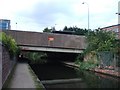
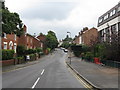
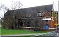
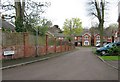
Photos of B15 2FL

Area Information
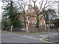
Living in B15 2FL places you in the heart of Birmingham’s Ladywood Ward, an inner-city district with a compact residential cluster of 1,999 residents. This area, historically rooted in medieval woodland and 1960s housing developments, is defined by its proximity to Birmingham’s core landmarks, including the Council House and Town Hall. The population is young, with a median age of 22, though the most common age range is 30–64, suggesting a mix of young professionals and families. The area’s character is shaped by its history of regeneration, with low-rise and high-rise flats dominating the housing stock. While centrally located, B15 2FL is a microcosm of urban life, balancing proximity to retail, transport hubs, and cultural landmarks with the challenges of inner-city living. Its small size means residents are close to key amenities but may feel the density of the city’s pace.
- Area Type
- Postcode
- Area Size
- Not available
- Population
- 1999
- Population Density
- 7308 people/km²
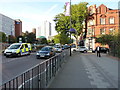
The property market in B15 2FL is characterised by a low home ownership rate of 14%, indicating that the area is primarily a rental market. Flats dominate the housing stock, a legacy of post-1960s regeneration efforts that replaced slums with high-rise and low-rise residential blocks. This configuration suggests limited availability of owner-occupied properties, which may pose challenges for buyers seeking long-term investment or family homes. The small area’s compact size means property choices are restricted to the immediate vicinity, with little scope for expansion. For those considering purchase, the flat-dominated market may offer affordability but limited scope for renovation or customization. The area’s proximity to transport and amenities could offset its limitations, but buyers should weigh the rental market dynamics against their financial goals.
House Prices in B15 2FL
No properties found in this postcode.
Energy Efficiency in B15 2FL
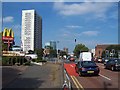
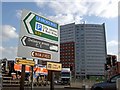
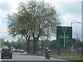
The lifestyle in B15 2FL is shaped by its proximity to retail, transport, and cultural hubs. Within practical reach are five retail outlets, including Morrisons Daily Bristol and Tesco Birmingham, offering everyday shopping needs. Metro stops like Grand Central New Street and Centenary Square provide easy access to Birmingham’s central districts, while rail stations such as Birmingham Snow Hill connect residents to regional routes. The area’s compact size means amenities are within walking distance, though parks or leisure facilities are not explicitly listed in the data. The presence of landmarks like the Council House and Town Hall adds a layer of historical and civic significance to daily life, blending urban convenience with a sense of place.
Amenities
Schools
The nearest school to B15 2FL is St Luke’s CofE Junior and Infant School, a primary institution serving the local community. While no Ofsted rating is provided, the presence of a primary school within reach is a key consideration for families. The absence of secondary schools or other educational institutions in the immediate vicinity means parents may need to look beyond the area for comprehensive schooling. This could be a limitation for families prioritising a full range of educational options. However, the proximity of St Luke’s to residential areas suggests it is a focal point for local children, potentially contributing to a sense of community cohesion.
| Rank | School | Type | Entry gender | Ages |
|---|
Explore more schools in this area
Go to Schools tabDemographics
B15 2FL has a median age of 22, but the most common age range is 30–64, indicating a community skewed toward working-age adults. Only 14% of residents own their homes, with flats being the predominant accommodation type. The area’s ethnic composition is dominated by the Black population, reflecting broader demographic trends in central Birmingham. This low home ownership rate suggests a rental-heavy market, which may influence community stability and long-term investment potential. The age profile implies a mix of young professionals and families, though the absence of data on household types means the balance between single-person households, couples, and larger families remains unclear. The area’s demographics align with its history as a regenerated inner-city district, where social and economic factors have shaped a distinct community identity.
Household Size
Accommodation Type
Tenure
Ethnic Group
Religion
Household Composition
Age
Household Deprivation
NS-SEC
Explore more demographic insights in this area
Go to Demographics tabPlanning
Planning Constraints
- Flood RiskPremium
- Ramsar Wetland SitesPremium
- Area of Outstanding Natural BeautyPremium
- Protected Nature ReservePremium
- Protected WoodlandPremium