Area Overview for B15 2EY
Photos of B15 2EY


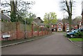


100 photos from this area
Area Information
Key information about the B15 2EY including its size, population, and administrative classification.
- Area Type
- Postcode
- Area Size
- Not available
- Population
- 1594
- Population Density
- 10405 people/km²
House Prices in B15 2EY
18
Properties
£144,356
Average Sold Price
£85,000
Lowest Price
£189,500
Highest Price
Showing 18 properties
| Address | Type | Beds | Baths | Last Sale Price | Last Sale Date | |
|---|---|---|---|---|---|---|
| 10 Mason Way, Birmingham, B15 2EY | Flat | 2 | 1 | £185,000 | Nov 2023 | |
| 8 Mason Way, Birmingham, B15 2EY | Flat | 2 | 1 | £162,000 | Aug 2023 | |
| 4 Mason Way, Birmingham, B15 2EY | Flat | 1 | 1 | £150,000 | Nov 2022 | |
| 28 Mason Way, Birmingham, B15 2EY | Flat | - | - | £125,000 | Apr 2021 | |
| 6 Mason Way, Birmingham, B15 2EY | Flat | 1 | 1 | £150,000 | Sep 2019 | |
| 14 Mason Way, Birmingham, B15 2EY | Flat | - | - | £131,000 | Apr 2017 | |
| 12 Mason Way, Birmingham, B15 2EY | Flat | 2 | - | £148,000 | Sep 2015 | |
| 44 Mason Way, Birmingham, B15 2EY | Flat | 1 | 1 | £103,000 | Jun 2015 | |
| 32 Mason Way, Birmingham, B15 2EY | Flat | - | - | £132,500 | Feb 2015 | |
| 2 Mason Way, Birmingham, B15 2EY | Flat | - | - | £155,000 | Jul 2014 |
Page 1 of 2
Energy Efficiency in B15 2EY
Amenities
Schools
| Rank | School | Type | Entry gender | Ages |
|---|
Explore more schools in this area
Go to Schools tabDemographics
Household Size
One person
most common
Accommodation Type
Flats
most common
Tenure
26
majority
Ethnic Group
White
most common
Religion
N/A
most common
Household Composition
N/A
most common
Age
47
median
Adults (30-64 years)
most common
Household Deprivation
N/A
with no deprivation
NS-SEC
44
in Lower managerial occupations
Explore more demographic insights in this area
Go to Demographics tabPlanning
Planning Constraints
- Flood RiskPremium
- Ramsar Wetland SitesPremium
- Area of Outstanding Natural BeautyPremium
- Protected Nature ReservePremium
- Protected WoodlandPremium