Area Overview for B15 2EL
Photos of B15 2EL
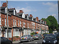
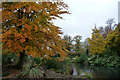
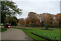
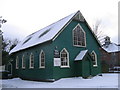
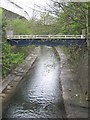
100 photos from this area
Area Information
Key information about the B15 2EL including its size, population, and administrative classification.
- Area Type
- Postcode
- Area Size
- 2.2 hectares
- Population
- 1538
- Population Density
- 2653 people/km²
House Prices in B15 2EL
23
Properties
£332,714
Average Sold Price
£145,000
Lowest Price
£600,000
Highest Price
Showing 23 properties
| Address | Type | Beds | Baths | Last Sale Price | Last Sale Date | |
|---|---|---|---|---|---|---|
| 10 Michael Drive, Birmingham, B15 2EL | house | - | - | £500,000 | Nov 2024 | |
| 25 Michael Drive, Birmingham, B15 2EL | Detached | 4 | 2 | £600,000 | Aug 2016 | |
| 31 Michael Drive, Birmingham, B15 2EL | Detached | 4 | 2 | £565,000 | Dec 2015 | |
| 29 Michael Drive, Birmingham, B15 2EL | Detached | - | - | £522,000 | Aug 2008 | |
| 20 Michael Drive, Birmingham, B15 2EL | Detached | - | - | £512,000 | May 2007 | |
| 4 Michael Drive, Birmingham, B15 2EL | Detached | - | - | £338,000 | Jun 2004 | |
| 8 Michael Drive, Birmingham, B15 2EL | Detached | 4 | 2 | £327,500 | Jan 2004 | |
| 34 Michael Drive, Birmingham, B15 2EL | Detached | - | - | £243,500 | Oct 2001 | |
| 32 Michael Drive, Birmingham, B15 2EL | Detached | 4 | 2 | £185,000 | Aug 1999 | |
| 38 Michael Drive, Birmingham, B15 2EL | Detached | - | - | £182,000 | Apr 1999 |
Page 1 of 3
Energy Efficiency in B15 2EL
Amenities
Schools
| Rank | School | Type | Entry gender | Ages |
|---|
Explore more schools in this area
Go to Schools tabDemographics
Household Size
One person
most common
Accommodation Type
Houses
most common
Tenure
54
majority
Ethnic Group
White
most common
Religion
N/A
most common
Household Composition
N/A
most common
Age
47
median
Adults (30-64 years)
most common
Household Deprivation
N/A
with no deprivation
NS-SEC
46
in Lower managerial occupations
Explore more demographic insights in this area
Go to Demographics tabPlanning
Planning Constraints
- Flood RiskPremium
- Ramsar Wetland SitesPremium
- Area of Outstanding Natural BeautyPremium
- Protected Nature ReservePremium
- Protected WoodlandPremium