Area Overview for B15 2BZ
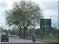
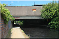
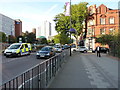
Photos of B15 2BZ

Area Information
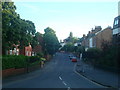
B15 2BZ lies within the Ladywood Ward of Birmingham, a historically significant inner-city district that forms part of the city’s central core. This small postcode area, home to 1,594 residents, is characterised by its compact residential cluster, nestled near landmarks such as Birmingham’s Council House and Town Hall. Historically, the area was shaped by medieval woodlands, later transformed by 20th-century redevelopment that replaced slums with housing estates. Today, it remains a densely populated urban space, offering proximity to key civic and commercial hubs. Daily life here is defined by its central location, with easy access to transport networks and a range of amenities. While the area’s history includes periods of deprivation, modern infrastructure and services have evolved to meet contemporary needs. For those considering living in B15 2BZ, the blend of historical legacy and practical urban living presents a distinct character, though the challenges of inner-city life—such as traffic and noise—should be weighed against the convenience of being at the heart of Birmingham.
- Area Type
- Postcode
- Area Size
- Not available
- Population
- 1594
- Population Density
- 10405 people/km²
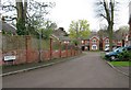
The property market in B15 2BZ is dominated by flats, with 26% of homes owned by residents and the remaining 74% likely occupied by renters. This indicates a rental-heavy market, typical of inner-city areas with post-war housing stock. The prevalence of flats suggests a focus on high-density living, which may appeal to those prioritising affordability and proximity to urban amenities. However, the low home ownership rate implies limited opportunities for long-term equity building. For buyers, this small postcode area offers a limited pool of owner-occupied properties, with most available homes likely being flats in multi-unit developments. Prospective buyers should consider the area’s compact nature and the potential for future redevelopment, which could impact property values and availability. The market’s character is defined by its practicality, catering to those seeking urban convenience over expansive living spaces.
House Prices in B15 2BZ
No properties found in this postcode.
Energy Efficiency in B15 2BZ
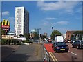
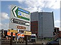
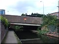
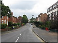
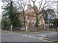
Life in B15 2BZ is shaped by its urban setting, offering a mix of retail, transport, and civic amenities within easy reach. The area’s retail landscape includes five notable venues, such as Co-op Birmingham and Tesco Bath, providing everyday shopping needs. Proximity to rail and metro stations—Five Ways Railway Station, Birmingham Moor Street, and Centenary Square—facilitates swift travel to work, leisure, or nearby attractions. While green spaces are limited in this densely built area, the presence of landmarks like the Town Hall and historical sites adds cultural value. The compact nature of the postcode means residents can access multiple services without long commutes, though the lack of extensive parks or recreational facilities may be a drawback for those prioritising outdoor activities. The area’s convenience and connectivity make it ideal for those who prioritise accessibility over expansive living environments.
Amenities
Schools
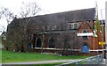
Residents of B15 2BZ have access to a range of educational institutions, including St Thomas Centre Nursery School, St Thomas’ Church of England VA Primary School, St Thoma’s Community High School, and James Brindley School, which specialises in supporting students with specific needs. The presence of a nursery and primary school ensures early education is readily available, while the special school caters to those requiring tailored support. The mix of school types reflects the area’s diverse educational needs, from early years care to specialist provisions. For families, this variety offers flexibility, though the absence of secondary schools in the immediate vicinity may require commuting. The schools’ proximity to residential areas underscores the area’s suitability for households with children, though parents should verify specific admission criteria and Ofsted ratings for each institution.
| Rank | School | Type | Entry gender | Ages |
|---|
Explore more schools in this area
Go to Schools tabDemographics
The population of B15 2BZ has a median age of 47, with the majority of residents aged between 30 and 64 years. This suggests a community skewed towards middle-aged adults, many of whom may be in their prime working years. Home ownership in the area is relatively low, with only 26% of properties owned by residents, indicating a rental-dominated market. The predominant accommodation type is flats, reflecting the area’s post-war housing stock. The predominant ethnic group is White, though the data does not provide further breakdowns on diversity. The age profile and ownership figures suggest a population that may include a mix of long-term residents and those in transitional housing phases. With no specific data on deprivation levels, the quality of life here likely hinges on access to services and infrastructure, which are generally robust in central Birmingham.
Household Size
Accommodation Type
Tenure
Ethnic Group
Religion
Household Composition
Age
Household Deprivation
NS-SEC
Explore more demographic insights in this area
Go to Demographics tabPlanning
Planning Constraints
- Flood RiskPremium
- Ramsar Wetland SitesPremium
- Area of Outstanding Natural BeautyPremium
- Protected Nature ReservePremium
- Protected WoodlandPremium