Area Overview for B15 1XD
Photos of B15 1XD


Area Information
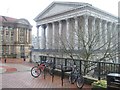
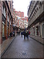
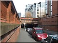
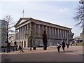
B15 1XD is a small, tightly packed postcode in west Birmingham, nestled within the Ladywood Ward—a historically significant district at the heart of the city. With a population of just 2,304, this area is a compact cluster of residential flats, reflecting its role as a densely urbanised inner-city neighbourhood. Its proximity to Birmingham’s core landmarks, including the Council House and Town Hall, underscores its central location. The area’s character is shaped by its history: once a site of 19th-century slums, it has since undergone regeneration, though social challenges persist. Daily life here is defined by proximity to city amenities, with residents navigating a mix of modern infrastructure and the legacy of past deprivation. The young demographic—median age 22—suggests a population skewed toward students, young professionals, or those in transient employment. Living in B15 1XD means being within walking distance of Birmingham’s cultural and administrative heart, but also grappling with the realities of a postcode where home ownership is rare and community dynamics remain complex.
- Area Type
- Postcode
- Area Size
- Not available
- Population
- 2304
- Population Density
- 10459 people/km²
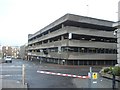
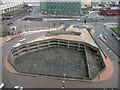
The property market in B15 1XD is almost entirely rental-based, with just 10% of residents owning their homes. The accommodation type is exclusively flats, a reflection of the area’s post-1960s housing developments, which were later partially demolished by 2000. This limited housing stock suggests a constrained market, with little scope for buyers seeking owner-occupied properties. The prevalence of flats also indicates a focus on affordability over long-term investment, typical of inner-city areas with high demand but low supply. For those considering purchasing, the small size of the postcode and its surrounding areas may mean competition is fierce, with limited options for larger homes or family-oriented properties. The rental market, while accessible, may not offer the security or appreciation potential of more established neighbourhoods.
House Prices in B15 1XD
No properties found in this postcode.
Energy Efficiency in B15 1XD
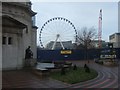
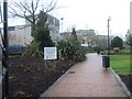
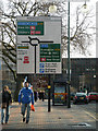
Living in B15 1XD offers access to a range of essential amenities within walking or short transit distance. Retail options include Sainsburys Brindley, Spar, and Tesco Bath, providing everyday shopping convenience. The proximity to railway stations like Five Ways and Birmingham Snow Hill ensures swift access to the city’s transport network, while metro stops at Centenary Square and Town Hall link to Birmingham’s cultural and commercial hubs. Though the area lacks expansive green spaces, its location near central landmarks such as the Council House and Birmingham Children’s Hospital (now relocated) reflects its historical significance. The density of services and transport options supports a lifestyle centred on urban convenience, though the absence of detailed data on leisure facilities means residents may need to venture further for parks or recreational spaces.
Amenities
Schools
| Rank | School | Type | Entry gender | Ages |
|---|
Explore more schools in this area
Go to Schools tabDemographics
The population of B15 1XD is overwhelmingly young, with a median age of 22 and 15–29-year-olds forming the largest age group. Only 10% of residents own their homes, a figure that highlights the area’s reliance on rental accommodation. Flats dominate the housing stock, reflecting a lack of traditional family homes or larger properties. The predominant ethnic group is White, though the data does not specify the proportion of other ethnicities. This demographic profile suggests a transient population, possibly including students or those in temporary housing. The low home ownership rate may impact community stability, as renters often move frequently. The area’s youthfulness also means services and amenities are tailored to younger residents, though the lack of data on deprivation levels makes it difficult to assess whether this demographic faces systemic barriers to quality of life.
Household Size
Accommodation Type
Tenure
Ethnic Group
Religion
Household Composition
Age
Household Deprivation
NS-SEC
Explore more demographic insights in this area
Go to Demographics tabPlanning
Planning Constraints
- Flood RiskPremium
- Ramsar Wetland SitesPremium
- Area of Outstanding Natural BeautyPremium
- Protected Nature ReservePremium
- Protected WoodlandPremium