Area Overview for B15 1UD
Photos of B15 1UD


Area Information
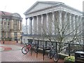
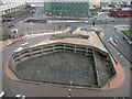
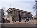
Living in B15 1UD means being part of a small, tightly packed residential cluster in the heart of Birmingham’s Ladywood Ward. This area, with a population of 2,304, sits within the historic core of the city, encompassing landmarks like the Council House and Town Hall. Its proximity to central Birmingham offers easy access to urban amenities, though the area itself is defined by its compact scale and dense urban fabric. Historically, Ladywood was shaped by 19th-century industrial activity and post-war redevelopment, leaving a legacy of social challenges. Today, it is a young, transient community, with a median age of 22 and a majority of residents aged 15–29. Daily life here is characterised by proximity to transport hubs, retail, and public services, but the area’s identity is shaped as much by its history as by its modern infrastructure. For buyers, B15 1UD presents a mix of practicality and urban vibrancy, though its small size and limited housing stock mean choices are constrained.
- Area Type
- Postcode
- Area Size
- Not available
- Population
- 2304
- Population Density
- 10459 people/km²
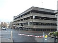
The property market in B15 1UD is dominated by rental flats, with only 10% of households being owner-occupied. This suggests a market where private landlords and housing associations hold significant influence, and individual buyers have limited opportunities for purchase. The area’s small size and focus on flats mean housing stock is constrained, with little scope for new developments. For buyers, this raises questions about long-term value and availability, particularly in a city like Birmingham where property prices are rising. The dominance of rental properties also means competition for available flats is likely high, especially among young professionals and students drawn to the area’s central location. Those considering purchase should factor in the need for flexibility, as the market is unlikely to offer the stability of a traditional owner-occupied home.
House Prices in B15 1UD
No properties found in this postcode.
Energy Efficiency in B15 1UD
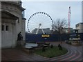
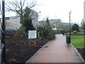
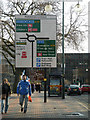
Life in B15 1UD is shaped by its proximity to Birmingham’s core, with retail options like Sainsburys Brindley, Tesco Bath, and Spar Edgbaston within easy reach. The area’s rail and metro links provide seamless access to shopping, dining, and leisure in the city centre, including landmarks like the Council House and Town Hall. While the immediate vicinity lacks large parks or green spaces, the nearby urban environment offers a mix of cultural and administrative facilities. The presence of multiple transport hubs ensures residents can quickly access Birmingham’s broader amenities, from museums to restaurants. However, the area’s compact nature means social and recreational options are limited to the immediate vicinity, with a focus on convenience over expansive leisure opportunities. For those prioritising accessibility over space, B15 1UD delivers a functional urban lifestyle.
Amenities
Schools
| Rank | School | Type | Entry gender | Ages |
|---|
Explore more schools in this area
Go to Schools tabDemographics
The community in B15 1UD is overwhelmingly young, with a median age of 22 and the majority of residents aged 15–29. Only 10% of households are owner-occupied, reflecting a rental-dominated market. The accommodation type is almost exclusively flats, a legacy of post-war housing developments that were later demolished or repurposed. The predominant ethnic group is White, though specific data on diversity beyond this is not provided. The low home ownership rate and high proportion of young adults suggest a transient population, often drawn by proximity to Birmingham’s central amenities. This demographic profile influences the area’s social dynamics, with a focus on affordability and convenience over long-term investment. The lack of data on deprivation or income levels means quality of life factors like access to services and safety must be inferred from available assessments, such as the critical crime risk rating.
Household Size
Accommodation Type
Tenure
Ethnic Group
Religion
Household Composition
Age
Household Deprivation
NS-SEC
Explore more demographic insights in this area
Go to Demographics tabPlanning
Planning Constraints
- Flood RiskPremium
- Ramsar Wetland SitesPremium
- Area of Outstanding Natural BeautyPremium
- Protected Nature ReservePremium
- Protected WoodlandPremium