Area Overview for B15 1PS
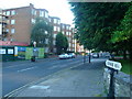
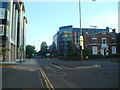
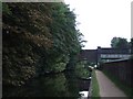
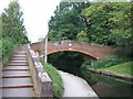
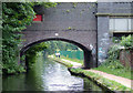
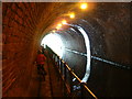
Photos of B15 1PS


Area Information
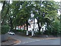
Living in B15 1PS means inhabiting a small, residential postcode cluster within Edgbaston, a historically affluent suburb of Birmingham. With a population of 1,586, the area retains a quiet, suburban character defined by green spaces, historic homes, and a mix of modern and traditional architecture. Situated southwest of Birmingham’s city centre, it benefits from proximity to cultural and commercial hubs while maintaining a distinct sense of community. The area’s roots trace back to the 19th century, when wealthy families like the Gough-Calthorpe ensured it remained a residential haven, a legacy visible in its tree-lined streets and Grade I listed properties. Today, it appeals to professionals and families seeking a balance between urban accessibility and suburban tranquillity. The presence of notable figures such as J.R.R. Tolkien and Nick Mason adds a layer of historical intrigue. Residents here enjoy a blend of local charm and connectivity, with nearby amenities and transport links ensuring ease of movement across Birmingham and beyond.
- Area Type
- Postcode
- Area Size
- Not available
- Population
- 1586
- Population Density
- 3154 people/km²
The property market in B15 1PS is characterised by a 45% home ownership rate, indicating that nearly half of residents rent their homes. This suggests a mix of owner-occupied and rental properties, with flats being the predominant accommodation type. Given the area’s small size and suburban layout, housing stock is likely limited to smaller, purpose-built developments or converted properties. The focus on flats may appeal to buyers seeking manageable, low-maintenance homes, though the market’s scale is constrained by the postcode’s limited reach. Proximity to Birmingham’s city centre and transport networks could enhance property value, but the small footprint of B15 1PS means buyers should consider nearby areas for broader options. The blend of historic and modern housing reflects Edgbaston’s evolving character, offering a range of styles for those prioritising location over expansive living space.
House Prices in B15 1PS
No properties found in this postcode.
Energy Efficiency in B15 1PS
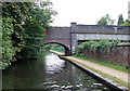
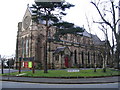
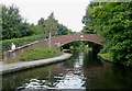
Residents of B15 1PS enjoy a range of nearby amenities, including five retail outlets such as Spar Edgbaston, Morrisons Edgbaston, and Co-op Edgbaston, ensuring everyday shopping needs are met. The area’s proximity to rail stations and metro points like Edgbaston Village and Town Hall adds to its convenience, linking residents to Birmingham’s broader urban landscape. While specific parks or leisure facilities are not listed, the area’s suburban character suggests access to green spaces, as noted in historical context. The blend of retail, transport, and connectivity options supports a lifestyle that balances local convenience with urban accessibility. The presence of historic sites, such as Edgbaston Hall and Grade I listed properties, also contributes to a unique cultural atmosphere, enriching daily life with architectural heritage.
Amenities
Schools
Residents of B15 1PS have access to two independent schools: West House School and Edgbaston College, the latter of which holds a ‘good’ Ofsted rating. Both institutions cater to families seeking non-state education, though specific details on student performance or facilities are not provided. The presence of independent schools suggests the area attracts households prioritising private education, aligning with Edgbaston’s historical association with affluence. While no state schools are listed, the proximity to Birmingham’s broader educational network may offer additional options. The mix of school types ensures families can choose between independent and state-run institutions, though the limited data means further research into specific curricula or admissions policies would be necessary for a comprehensive assessment.
| Rank | School | Type | Entry gender | Ages |
|---|
Explore more schools in this area
Go to Schools tabDemographics
The community in B15 1PS is predominantly composed of adults aged 30–64, with a median age of 47. This suggests a population skewed towards established professionals and families, rather than younger or older demographics. Home ownership rates stand at 45%, indicating that nearly half of residents rent their homes, which may reflect the area’s mix of private and rental housing stock. The accommodation type is primarily flats, a feature common in suburban Birmingham. The predominant ethnic group is White, though specific data on diversity beyond this is not provided. The age profile and ownership figures suggest a stable, mature community with a focus on long-term residency. The absence of detailed deprivation data means no direct conclusions can be drawn about socioeconomic challenges, but the median age and home ownership rate imply a relatively settled, middle-aged population.
Household Size
Accommodation Type
Tenure
Ethnic Group
Religion
Household Composition
Age
Household Deprivation
NS-SEC
Explore more demographic insights in this area
Go to Demographics tabPlanning
Planning Constraints
- Flood RiskPremium
- Ramsar Wetland SitesPremium
- Area of Outstanding Natural BeautyPremium
- Protected Nature ReservePremium
- Protected WoodlandPremium