Area Overview for B15 1NL
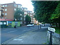
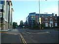
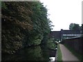
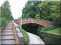
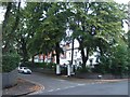
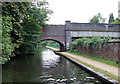
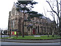
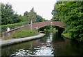
Photos of B15 1NL


Area Information
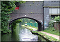
Living in B15 1NL means inhabiting a compact, suburban enclave within Birmingham’s Edgbaston district. With a population of 1,586, this postcode area reflects a quiet, residential character shaped by its history as a historically affluent suburb. The area’s layout suggests a mix of private housing and community spaces, with greenery and historic architecture contributing to its distinct feel. Residents benefit from proximity to Birmingham’s core while retaining a suburban rhythm. The ward’s boundaries encompass parts of Edgbaston, Harborne, and Quinton, areas long associated with wealthy landowners and cultural figures, including J.R.R. Tolkien and Cardinal Newman. Daily life here balances convenience with tranquillity, with access to rail networks, retail hubs, and green spaces. The presence of independent schools and historic landmarks, such as Edgbaston Hall, adds to its appeal for families and heritage enthusiasts. For those seeking a blend of suburban comfort and city proximity, B15 1NL offers a defined, manageable community.
- Area Type
- Postcode
- Area Size
- Not available
- Population
- 1586
- Population Density
- 3154 people/km²
The property market in B15 1NL is characterised by a 45% home ownership rate, with flats being the predominant accommodation type. This suggests a housing stock skewed towards rental properties, as the remaining 55% of residents likely occupy rented flats. The compact nature of the postcode area, covering a small residential cluster, means the market is likely limited in scale but may offer niche opportunities for buyers seeking flats in a suburban setting. The presence of historic architecture and green spaces could add value to properties, though the area’s small size may limit availability. For buyers, this means a focus on flats rather than detached homes, with potential for investment in properties near amenities like rail stations and independent schools. However, the limited size of the area may require buyers to consider nearby postcodes for more options.
House Prices in B15 1NL
No properties found in this postcode.
Energy Efficiency in B15 1NL
Residents of B15 1NL enjoy access to a range of amenities within walking or short-vehicle distance. Retail options include Co-op Edgbaston, Morrisons Edgbaston, and Spar Edgbaston, offering everyday shopping needs. The area’s proximity to rail and metro stations, such as Edgbaston Village and Centenary Square, ensures easy access to Birmingham’s cultural and commercial hubs. While specific parks or leisure facilities are not detailed in the data, the area’s historical character suggests the presence of green spaces, as noted in research about Edgbaston’s suburban layout. The combination of retail, transport, and suburban tranquillity creates a convenient lifestyle, balancing local convenience with the opportunity to engage with Birmingham’s broader offerings.
Amenities
Schools
Residents of B15 1NL have access to two notable independent schools: West House School and Edgbaston College. Both institutions cater to families seeking non-state education, with Edgbaston College holding an Ofsted rating of ‘good’. The presence of independent schools suggests the area appeals to households prioritising private education, though no state schools are listed in the data. This mix of school types may attract families desiring choice in education, though it also highlights a reliance on private institutions. The proximity of these schools to the area’s residential cluster could be a key draw for buyers, particularly those with children. However, the absence of state school data means potential buyers should verify additional options beyond the listed institutions.
| Rank | School | Type | Entry gender | Ages |
|---|
Explore more schools in this area
Go to Schools tabDemographics
The demographic profile of B15 1NL is defined by a median age of 47, with the majority of residents falling within the 30–64 age range. This suggests a community of established professionals and families, rather than a younger or elderly demographic. Home ownership stands at 45%, indicating that nearly half of residents rent their homes, which may reflect the area’s mix of private and rental housing stock. The predominant accommodation type is flats, which aligns with the compact nature of the postcode area. The predominant ethnic group is White, though no specific diversity metrics are provided. This age profile and housing mix imply a stable, middle-aged population with established roots. The 45% home ownership rate suggests a balance between long-term residents and those in rental properties, potentially influencing local dynamics and community cohesion.
Household Size
Accommodation Type
Tenure
Ethnic Group
Religion
Household Composition
Age
Household Deprivation
NS-SEC
Explore more demographic insights in this area
Go to Demographics tabPlanning
Planning Constraints
- Flood RiskPremium
- Ramsar Wetland SitesPremium
- Area of Outstanding Natural BeautyPremium
- Protected Nature ReservePremium
- Protected WoodlandPremium