Area Overview for B15 1LH
Photos of B15 1LH
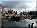

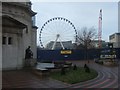
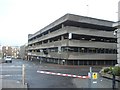
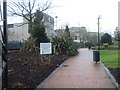
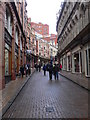

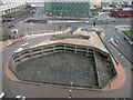
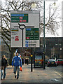
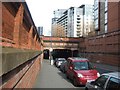

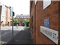
100 photos from this area
Area Information
Key information about the B15 1LH including its size, population, and administrative classification.
- Area Type
- Postcode
- Area Size
- 9637 m²
- Population
- 2304
- Population Density
- 10459 people/km²
House Prices in B15 1LH
82
Properties
£90,818
Average Sold Price
£27,000
Lowest Price
£150,000
Highest Price
Showing 82 properties
| Address | Type | Beds | Baths | Last Sale Price | Last Sale Date | |
|---|---|---|---|---|---|---|
| 122 William Street, Birmingham, B15 1LH | Flat | 1 | 1 | £120,000 | Jan 2025 | |
| 72 William Street, Birmingham, B15 1LH | Flat | - | - | £114,000 | Jul 2020 | |
| 28 William Street, Birmingham, B15 1LH | Flat | - | - | £135,000 | Mar 2019 | |
| 42 William Street, Birmingham, B15 1LH | Flat | - | - | £150,000 | Feb 2016 | |
| 92 William Street, Birmingham, B15 1LH | Flat | - | - | £94,000 | Nov 2014 | |
| 62 William Street, Birmingham, B15 1LH | Flat | 2 | 1 | £97,000 | May 2011 | |
| 36 William Street, Birmingham, B15 1LH | Flat | 1 | 1 | £98,500 | Nov 2004 | |
| 12 William Street, Birmingham, B15 1LH | Flat | - | - | £27,000 | Jan 2003 | |
| 114 William Street, Birmingham, B15 1LH | Flat | 1 | 1 | £73,000 | Oct 2002 | |
| 100 William Street, Birmingham, B15 1LH | Flat | - | - | £38,500 | Apr 1999 |
Page 1 of 9
Energy Efficiency in B15 1LH
Amenities
Schools
| Rank | School | Type | Entry gender | Ages |
|---|
Explore more schools in this area
Go to Schools tabDemographics
Household Size
One person
most common
Accommodation Type
Flats
most common
Tenure
10
majority
Ethnic Group
White
most common
Religion
N/A
most common
Household Composition
N/A
most common
Age
22
median
Young Adults (15-29 years)
most common
Household Deprivation
N/A
with no deprivation
NS-SEC
19
in Lower managerial occupations
Explore more demographic insights in this area
Go to Demographics tabPlanning
Planning Constraints
- Flood RiskPremium
- Ramsar Wetland SitesPremium
- Area of Outstanding Natural BeautyPremium
- Protected Nature ReservePremium
- Protected WoodlandPremium