Area Overview for B15 1JA
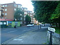
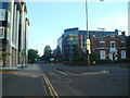
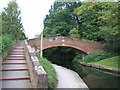
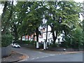
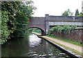
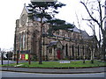
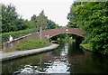
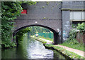
Photos of B15 1JA


Area Information
B15 1JA lies in the southwest of Birmingham, a historically affluent suburb with a distinct suburban character. This postcode area covers a small residential cluster, home to 1,586 people, and is part of the larger Edgbaston district, known for its green spaces, historic architecture, and proximity to the city centre. The area’s roots trace back to the 19th century, when wealthy families like the Gough-Calthorpe built private homes, shaping its enduring residential feel. Today, B15 1JA retains its appeal with a mix of older properties and modern amenities. Residents benefit from easy access to Birmingham’s cultural and commercial hubs, while the area’s tree-lined streets and low-rise buildings offer a quieter alternative to the city’s bustling core. The presence of independent schools and well-connected transport links further enhance its appeal. For those seeking a balance between urban convenience and suburban tranquillity, B15 1JA provides a compact, self-contained environment with a strong sense of community.
- Area Type
- Postcode
- Area Size
- Not available
- Population
- 1586
- Population Density
- 3154 people/km²
The property market in B15 1JA is characterised by a 45% home ownership rate, with flats making up the majority of accommodation types. This suggests a rental market that is not dominant, but where owner-occupied properties coexist with private rentals. The prevalence of flats indicates a housing stock that is likely to include older, low-rise buildings, typical of suburban areas with historical development patterns. For buyers, this means a focus on individual properties rather than large-scale developments. The small postcode area’s compact nature means that property choices are limited, but the proximity to Birmingham’s amenities offers broader appeal. The mix of ownership and rental options may provide flexibility for buyers, though the limited size of the area means competition for available properties could be keen.
House Prices in B15 1JA
No properties found in this postcode.
Energy Efficiency in B15 1JA
The lifestyle in B15 1JA is shaped by its proximity to a range of amenities. Within walking distance are five retail outlets, including Spar Edgbaston, Morrisons Edgbaston, and Co-op Edgbaston, offering everyday shopping needs. The area’s transport links extend beyond rail, with metro stops at Edgbaston Village, Centenary Square, and Town Hall, connecting residents to Birmingham’s cultural and commercial districts. While specific parks or leisure facilities are not detailed in the data, the area’s historical character suggests access to green spaces. The combination of retail, transport, and proximity to Birmingham’s core means daily life is both convenient and varied, supporting a balanced mix of local and urban experiences.
Amenities
Schools
Residents of B15 1JA have access to two notable schools within practical reach. West House School is an independent institution, catering to a range of age groups. Nearby, Edgbaston College is also independent and holds a ‘good’ Ofsted rating, reflecting its quality of education and facilities. The presence of two independent schools suggests a strong educational offering for families, though no state schools are listed in the data. This mix of school types provides options for parents seeking either fee-paying or state-funded education, though the absence of state schools may limit choices for those prioritising affordability. The proximity of these institutions to the area reinforces its appeal to families.
| Rank | School | Type | Entry gender | Ages |
|---|
Explore more schools in this area
Go to Schools tabDemographics
The population of B15 1JA has a median age of 47, with the majority of residents aged between 30 and 64. This suggests a community of established professionals and families, reflecting the area’s historical association with affluent households. Home ownership stands at 45%, indicating a mix of owner-occupied properties and rental units. The predominant accommodation type is flats, which aligns with the area’s suburban layout and older housing stock. The predominant ethnic group is White, though specific data on diversity beyond this is not provided. The age profile and home ownership figures suggest a stable, mature community with a focus on long-term residency. The absence of detailed deprivation data means the area’s economic profile remains less defined, but the presence of independent schools and retail amenities points to a generally well-served environment.
Household Size
Accommodation Type
Tenure
Ethnic Group
Religion
Household Composition
Age
Household Deprivation
NS-SEC
Explore more demographic insights in this area
Go to Demographics tabPlanning
Planning Constraints
- Flood RiskPremium
- Ramsar Wetland SitesPremium
- Area of Outstanding Natural BeautyPremium
- Protected Nature ReservePremium
- Protected WoodlandPremium