Area Overview for B15 1BT
Photos of B15 1BT


Area Information
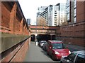
B15 1BT is a small residential postcode area in the heart of Birmingham, England, nestled within the historically significant Ladywood Ward. With a population of 2,304, it reflects the dense urban character of central Birmingham, where landmarks like the Council House and Town Hall stand alongside residential clusters. The area is defined by its proximity to the city centre, with boundaries stretching into Hockley and Lee Bank. Daily life here is shaped by its inner-city location, offering easy access to key institutions and transport hubs. The postcode’s compact size means it is tightly integrated with surrounding districts, creating a dynamic but compact living environment. Historically, Ladywood was marked by social challenges, including high crime and deprivation, though recent decades have seen regeneration efforts. Today, the area remains a focal point for commuters and students, given its rail and metro connectivity. Living in B15 1BT means navigating a blend of urban convenience and the legacy of a district that has undergone significant transformation. Its small footprint ensures a tightly knit community, though one that demands awareness of the broader city’s complexities.
- Area Type
- Postcode
- Area Size
- Not available
- Population
- 2304
- Population Density
- 10459 people/km²
The property market in B15 1BT is characterised by a low rate of home ownership, with only 10% of properties owned by residents. This suggests that the area is primarily a rental market, with flats making up the majority of the housing stock. The prevalence of flats, many of which were built during mid-20th-century redevelopment, reflects a history of social housing and later regeneration. Buyers considering the area should be aware that the small postcode area offers limited housing diversity, with most properties concentrated in multi-unit blocks. This dynamic may make the area less attractive to those seeking owner-occupied homes, though it could appeal to investors targeting the rental sector. The immediate surroundings, including parts of central Birmingham, may offer more varied housing options, but proximity to the city centre comes with higher demand and potential competition. For those prioritising property ownership, exploring nearby districts with more traditional housing stock might be more viable.
House Prices in B15 1BT
No properties found in this postcode.
Energy Efficiency in B15 1BT
Living in B15 1BT means proximity to a range of essential retail and dining options, including Sainsburys Brindley, Spar, and Spar Edgbaston, which cater to daily needs. The area’s integration with central Birmingham ensures that residents have easy access to the city’s cultural and economic hubs, including landmarks like the Council House and Town Hall. Public transport links to rail and metro stations make commuting efficient, with multiple routes available for both local and long-distance travel. The compact nature of the postcode means that amenities are tightly clustered, reducing the need for long journeys. However, the area lacks green spaces or leisure facilities, which may be a drawback for those prioritising outdoor recreation. The lifestyle here is defined by urban convenience, with a focus on accessibility to services and transport over expansive natural environments. For residents comfortable with a fast-paced, city-centre existence, B15 1BT offers a practical, though densely packed, living experience.
Amenities
Schools
| Rank | School | Type | Entry gender | Ages |
|---|
Explore more schools in this area
Go to Schools tabDemographics
The population of B15 1BT is overwhelmingly young, with a median age of 22 and the most common age range being 15–29 years. This demographic profile suggests a community skewed towards students, young professionals, and recent graduates. Home ownership in the area is exceptionally low, at just 10%, indicating that the majority of residents are likely renters. The accommodation type is predominantly flats, reflecting a housing stock shaped by post-war redevelopment and later demolition efforts. The predominant ethnic group is White, though the data does not specify further diversity metrics. The low home ownership rate and high proportion of young adults suggest a transient population, with limited long-term stability. This dynamic may influence local services and amenities, as demand for short-term housing and student-focused facilities is likely higher. The area’s youthful profile also means it may lack the established community networks found in older, more settled neighbourhoods.
Household Size
Accommodation Type
Tenure
Ethnic Group
Religion
Household Composition
Age
Household Deprivation
NS-SEC
Explore more demographic insights in this area
Go to Demographics tabPlanning
Planning Constraints
- Flood RiskPremium
- Ramsar Wetland SitesPremium
- Area of Outstanding Natural BeautyPremium
- Protected Nature ReservePremium
- Protected WoodlandPremium