Area Overview for B14 7TS
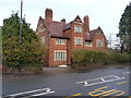
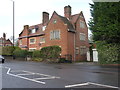
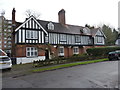
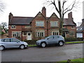
Photos of B14 7TS


Area Information
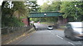
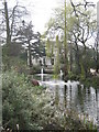
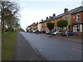
Living in B14 7TS means being part of a small, defined residential cluster in Birmingham’s Brandwood & King’s Heath Ward. With a population of 1,489, it is a compact area with a distinct suburban character, historically shaped by 18th-century road improvements and 19th-century housing developments. The postcode lies in the Birmingham Selly Oak constituency, near coordinates 52.433123, -1.894511, just south of the city centre. Daily life here is influenced by its proximity to schools, transport links, and local amenities. The area’s mix of historic sites, like the Hare and Hounds pub and Brandwood End Cemetery, adds a layer of heritage to modern living. Residents benefit from excellent broadband connectivity and access to nearby rail and metro stations, making it practical for commuters. While the area avoids the dense urban feel of central Birmingham, it retains a quiet, community-oriented vibe, with schools and shops within easy reach.
- Area Type
- Postcode
- Area Size
- Not available
- Population
- 1489
- Population Density
- 3035 people/km²
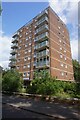
The property market in B14 7TS is characterised by a high rate of home ownership (63%) and a focus on houses as the primary accommodation type. This suggests a market where private, family-oriented homes dominate, rather than rental properties or flats. Given the area’s small size, the housing stock is likely limited to a few hundred properties, with demand driven by proximity to schools, transport, and historical amenities. Buyers should consider that the market may be more competitive for owner-occupied homes, with limited scope for rental investment. The presence of high-quality schools nearby could also influence property values, making the area attractive to families seeking stability. However, the small postcode area means that buyers may need to look beyond immediate surroundings for a broader range of options.
House Prices in B14 7TS
No properties found in this postcode.
Energy Efficiency in B14 7TS
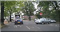
Residents of B14 7TS enjoy a mix of retail, dining, and transport options within practical reach. Nearby shops include Lidl Moseley, Sainsburys Kings, and Iceland Kings, providing convenience for daily essentials. The area’s rail and metro stations—such as Bournville and Selly Oak—offer direct links to Birmingham’s wider transport network, facilitating travel to work, leisure, or social activities. The presence of historical sites like the Hare and Hounds pub and Brandwood End Cemetery adds a unique character to the area, blending heritage with modern convenience. While the postcode is small, its proximity to larger amenities in surrounding wards ensures a balance between local charm and broader accessibility. This combination of practicality and historical interest makes daily life in B14 7TS both efficient and engaging.
Amenities
Schools
Residents of B14 7TS have access to two primary schools and two academies, all with outstanding Ofsted ratings. King Edward VI Camp Hill School for Girls and King Edward VI Camp Hill School for Boys operate as both primary schools and academies, offering a consistent educational standard for local families. The dual presence of primary and academy schools provides flexibility for parents, ensuring continuity in education as children progress through school years. The outstanding ratings indicate high academic performance and effective governance, which is a significant draw for families prioritising quality education. These schools are likely to be a key factor in the area’s appeal, supporting a community focused on long-term residency and family life.
| Rank | School | Type | Entry gender | Ages |
|---|
Explore more schools in this area
Go to Schools tabDemographics
The community in B14 7TS has a median age of 47, with the majority of residents aged between 30 and 64. This suggests a mature, stable population, likely with established careers and families. Home ownership is high at 63%, indicating a strong presence of long-term residents in private homes. The predominant accommodation type is houses, reflecting a residential area focused on family homes rather than flats. The dominant ethnic group is White, though specific data on other groups is not provided. The age profile and ownership rates suggest a low-deprivation environment, with residents prioritising stability and long-term investment in property. This demographic profile aligns with the area’s suburban character, where community ties and local amenities are central to daily life.
Household Size
Accommodation Type
Tenure
Ethnic Group
Religion
Household Composition
Age
Household Deprivation
NS-SEC
Explore more demographic insights in this area
Go to Demographics tabPlanning
Planning Constraints
- Flood RiskPremium
- Ramsar Wetland SitesPremium
- Area of Outstanding Natural BeautyPremium
- Protected Nature ReservePremium
- Protected WoodlandPremium