Area Overview for B14 7SS
Photos of B14 7SS
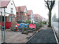
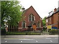
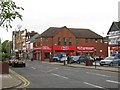
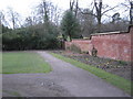
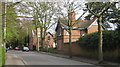
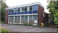
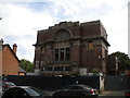
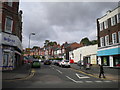
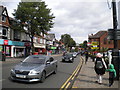
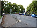
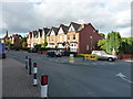
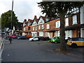
80 photos from this area
Area Information
Key information about the B14 7SS including its size, population, and administrative classification.
- Area Type
- Postcode
- Area Size
- 8761 m²
- Population
- 1646
- Population Density
- 5942 people/km²
House Prices in B14 7SS
40
Properties
£192,610
Average Sold Price
£50,000
Lowest Price
£465,000
Highest Price
Showing 40 properties
| Address | Type | Beds | Baths | Last Sale Price | Last Sale Date | |
|---|---|---|---|---|---|---|
| 51 Station Road, Moseley And Kings Heath, Birmingham, B14 7SS | Terraced | 4 | 2 | £80,000 | May 2025 | |
| 65 Station Road, Moseley And Kings Heath, Birmingham, B14 7SS | Terraced | 3 | 2 | £230,000 | Feb 2024 | |
| 31 Station Road, Moseley And Kings Heath, Birmingham, B14 7SS | Terraced | 5 | 1 | £400,000 | Nov 2022 | |
| 47 Station Road, Moseley And Kings Heath, Birmingham, B14 7SS | Terraced | 5 | 3 | £465,000 | Aug 2022 | |
| 67 Station Road, Moseley And Kings Heath, Birmingham, B14 7SS | house | - | - | £256,125 | Aug 2021 | |
| 55 Station Road, Moseley And Kings Heath, Birmingham, B14 7SS | Terraced | 4 | 2 | £280,000 | Feb 2017 | |
| 79 Station Road, Moseley And Kings Heath, Birmingham, B14 7SS | Terraced | 3 | 1 | £175,000 | Oct 2015 | |
| 97 Station Road, Moseley And Kings Heath, Birmingham, B14 7SS | Terraced | 4 | - | £260,000 | Apr 2015 | |
| 69 Station Road, Moseley And Kings Heath, Birmingham, B14 7SS | house | 5 | - | £239,000 | Jun 2014 | |
| 63 Station Road, Moseley And Kings Heath, Birmingham, B14 7SS | Terraced | 3 | - | £224,000 | Mar 2014 |
Page 1 of 4
Energy Efficiency in B14 7SS
Amenities
Schools
| Rank | School | Type | Entry gender | Ages |
|---|
Explore more schools in this area
Go to Schools tabDemographics
Household Size
One person
most common
Accommodation Type
Houses
most common
Tenure
52
majority
Ethnic Group
White
most common
Religion
N/A
most common
Household Composition
N/A
most common
Age
47
median
Adults (30-64 years)
most common
Household Deprivation
N/A
with no deprivation
NS-SEC
44
in Lower managerial occupations
Explore more demographic insights in this area
Go to Demographics tabPlanning
Planning Constraints
- Flood RiskPremium
- Ramsar Wetland SitesPremium
- Area of Outstanding Natural BeautyPremium
- Protected Nature ReservePremium
- Protected WoodlandPremium