Area Overview for B14 7RR
Photos of B14 7RR
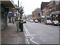
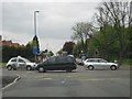
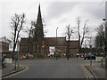
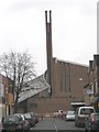
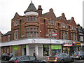
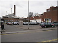
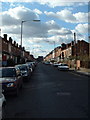
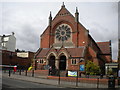

65 photos from this area
Area Information
Key information about the B14 7RR including its size, population, and administrative classification.
- Area Type
- Postcode
- Area Size
- 7302 m²
- Population
- 1535
- Population Density
- 10206 people/km²
House Prices in B14 7RR
36
Properties
£182,738
Average Sold Price
£25,000
Lowest Price
£400,500
Highest Price
Showing 36 properties
| Address | Type | Beds | Baths | Last Sale Price | Last Sale Date | |
|---|---|---|---|---|---|---|
| 120 Grange Road, Moseley And Kings Heath, Birmingham, B14 7RR | Terraced | 3 | 1 | £315,000 | Oct 2024 | |
| 124 Grange Road, Moseley And Kings Heath, Birmingham, B14 7RR | Terraced | 2 | 1 | £280,000 | Feb 2024 | |
| 142 Grange Road, Moseley And Kings Heath, Birmingham, B14 7RR | Terraced | 2 | 1 | £299,950 | Feb 2023 | |
| 108 Grange Road, Moseley And Kings Heath, Birmingham, B14 7RR | house | - | - | £240,000 | Nov 2021 | |
| 126 Grange Road, Moseley And Kings Heath, Birmingham, B14 7RR | Terraced | 2 | 2 | £213,000 | Apr 2021 | |
| 156 Grange Road, Moseley And Kings Heath, Birmingham, B14 7RR | Terraced | 4 | 2 | £400,500 | Jan 2021 | |
| 122 Grange Road, Moseley And Kings Heath, Birmingham, B14 7RR | house | - | - | £185,000 | Sep 2020 | |
| 106 Grange Road, Moseley And Kings Heath, Birmingham, B14 7RR | Flat | 1 | 1 | £267,250 | Apr 2019 | |
| 138 Grange Road, Moseley And Kings Heath, Birmingham, B14 7RR | Terraced | 3 | 2 | £228,500 | Oct 2018 | |
| 164 Grange Road, Moseley And Kings Heath, Birmingham, B14 7RR | Terraced | 2 | 2 | £189,000 | Jul 2017 |
Page 1 of 4
Energy Efficiency in B14 7RR
Amenities
Schools
| Rank | School | Type | Entry gender | Ages |
|---|
Explore more schools in this area
Go to Schools tabDemographics
Household Size
Family (3-5 people)
most common
Accommodation Type
Houses
most common
Tenure
70
majority
Ethnic Group
White
most common
Religion
N/A
most common
Household Composition
N/A
most common
Age
47
median
Adults (30-64 years)
most common
Household Deprivation
N/A
with no deprivation
NS-SEC
47
in Lower managerial occupations
Explore more demographic insights in this area
Go to Demographics tabPlanning
Planning Constraints
- Flood RiskPremium
- Ramsar Wetland SitesPremium
- Area of Outstanding Natural BeautyPremium
- Protected Nature ReservePremium
- Protected WoodlandPremium