Area Overview for B14 7NW
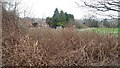
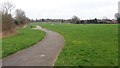
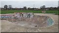
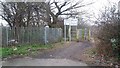
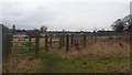
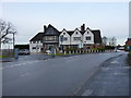
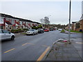
Photos of B14 7NW

Area Information
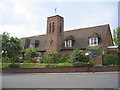
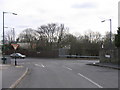
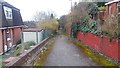
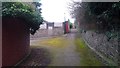
Living in B14 7NW means being part of a small, tightly knit residential cluster in Birmingham’s West Midlands, where history meets modern convenience. The postcode covers a compact area with a population of 1,745, nestled in the Brandwood & King’s Heath Ward. Historically a heathland, the area developed in the 18th century alongside the Alcester to Birmingham road, evolving into a suburban community with a mix of older homes and 19th-century expansions. Today, it offers a quiet alternative to the city’s bustling core, with proximity to rail and metro links. Daily life here balances suburban calm with easy access to urban amenities. Residents benefit from nearby shops, including Co-op Kings and Lidl Pershore, and multiple railway stations like Bournville and Kings Norton. The area’s character is defined by its historical roots—such as the Hare and Hounds pub, built in the 1820s—and its practical layout, making it appealing to those seeking a manageable lifestyle without sacrificing connectivity.
- Area Type
- Postcode
- Area Size
- Not available
- Population
- Not available
- Population Density
- Not available
The property market in B14 7NW is characterised by a 47% home ownership rate, with houses forming the primary accommodation type. This suggests a mix of owner-occupied homes and rental properties, though the exact proportion of rentals is unspecified. The area’s small size means the housing stock is limited to a defined cluster of residences, likely with older or mid-century properties reflecting its 19th-century development. For buyers, this presents a niche market where availability may be constrained by the area’s compact nature. The prevalence of houses over flats or apartments indicates a focus on traditional, family-friendly living. However, the lower home ownership rate implies a significant portion of the housing stock is rented, which could affect property values and investment potential. Buyers should consider the area’s proximity to transport links and amenities when evaluating its appeal.
House Prices in B14 7NW
No properties found in this postcode.
Energy Efficiency in B14 7NW
Residents of B14 7NW have access to a range of amenities within practical reach, including retail outlets like Co-op Kings, Aldi 1326 Pershore Road, and Lidl Pershore. These stores cater to daily needs, from groceries to household goods. The area’s proximity to railway stations such as Bournville and Selly Oak, along with metro stops like Grand Central New Street, ensures easy access to urban centres for work, leisure, or shopping. While the area itself is suburban, its connections to Birmingham’s transport network mean residents can quickly reach cultural hubs, parks, and entertainment venues. The presence of multiple retail options and transport links contributes to a convenient, balanced lifestyle, blending local convenience with urban accessibility.
Amenities
Schools
| Rank | School | Type | Entry gender | Ages |
|---|
Explore more schools in this area
Go to Schools tabDemographics
The community in B14 7NW is predominantly composed of adults aged 30–64, with a median age of 47. This suggests a stable, mature population, likely with established careers and families. Home ownership rates here are 47%, indicating a mix of owner-occupied properties and rentals. The area’s accommodation is largely houses, reflecting a traditional suburban layout. The predominant ethnic group is White, though specific data on diversity is not provided. With a population of 1,745, the area is small enough to foster a close-knit community but large enough to support essential services. The age profile suggests a balance between working professionals and retirees, with fewer younger families compared to other urban areas. This demographic profile may influence local amenities and social dynamics, prioritising stability over rapid change.
Household Size
Accommodation Type
Tenure
Ethnic Group
Religion
Household Composition
Age
Household Deprivation
NS-SEC
Explore more demographic insights in this area
Go to Demographics tabPlanning
Planning Constraints
- Flood RiskPremium
- Ramsar Wetland SitesPremium
- Area of Outstanding Natural BeautyPremium
- Protected Nature ReservePremium
- Protected WoodlandPremium