Area Overview for B14 7LP
Photos of B14 7LP
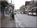
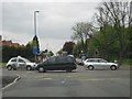
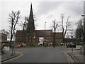
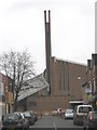
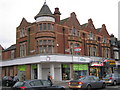
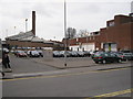
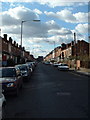
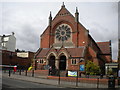

65 photos from this area
Area Information
Key information about the B14 7LP including its size, population, and administrative classification.
- Area Type
- Postcode
- Area Size
- 1.5 hectares
- Population
- 1450
- Population Density
- 5284 people/km²
House Prices in B14 7LP
29
Properties
£258,538
Average Sold Price
£60,000
Lowest Price
£391,500
Highest Price
Showing 29 properties
| Address | Type | Beds | Baths | Last Sale Price | Last Sale Date | |
|---|---|---|---|---|---|---|
| 97 Drayton Road, Birmingham, B14 7LP | Terraced | 2 | 1 | £330,000 | Aug 2024 | |
| 15 Drayton Road, Birmingham, B14 7LP | Terraced | 5 | 1 | £390,000 | Aug 2023 | |
| 31 Drayton Road, Birmingham, B14 7LP | Terraced | 3 | 1 | £391,500 | Nov 2022 | |
| 89 Drayton Road, Birmingham, B14 7LP | Terraced | 3 | 1 | £325,000 | Jul 2022 | |
| 87 Drayton Road, Birmingham, B14 7LP | house | 3 | - | £350,000 | Jun 2021 | |
| 13 Drayton Road, Birmingham, B14 7LP | Terraced | 6 | 2 | £375,000 | Oct 2018 | |
| 91 Drayton Road, Birmingham, B14 7LP | Terraced | 3 | 1 | £320,000 | Jun 2018 | |
| 99 Drayton Road, Birmingham, B14 7LP | Terraced | 3 | - | £218,492 | Apr 2016 | |
| 25 Drayton Road, Birmingham, B14 7LP | house | - | - | £230,000 | Oct 2015 | |
| 11 Drayton Road, Birmingham, B14 7LP | Terraced | 4 | 1 | £175,000 | Dec 2009 |
Page 1 of 3
Energy Efficiency in B14 7LP
Amenities
Schools
| Rank | School | Type | Entry gender | Ages |
|---|
Explore more schools in this area
Go to Schools tabDemographics
Household Size
Family (3-5 people)
most common
Accommodation Type
Houses
most common
Tenure
68
majority
Ethnic Group
White
most common
Religion
N/A
most common
Household Composition
N/A
most common
Age
47
median
Adults (30-64 years)
most common
Household Deprivation
N/A
with no deprivation
NS-SEC
49
in Lower managerial occupations
Explore more demographic insights in this area
Go to Demographics tabPlanning
Planning Constraints
- Flood RiskPremium
- Ramsar Wetland SitesPremium
- Area of Outstanding Natural BeautyPremium
- Protected Nature ReservePremium
- Protected WoodlandPremium