Area Overview for B14 7LB
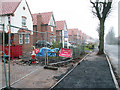
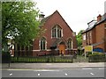
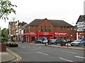
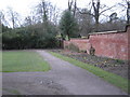
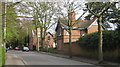
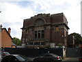
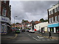
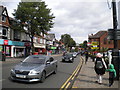
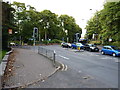
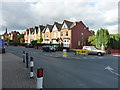
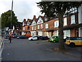
Photos of B14 7LB
Area Information
Living in B14 7LB means inhabiting a small, defined postcode area within Birmingham’s King’s Heath and Brandwood wards. With a population of 1,646, this suburban cluster blends historical roots with modern convenience. The area’s character is shaped by its proximity to key transport links, including nearby rail stations and metro hubs, while retaining a sense of residential tranquillity. Historically part of heathland, the area developed in the 18th century alongside improved roads and later became part of Birmingham in 1911. Today, it is served by essential amenities such as Asda Kings, Lidl Moseley, and Iceland Kings, alongside accessible rail services like Bournville and Selly Oak stations. The presence of three primary schools—Kings Heath Infant and Nursery School, Kings Heath Junior School, and Kings Heath Primary School—adds to its appeal for families. While the area lacks large-scale commercial or industrial features, its compact size ensures residents are within reach of Birmingham’s broader infrastructure. The median age of 47 suggests a stable, mature community, with a focus on housing rather than rental properties. For buyers, this postcode offers a snapshot of suburban Birmingham, where historical preservation meets practical living.
- Area Type
- Postcode
- Area Size
- Not available
- Population
- 1646
- Population Density
- 5942 people/km²
The property market in B14 7LB is characterised by a 52% home ownership rate, with houses being the predominant accommodation type. This suggests a residential area where long-term ownership is common, though the small postcode area means the housing stock is limited in scale. The absence of rental data implies that the market may not be heavily driven by short-term tenancies, though this cannot be confirmed. The focus on houses rather than flats or apartments indicates a preference for single-family homes, which may appeal to families or professionals seeking space. Buyers in this area should consider the limited size of the postcode, which means the immediate surroundings are critical for assessing property options. The proximity to rail stations and schools may enhance the area’s desirability, though the high crime risk noted in assessments could influence perceptions of safety. For those prioritising stability and historical context, B14 7LB offers a compact, defined residential environment with a distinct suburban character.
House Prices in B14 7LB
Showing 1 properties
| Address | Type | Beds | Baths | Last Sale Price | Last Sale Date | |
|---|---|---|---|---|---|---|
| Argos, 38-44 High Street, Moseley And Kings Heath, Birmingham, B14 7LB | retail_financial | - | - | - | - |
Energy Efficiency in B14 7LB
Daily life in B14 7LB is shaped by its proximity to retail, dining, and transport hubs. The area’s retail options include Asda Kings, Lidl Moseley, and Iceland Kings, providing essential shopping and grocery needs within walking distance. For dining, while no specific restaurants are named, the presence of retail outlets suggests a range of local eateries and cafes in the surrounding area. Transport connectivity is a key feature, with rail stations such as Bournville and Selly Oak offering access to Birmingham’s rail network, while metro stops like Edgbaston Village and Grand Central New Street provide links to the city’s central business districts. Parks and open spaces are not explicitly mentioned in the data, but the area’s historical roots in heathland may imply green spaces or recreational areas nearby. The combination of retail, transport, and educational facilities creates a convenient, self-contained environment. Residents can access daily essentials, commute efficiently, and benefit from proximity to schools, though further investigation may be needed to confirm the presence of parks or leisure facilities.
Amenities
Schools
Residents of B14 7LB have access to three primary schools within close proximity: Kings Heath Infant and Nursery School, Kings Heath Junior School, and Kings Heath Primary School. The latter holds an Ofsted rating of ‘good’, reflecting its performance in education. The presence of multiple primary schools suggests a strong focus on local education, with options for younger children. Families seeking schooling for their children may benefit from the variety of institutions, though no secondary schools are listed in the data. The availability of primary education is a key factor for homebuyers prioritising family-friendly environments. The ‘good’ rating at Kings Heath Primary School indicates a school that meets standards in teaching and pupil outcomes, which could be a deciding factor for families. However, the absence of secondary school data means buyers should investigate further if they require options for older children.
| Rank | School | Type | Entry gender | Ages |
|---|
Explore more schools in this area
Go to Schools tabDemographics
The community in B14 7LB is predominantly composed of adults aged 30–64, with a median age of 47. This suggests a mature, established population, likely with long-term ties to the area. Home ownership stands at 52%, indicating a mix of owner-occupied properties and rental units. The accommodation type is primarily houses, reflecting a residential focus rather than high-density housing. The predominant ethnic group is White, though no specific data on diversity or deprivation levels is provided. The age profile suggests a community with a strong presence of working-age adults, potentially supporting local services and schools. The absence of data on deprivation means it is unclear whether this influences access to amenities or quality of life. However, the presence of three primary schools and nearby retail options implies that essential services are available to meet the needs of this demographic. The area’s stability is further reinforced by its low flood risk and proximity to transport networks, which may contribute to its appeal for families and professionals.
Household Size
Accommodation Type
Tenure
Ethnic Group
Religion
Household Composition
Age
Household Deprivation
NS-SEC
Explore more demographic insights in this area
Go to Demographics tabPlanning
Planning Constraints
- Flood RiskPremium
- Ramsar Wetland SitesPremium
- Area of Outstanding Natural BeautyPremium
- Protected Nature ReservePremium
- Protected WoodlandPremium