Area Overview for B14 7JS
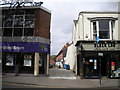
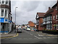
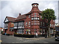
Photos of B14 7JS


Area Information
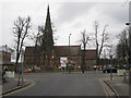
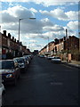
Living in B14 7JS means being part of a small, residential postcode cluster in Birmingham’s West Midlands. With a population of 1,534, this area is defined by its suburban character, nestled in the Brandwood & King’s Heath Ward. Historically, the region was heathland under local manors before development began in the 18th century, spurred by improved road connections. Today, it offers a quiet, established feel with a mix of older housing stock and modern infrastructure. The area is well-connected to Birmingham’s core via rail and metro links, making it accessible for commuters. Residents benefit from a low crime rate and no significant environmental constraints, such as flood risks or protected natural sites. The community is predominantly middle-aged, with a strong focus on home ownership, reflecting a stable, family-oriented environment. While the area is small, it is positioned near key amenities, blending suburban tranquillity with urban convenience.
- Area Type
- Postcode
- Area Size
- Not available
- Population
- Not available
- Population Density
- Not available
The property market in B14 7JS is dominated by owner-occupied homes, with 81% of properties owned by their residents. This high home ownership rate points to a community focused on long-term investment rather than rental turnover. The accommodation type is predominantly houses, which are typically larger and suited to families or multi-generational living. Given the small size of the postcode area, the housing stock is likely limited but concentrated, offering buyers a mix of established homes with potential for personalization. The lack of planning constraints, such as protected natural sites, means properties are not subject to restrictive development rules. However, the area’s size means buyers should consider nearby neighbourhoods for a broader range of options. The market is likely to be competitive, with demand driven by the area’s safety, connectivity, and suburban appeal.
House Prices in B14 7JS
No properties found in this postcode.
Energy Efficiency in B14 7JS
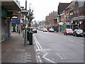
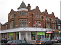
Residents of B14 7JS have access to a range of nearby amenities that support daily life. The area is within walking distance of five retail outlets, including Sainsburys Kings, Iceland Kings, and Lidl Moseley, providing convenience for grocery shopping and household needs. Rail and metro stations are strategically located, with Bournville Railway Station, Yardley Wood Railway Station, and Selly Oak Railway Station offering easy access to Birmingham’s transport network. Metro stops like Grand Central New Street and Centenary Square further enhance connectivity to the city’s core. While the area does not list parks or leisure facilities explicitly, its proximity to Birmingham’s urban centres suggests access to cultural and recreational opportunities. The combination of retail, transport, and suburban calm creates a lifestyle that balances practicality with accessibility.
Amenities
Schools
| Rank | School | Type | Entry gender | Ages |
|---|
Explore more schools in this area
Go to Schools tabDemographics
The population of B14 7JS has a median age of 47, with the majority of residents falling into the 30-64 age range. This suggests a mature, settled community, likely with a high proportion of working-age adults and families. Home ownership is exceptionally high at 81%, indicating a strong preference for long-term residency over renting. The accommodation type is primarily houses, which aligns with the suburban character of the area and may cater to larger households. The predominant ethnic group is White, though no specific data on diversity beyond this is provided. The age profile and ownership figures suggest a low-deprivation environment, where residents are likely to have stable incomes and established careers. This demographic profile contributes to a community that values stability, with fewer transient populations compared to more urban areas.
Household Size
Accommodation Type
Tenure
Ethnic Group
Religion
Household Composition
Age
Household Deprivation
NS-SEC
Explore more demographic insights in this area
Go to Demographics tabPlanning
Planning Constraints
- Flood RiskPremium
- Ramsar Wetland SitesPremium
- Area of Outstanding Natural BeautyPremium
- Protected Nature ReservePremium
- Protected WoodlandPremium