Area Overview for B14 7HN
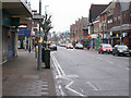
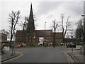
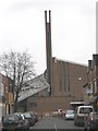
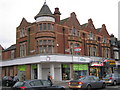
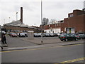
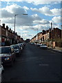
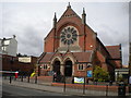
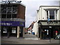
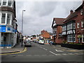
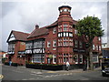
Photos of B14 7HN

Area Information
Living in B14 7HN means inhabiting a small, suburban cluster in Birmingham’s West Midlands, part of the Brandwood & King’s Heath Ward. With a population of 1,659, this area blends historical roots with modern convenience. Situated south of the city centre, it lies within the Birmingham Selly Oak constituency, bordered by landmarks like the Hare and Hounds pub, built in the 1820s. The postcode covers a compact residential zone, historically shaped by 18th-century road improvements and 19th-century housing developments. Residents benefit from proximity to primary schools with strong Ofsted ratings, such as Wheelers Lane Technology College, and easy access to rail networks. Daily life here is defined by a mix of quiet suburban living and connectivity to urban amenities, making it suitable for families and professionals seeking a balance between tranquillity and accessibility. The area’s compact size means most needs are within walking or short driving distance, though its small footprint limits large-scale retail or leisure options.
- Area Type
- Postcode
- Area Size
- Not available
- Population
- Not available
- Population Density
- Not available
The property market in B14 7HN is dominated by owner-occupied homes, with 76% of properties owned by residents. This high home ownership rate suggests a stable market with limited rental activity, likely attracting buyers seeking long-term investment or family homes. The predominant accommodation type is houses, which is typical of suburban areas and contrasts with city-centre flats or apartments. This housing stock implies a focus on private, spacious living rather than high-density development. Given the area’s small size, property availability is limited, and buyers should consider proximity to nearby amenities like schools and transport links. The lack of commercial or industrial properties reinforces the residential character, making it ideal for those prioritising quiet, family-friendly living over proximity to urban hubs.
House Prices in B14 7HN
No properties found in this postcode.
Energy Efficiency in B14 7HN
Residents of B14 7HN enjoy access to a range of amenities within practical reach. Retail options include Sainsburys Kings, Iceland Kings, and Lidl Moseley, offering everyday shopping needs. The area’s rail network connects to Bournville, Yardley Wood, and Kings Norton stations, while metro links to Edgbaston Village and Centenary Square provide access to Birmingham’s cultural and commercial centres. Though the postcode itself is small, its proximity to larger areas means residents can access parks, leisure facilities, and dining options in nearby suburbs. The presence of multiple schools and a strong community focus suggests a family-oriented lifestyle, with a balance between suburban calm and urban connectivity. However, the area’s limited size means larger retail or entertainment venues are not immediately available, requiring trips to adjacent wards for more extensive choices.
Amenities
Schools
Residents of B14 7HN have access to several primary schools, including Wheelers Lane Infant School, Wheelers Lane Junior School, Wheelers Lane Primary School, and Wheelers Lane Technology College. The latter holds an Ofsted rating of “outstanding,” while the others are rated “good.” This mix of primary and technology-focused schools provides a range of educational options for families. The presence of multiple schools within the area suggests a strong emphasis on education, with proximity to these institutions likely influencing housing demand. The high Ofsted ratings indicate quality teaching and facilities, which is a significant draw for parents seeking reliable schooling. However, the absence of secondary schools in the immediate vicinity may require families to consider commuting for older children, though nearby areas like Edgbaston or Selly Oak are within practical reach.
| Rank | School | Type | Entry gender | Ages |
|---|
Explore more schools in this area
Go to Schools tabDemographics
The population of B14 7HN is 1,659, with a median age of 47 and the majority of residents aged 30–64. This suggests a community skewed toward middle-aged adults, likely including professionals, families, and retirees. Home ownership is high, with 76% of properties occupied by their owners, indicating a stable, long-term resident base. The predominant accommodation type is houses, reflecting a suburban character rather than high-density living. The predominant ethnic group is White, though no specific data on diversity or deprivation is provided. The age profile and ownership rates suggest a mature, settled population, with fewer young families or transient renters compared to larger urban areas. This demographic profile aligns with the area’s historical development as a residential suburb rather than a commercial or student hub.
Household Size
Accommodation Type
Tenure
Ethnic Group
Religion
Household Composition
Age
Household Deprivation
NS-SEC
Explore more demographic insights in this area
Go to Demographics tabPlanning
Planning Constraints
- Flood RiskPremium
- Ramsar Wetland SitesPremium
- Area of Outstanding Natural BeautyPremium
- Protected Nature ReservePremium
- Protected WoodlandPremium