Area Overview for B14 7BN
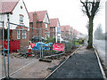
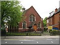
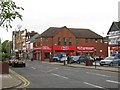
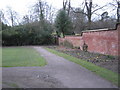
Photos of B14 7BN
Area Information
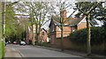
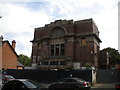
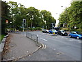
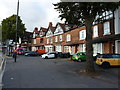
Living in B14 7BN means inhabiting a small, tightly knit residential cluster in the West Midlands, part of the Brandwood & King’s Heath Ward in Birmingham. With a population of 1,479, this area is defined by its suburban character and historical roots. Situated in the Birmingham Selly Oak constituency, it lies south of the city centre, historically shaped by 18th-century road improvements that spurred development. The area’s charm lies in its mix of older homes and established infrastructure, with landmarks like the Hare and Hounds pub—built in the 1820s—and Brandwood House, dating back to at least 1638. Daily life here is punctuated by proximity to rail networks, retail hubs, and a moderate pace of living. While it avoids the density of Birmingham’s core, it retains a quiet, community-focused vibe. The area’s compact size means residents are close to amenities, yet it remains distinct from the city’s more industrial or commercial zones. For those seeking a balance between suburban tranquillity and urban accessibility, B14 7BN offers a snapshot of Birmingham’s evolving residential landscape.
- Area Type
- Postcode
- Area Size
- Not available
- Population
- 1479
- Population Density
- 5400 people/km²
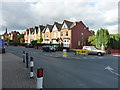
The property market in B14 7BN is dominated by owner-occupied homes, with 61% of residents living in properties they own. This contrasts with rental markets, where buy-to-let or private rentals are more common. The prevalence of houses over flats indicates a focus on single-family homes, which may appeal to those prioritising space and privacy. Given the area’s small size, the housing stock is likely limited, making it a niche market for buyers seeking established properties. The high home ownership rate suggests a stable market with potential for long-term value retention. However, buyers should consider the proximity to nearby areas, as the immediate surroundings may offer more options. The mix of houses and the moderate population size means the market is unlikely to be oversupplied, but competition could arise from local demand.
House Prices in B14 7BN
No properties found in this postcode.
Energy Efficiency in B14 7BN
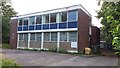
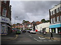
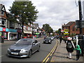
The lifestyle in B14 7BN is shaped by its accessible amenities, including five retail outlets such as Asda Kings, Lidl Moseley, and Iceland Kings. These shops provide convenience for daily needs, from groceries to household items. The area’s rail and metro links—Bournville, Selly Oak, and Edgbaston Village—enhance its connectivity, allowing residents to reach cultural, commercial, and recreational hubs in Birmingham. While the data does not specify parks or leisure facilities, the proximity to historical sites like the Hare and Hounds pub and Brandwood House suggests a blend of local character and practicality. The mix of retail and transport options supports a balanced lifestyle, balancing suburban comfort with urban accessibility.
Amenities
Schools
The nearest school to B14 7BN is Reach School, categorised as an 'other' type in the data. No Ofsted ratings are provided, so its performance remains unspecified. Families relying on this school must consider its type and any additional resources it may offer. The absence of other schools in the data means Reach School is the sole option within the immediate vicinity. For parents seeking multiple educational choices, this could be a limitation. However, the area’s proximity to rail and metro stations may provide access to broader schooling networks beyond B14 7BN. The single school listed reflects the area’s small size, but its adequacy for local needs depends on its capacity and curriculum.
| Rank | School | Type | Entry gender | Ages |
|---|
Explore more schools in this area
Go to Schools tabDemographics
The community in B14 7BN is predominantly composed of adults aged 30–64, with a median age of 47. This suggests a mature, stable population, likely with established careers and families. Home ownership is high, at 61%, indicating a strong presence of long-term residents. The area is characterised by houses rather than flats, reflecting a preference for single-family dwellings. The predominant ethnic group is White, which aligns with broader trends in the region. While no specific deprivation data is provided, the high home ownership rate and age profile suggest a community with relatively stable economic conditions. The absence of detailed diversity statistics means the area’s demographic makeup remains largely unexplored in the data, but the focus on houses and adult residents points to a settled, family-oriented environment.
Household Size
Accommodation Type
Tenure
Ethnic Group
Religion
Household Composition
Age
Household Deprivation
NS-SEC
Explore more demographic insights in this area
Go to Demographics tabPlanning
Planning Constraints
- Flood RiskPremium
- Ramsar Wetland SitesPremium
- Area of Outstanding Natural BeautyPremium
- Protected Nature ReservePremium
- Protected WoodlandPremium