Area Overview for B14 7BE
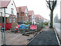
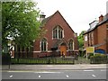
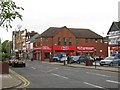
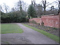
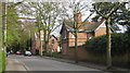
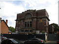
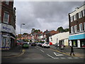
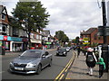
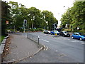
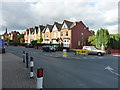
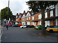
Photos of B14 7BE
Area Information
B14 7BE is a small, residential postcode area in Birmingham’s Brandwood & King’s Heath Ward, home to 1,479 people. Situated south of the city centre, it lies within a historically developed suburban zone shaped by 18th-century road improvements and 19th-century housing expansions. The area’s character is defined by its mix of older homes and established neighbourhoods, with a median age of 47 suggesting a mature, settled community. Residents benefit from proximity to key transport links and local amenities, while the area’s low flood risk and absence of protected natural sites make it a practical choice for families. Though compact, B14 7BE offers a quiet alternative to Birmingham’s more densely populated zones, with a focus on residential stability. Its location within the Birmingham Selly Oak constituency and access to nearby rail services highlight its role as a commuter hub, blending suburban tranquillity with urban connectivity.
- Area Type
- Postcode
- Area Size
- Not available
- Population
- 1479
- Population Density
- 5400 people/km²
B14 7BE is primarily a home-owning area, with 61% of residents living in properties they own. The accommodation type is predominantly houses, which aligns with the area’s suburban character and family-oriented appeal. This suggests a housing market focused on single-family homes rather than high-density developments, making it an attractive option for buyers seeking stability and space. However, the small size of the postcode area means the property market is limited in scope, with fewer options compared to larger urban zones. The emphasis on houses may also indicate a lower proportion of rental properties, though the exact balance is not specified. For buyers, this means a niche market where properties are likely to be well-maintained and suited to long-term ownership. The area’s proximity to transport links and amenities further enhances its value for those prioritising convenience and quality of life.
House Prices in B14 7BE
No properties found in this postcode.
Energy Efficiency in B14 7BE
Residents of B14 7BE have access to a range of nearby amenities, including five retail outlets such as Asda Kings, Lidl Moseley, and Iceland Kings, which provide convenience for daily shopping. The area’s rail and metro stations, like Selly Oak and Grand Central New Street, offer easy access to Birmingham’s cultural and commercial hubs. While the data does not specify parks or leisure facilities, the proximity to historical sites like the Hare and Hounds pub and Brandwood End Cemetery suggests a blend of heritage and community spaces. The presence of multiple retail and transport options contributes to a practical lifestyle, supporting both routine needs and broader mobility. This mix of convenience and connectivity makes the area appealing for those prioritising accessibility and everyday ease.
Amenities
Schools
The nearest school to B14 7BE is Reach School, which is categorised as an "other" type in the data. No specific Ofsted rating is provided, so its performance remains unquantified. The single listed school suggests a limited range of educational options within the immediate vicinity, though the area’s proximity to larger Birmingham districts may offer additional choices. Families relying solely on local schools may need to consider commuting to nearby areas for secondary education or specialist provisions. The absence of multiple schools in the data implies that B14 7BE is not a hub for educational institutions, and prospective residents should investigate further to assess whether the available school meets their needs.
| Rank | School | Type | Entry gender | Ages |
|---|
Explore more schools in this area
Go to Schools tabDemographics
The population of B14 7BE is predominantly adults aged 30–64, reflecting a mature demographic with a median age of 47. Home ownership stands at 61%, indicating a mix of owner-occupied properties and rental units. The area is characterised by a predominance of houses, which suggests a focus on family-friendly housing stock. The predominant ethnic group is White, aligning with broader trends in the region. While specific data on deprivation is not provided, the age profile and home ownership rates suggest a community with established roots and a stable economic base. This demographic structure likely influences local services, with amenities tailored to older residents and families. The absence of detailed diversity metrics means the area’s social composition remains largely unexplored in public data, but the presence of schools and retail options hints at a functioning, self-sufficient community.
Household Size
Accommodation Type
Tenure
Ethnic Group
Religion
Household Composition
Age
Household Deprivation
NS-SEC
Explore more demographic insights in this area
Go to Demographics tabPlanning
Planning Constraints
- Flood RiskPremium
- Ramsar Wetland SitesPremium
- Area of Outstanding Natural BeautyPremium
- Protected Nature ReservePremium
- Protected WoodlandPremium