Area Overview for B14 7AY
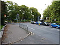
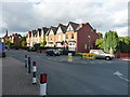
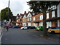
Photos of B14 7AY

Area Information
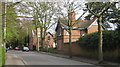
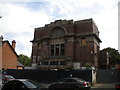
Living in B14 7AY, part of the Moseley area in Birmingham, offers a blend of suburban tranquillity and historical depth. This small postcode cluster, with a population of 1,479, sits within a residential zone that evolved from a 19th-century village into a middle-class suburb. The area’s character is shaped by its past as an independent village before joining Birmingham in 1911. Residents benefit from proximity to retail hubs like Asda Kings and M&S Moseley, as well as rail links to Bournville and Selly Oak stations. The community is defined by its older housing stock, with 61% of homes owner-occupied. While the area lacks large-scale amenities, its charm lies in its compactness and access to nearby green spaces, including Cannon Hill Park, which was donated in 1873. For buyers, B14 7AY represents a quiet, established neighbourhood with a strong sense of local identity, though its small size means limited expansion.
- Area Type
- Postcode
- Area Size
- Not available
- Population
- 1479
- Population Density
- 5400 people/km²
B14 7AY is primarily an owner-occupied area, with 61% of properties owned by residents rather than rented. The housing stock consists mainly of houses, which aligns with the area’s suburban character and historical development as a middle-class suburb. This contrasts with newer urban developments that often feature high-density housing or rental-focused builds. For buyers, this means a market skewed towards established, family homes rather than speculative investment. The small size of the postcode area limits the availability of properties, making it a niche market for those seeking a quiet, low-traffic environment. Proximity to rail links and retail amenities adds practical appeal, though the lack of larger commercial or industrial zones restricts scope for property diversification.
House Prices in B14 7AY
No properties found in this postcode.
Energy Efficiency in B14 7AY
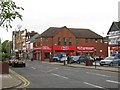
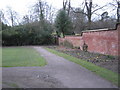
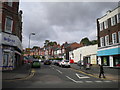
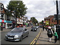
Residents of B14 7AY have access to a range of amenities within walking or short driving distance. Retail options include Asda Kings, M&S Moseley, and Iceland Kings, catering to daily needs. The area’s rail links to Bournville, Selly Oak, and Hall Green stations provide easy access to Birmingham’s broader transport network, while metro stops at Edgbaston Village and Grand Central New Street connect to central Birmingham. Though the data does not list parks explicitly, historical context from local research highlights nearby green spaces like Moseley Park and Cannon Hill Park, which were established in the 19th century. These spaces offer recreational value, contributing to a balanced lifestyle. The area’s compact nature means amenities are concentrated, encouraging a walkable, community-focused way of life.
Amenities
Schools
The nearest school to B14 7AY is Reach School, categorised as an “other” type in the data. No Ofsted rating is provided, so its performance remains unspecified. The single school in the area suggests limited educational options for families, though its presence indicates a focus on local provision. For parents, this may mean relying on nearby schools in adjacent postcode areas or considering broader Birmingham school networks. The absence of multiple schools or detailed performance metrics means families must assess suitability based on proximity and broader reputation, rather than specific local data.
| Rank | School | Type | Entry gender | Ages |
|---|
Explore more schools in this area
Go to Schools tabDemographics
The population of B14 7AY is predominantly middle-aged, with a median age of 47 and the most common age range being adults aged 30–64. This suggests a community of settled residents, many of whom are likely to be homeowners, as 61% of homes are owner-occupied. The area is characterised by houses rather than flats, reflecting a traditional suburban layout. The predominant ethnic group is White, indicating a relatively homogenous demographic. While no specific deprivation data is provided, the age profile and home ownership rate suggest a stable, low-turnover community. The absence of detailed diversity metrics means the area’s social composition remains less defined in terms of broader ethnic or cultural representation.
Household Size
Accommodation Type
Tenure
Ethnic Group
Religion
Household Composition
Age
Household Deprivation
NS-SEC
Explore more demographic insights in this area
Go to Demographics tabPlanning
Planning Constraints
- Flood RiskPremium
- Ramsar Wetland SitesPremium
- Area of Outstanding Natural BeautyPremium
- Protected Nature ReservePremium
- Protected WoodlandPremium