Area Overview for B14 6WD
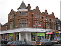
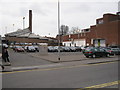
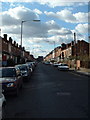
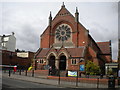
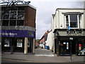
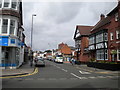
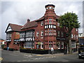
Photos of B14 6WD

Area Information
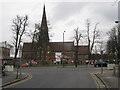
Living in B14 6WD means being part of a small, residential cluster in the Billesley ward of Birmingham, a suburb with historical roots dating back to the 8th century. The area spans parts of Moseley, Hall Green, Yardley Wood, and Kings Heath, bordered by green spaces like Billesley Common and Swanshurst Park. With a population of 1,806, it’s a compact community where the 1920s council estate developments still shape the local character. Residents benefit from proximity to Birmingham’s city centre, just 6 km away, while the area’s expansion from former farmland in the 1920s reflects its long-standing role as a residential hub. Daily life here is defined by a mix of suburban tranquillity and easy access to urban amenities, with local parks offering respite from the city’s pace. The area’s blend of older housing stock and nearby transport links makes it appealing to families and professionals seeking a balance between convenience and community.
- Area Type
- Postcode
- Area Size
- Not available
- Population
- 1806
- Population Density
- 5314 people/km²
The property market in B14 6WD is characterised by a high rate of home ownership (80%) and a predominance of houses, indicating a community where long-term residency is common. This contrasts with areas dominated by rental properties or flats, suggesting a more settled demographic. The concentration of houses, rather than apartments or terraced units, points to a focus on family homes and suburban living. Given the area’s small size, the housing stock is likely limited, meaning buyers may need to consider nearby postcode areas for more options. The high home ownership rate also implies that properties here are often held by owner-occupiers, potentially influencing market stability. For those seeking a home in B14 6WD, the emphasis on houses may appeal to those prioritising space and a traditional residential feel, though the limited supply could mean competition for available properties.
House Prices in B14 6WD
No properties found in this postcode.
Energy Efficiency in B14 6WD
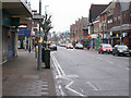
Residents of B14 6WD have access to a range of local amenities within practical reach. The area is served by five retail outlets, including Sainsburys Kings, Iceland Kings, and Tesco Kings, providing convenience for everyday shopping. Nearby parks such as Billesley Common, Chinn Brook Meadows, and Swanshurst Park offer green spaces for leisure, walking, or family activities. The Friends of Billesley Commons group highlights the community’s engagement with local natural areas. The proximity to rail and metro stations also opens access to Birmingham’s cultural and commercial hubs, from Edgbaston’s restaurants to Centenary Square’s events. This mix of retail, greenery, and transport connectivity creates a lifestyle that balances suburban calm with urban accessibility, making daily life both practical and enjoyable.
Amenities
Schools
| Rank | School | Type | Entry gender | Ages |
|---|
Explore more schools in this area
Go to Schools tabDemographics
The population of B14 6WD is 1,806, with a median age of 47 and the majority of residents aged 30–64. This suggests a mature, stable community with a focus on family living, reflected in the 80% home ownership rate. The area is predominantly composed of houses, aligning with the demographics of middle-aged adults who are likely to have long-term ties to the neighbourhood. The predominant ethnic group is White, which is consistent with broader trends in Birmingham’s suburban areas. The age profile indicates a low proportion of young families or retirees, shaping the social dynamics of the area. The high home ownership rate suggests a community of established residents, which may contribute to a sense of continuity and local identity. However, the absence of specific data on deprivation means the area’s economic diversity remains unquantified.
Household Size
Accommodation Type
Tenure
Ethnic Group
Religion
Household Composition
Age
Household Deprivation
NS-SEC
Explore more demographic insights in this area
Go to Demographics tabPlanning
Planning Constraints
- Flood RiskPremium
- Ramsar Wetland SitesPremium
- Area of Outstanding Natural BeautyPremium
- Protected Nature ReservePremium
- Protected WoodlandPremium