Area Overview for B14 6UA
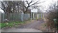
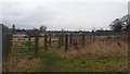
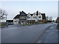
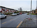
Photos of B14 6UA


Area Information
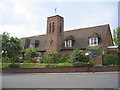
Living in B14 6UA offers a settled suburban experience within the Brandwood and King's Heath ward of Birmingham City Council. This postcode covers a specific residential cluster south of the city centre, defined as part of the Birmingham Selly Oak constituency. The ward holds a total population of 18,970, yet your immediate cluster contains 1,458 residents, creating a close-knit community environment. Historically, this land transitioned from heathland under the control of various manors to a developed suburban area following improvements to the Alcester to Birmingham road in the 18th century. The area avoided the worst slum conditions of 19th-century Birmingham, instead developing with structured housing expansion along roads like Drayton and Goldsmith Roads during the 1890s. You will find yourself in a neighbourhood shaped by significant history, including local landmarks such as the Hare and Hounds pub, which operated from circa 1820. The character of B14 6UA remains rooted in this heritage, offering a quiet residential setting far removed from the industrial density of the city's past. Proximity to Bournville and Kings Norton stations ensures your location benefits from easy access to wider travel networks. This blend of historical significance and modern suburban convenience defines daily life for residents who value a slower pace without isolation.
- Area Type
- Postcode
- Area Size
- Not available
- Population
- 1458
- Population Density
- 7427 people/km²
The property market in B14 6UA is defined by a stock of detached, semi-detached, and terraced houses. With 1,458 residents living within this specific cluster, the housing supply is limited compared to larger wards, which often drives competition among buyers seeking established homes. The 57% home ownership rate indicates that the area is primarily an owner-occupied market rather than a rental district. This is evident from the fact that the predominant accommodation type is houses, not flats or apartments. Prospective buyers looking for family homes or single-family dwellings will find this postcode suitable, as the architectural fabric consists of houses built during the expansion of the 1890s and earlier. The absence of flats or social housing data in your immediate view suggests that investment buyers targeting young professionals or students are less likely to succeed here than those seeking residential stability. The market reflects the neighbourhood's history of organic growth rather than large-scale planned estates. If you are considering purchasing, you are entering a market that values tenure over tenancy. The small size of the residential cluster means that specific properties may hold significant value due to scarcity. Buyers should approach this area with an eye on individual household valuation rather than broad speculative trends, given the low population density of 1,458 in this specific zone.
House Prices in B14 6UA
No properties found in this postcode.
Energy Efficiency in B14 6UA
Your lifestyle in B14 6UA is supported by a practical network of amenities located within immediate reach. For daily grocery shopping and weekly provisions, you have access to five retail outlets including Co-op Kings, Tesco Kings, and Spar. These shops are concentrated enough to satisfy most household needs without requiring a long journey. Connectivity extends to five rail stations nearby, offering routes to Bournville, Kings Norton, and Selly Oak. Your options for rapid city centre access include five metro stations, such as Edgbaston Village, Grand Central New Street, and Centenary Square. These transport hubs are not distant stops but practical extensions of your local neighbourhood. The historical character of the area adds to the local experience, with notable sites like the Hare and Hounds pub serving as social anchors dating back to the early 19th century. Brandwood End Cemetery and Brandwood House reflect the deep roots of the community. While the area is strictly residential, the density of five retail and five transport options nearby ensures you do not feel cut off from the wider city. The lifestyle here balances suburban quiet with just enough local convenience for everyday tasks.
Amenities
Schools
| Rank | School | Type | Entry gender | Ages |
|---|
Explore more schools in this area
Go to Schools tabDemographics
The community in B14 6UA reflects a mature demographic profile with strong stability. The median age sits at 47 years, indicating that the local population consists primarily of adults between 30 and 64 years. This age range represents the most common demographic group in your neighbourhood, suggesting a neighbourhood dominated by established families and individuals in their prime earning years. Home ownership is notably high at 57%, meaning most residents have purchased their properties rather than renting. This contrasts sharply with many fast-growing city zones and points to a community seeking long-term residency. The predominant ethnic group is White, aligning with broader patterns in established Birmingham suburbs. Accommodation types are almost exclusively houses, reinforcing the character of this independent, single-family living environment. There is no significant presence of multi-story apartment blocks or high-density social housing. The absence of deprivation indicators in the provided data suggests a relatively affluent and stable economic environment. Residents here typically look for permanence, which is underscored by the high rate of individual property ownership. You are likely to encounter neighbours who have lived in these houses for decades, fostering a sense of continuity and local knowledge that new arrivals can draw upon.
Household Size
Accommodation Type
Tenure
Ethnic Group
Religion
Household Composition
Age
Household Deprivation
NS-SEC
Explore more demographic insights in this area
Go to Demographics tabPlanning
Planning Constraints
- Flood RiskPremium
- Ramsar Wetland SitesPremium
- Area of Outstanding Natural BeautyPremium
- Protected Nature ReservePremium
- Protected WoodlandPremium