Area Overview for B14 6TS
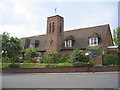
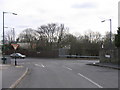
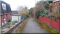
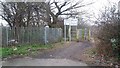
Photos of B14 6TS


Area Information
Living in B14 6TS means being part of a small, tightly knit residential cluster in Birmingham’s West Midlands. With a population of just 1,745, the area retains a quiet, suburban character, distinct from the city’s busier districts. Historically part of King’s Heath and Brandwood, it sits south of Birmingham’s centre, near coordinates 52.433123, -1.894511. The area’s roots trace back to 18th-century heathland, later shaped by road improvements and 19th-century housing developments. Today, it balances historical charm with modern convenience. Residents benefit from proximity to multiple rail stations, including Bournville and Kings Norton, and easy access to Birmingham’s metro network. The community is predominantly middle-aged, with a median age of 47, and many households own their homes. Daily life here is defined by a mix of local shops, historic sites like the Hare and Hounds pub, and straightforward access to the city’s transport arteries. While not a high-density area, B14 6TS offers a self-contained lifestyle with practical amenities within walking or cycling distance.
- Area Type
- Postcode
- Area Size
- Not available
- Population
- Not available
- Population Density
- Not available
The property market in B14 6TS is defined by a 47% home ownership rate, indicating that nearly half of properties are rented. The area is dominated by houses, which contrasts with higher-density urban areas. This suggests a suburban, family-oriented housing stock, though the small population of 1,745 limits the scale of the market. Buyers should consider that the area is a small cluster, so property availability may be constrained. The predominance of houses may appeal to those seeking space, but the lower home ownership rate implies competition for rental properties. For buyers, this means the area is not a hotbed of investment activity but offers a niche opportunity for those prioritising residential character over speculative growth. Proximity to rail and metro links adds practical value, though the limited size of the area means buyers may need to look beyond B14 6TS for larger options.
House Prices in B14 6TS
No properties found in this postcode.
Energy Efficiency in B14 6TS
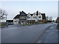
Residents of B14 6TS enjoy a blend of local retail, historic sites, and transport links that shape a practical lifestyle. Within walking distance are five retail outlets, including Co-op Kings, Tesco Kings, and Sainsburys Kings, offering everyday shopping needs. The area’s historical character is evident in sites like the Hare and Hounds pub, Brandwood End Cemetery, and Brandwood House, which date back to the 18th and 19th centuries. These landmarks add a sense of heritage to daily life. Public transport is a key feature, with five rail stations and metro stops providing seamless access to Birmingham’s city centre and beyond. The area’s suburban nature means it avoids the density of inner-city living, offering a quieter environment with easy access to urban amenities. For families, the mix of local shops, green spaces, and transport options creates a balanced lifestyle, though the small size of the area may require residents to venture further for specialist services.
Amenities
Schools
| Rank | School | Type | Entry gender | Ages |
|---|
Explore more schools in this area
Go to Schools tabDemographics
The community in B14 6TS is predominantly middle-aged, with a median age of 47 and the most common age range being adults aged 30–64. Home ownership is relatively low at 47%, suggesting a mix of owner-occupied properties and rental units. The area is characterised by houses rather than flats, reflecting a suburban housing stock. The predominant ethnic group is White, though specific diversity statistics are not provided. This age profile indicates a stable, mature population, likely with established careers and families. The lower home ownership rate may suggest a proportion of younger residents or those renting for lifestyle flexibility. The absence of detailed deprivation data means the area’s socioeconomic challenges are not quantified here, but the demographic suggests a community focused on long-term stability rather than transient populations.
Household Size
Accommodation Type
Tenure
Ethnic Group
Religion
Household Composition
Age
Household Deprivation
NS-SEC
Explore more demographic insights in this area
Go to Demographics tabPlanning
Planning Constraints
- Flood RiskPremium
- Ramsar Wetland SitesPremium
- Area of Outstanding Natural BeautyPremium
- Protected Nature ReservePremium
- Protected WoodlandPremium