Area Overview for B14 6RL
Photos of B14 6RL
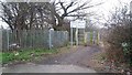
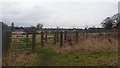
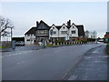
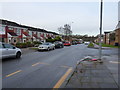
24 photos from this area
Area Information
Key information about the B14 6RL including its size, population, and administrative classification.
- Area Type
- Postcode
- Area Size
- 1.5 hectares
- Population
- Not available
- Population Density
- Not available
House Prices in B14 6RL
27
Properties
£147,333
Average Sold Price
£85,000
Lowest Price
£232,500
Highest Price
Showing 27 properties
| Address | Type | Beds | Baths | Last Sale Price | Last Sale Date | |
|---|---|---|---|---|---|---|
| 77 Allens Croft Road, Birmingham, B14 6RL | house | 1 | - | £232,500 | Dec 2021 | |
| 81 Allens Croft Road, Birmingham, B14 6RL | house | - | - | £220,000 | Oct 2021 | |
| 52 Allens Croft Road, Birmingham, B14 6RL | Semi-detached | 3 | 1 | £163,500 | Nov 2020 | |
| 56 Allens Croft Road, Birmingham, B14 6RL | Semi-detached | 3 | 1 | £175,000 | Sep 2020 | |
| 60 Allens Croft Road, Birmingham, B14 6RL | Semi-detached | 1 | 1 | £175,000 | Jan 2019 | |
| 91 Allens Croft Road, Birmingham, B14 6RL | house | - | - | £135,000 | Apr 2016 | |
| 71 Allens Croft Road, Birmingham, B14 6RL | house | 3 | - | £110,000 | Dec 2011 | |
| 73 Allens Croft Road, Birmingham, B14 6RL | Terraced | 3 | 1 | £104,000 | Jul 2010 | |
| 95 Allens Croft Road, Birmingham, B14 6RL | Semi-detached | - | - | £122,000 | Aug 2009 | |
| 46 Allens Croft Road, Birmingham, B14 6RL | house | - | - | £113,500 | Jan 2009 |
Page 1 of 3
Energy Efficiency in B14 6RL
Amenities
Schools
| Rank | School | Type | Entry gender | Ages |
|---|
Explore more schools in this area
Go to Schools tabDemographics
Household Size
One person
most common
Accommodation Type
Houses
most common
Tenure
47
majority
Ethnic Group
White
most common
Religion
N/A
most common
Household Composition
N/A
most common
Age
47
median
Adults (30-64 years)
most common
Household Deprivation
N/A
with no deprivation
NS-SEC
25
in Lower managerial occupations
Explore more demographic insights in this area
Go to Demographics tabPlanning
Planning Constraints
- Flood RiskPremium
- Ramsar Wetland SitesPremium
- Area of Outstanding Natural BeautyPremium
- Protected Nature ReservePremium
- Protected WoodlandPremium